- Here’s how Austin-area leaders are preparing for wildfire threats this summer
- Harris County sues Trump administration, cites threat to hurricane season preparedness
- Prescribed burn in Morrow Mountain aims to prevent future wildfires
- Prescribed burns aim to prevent wildfires in Stanly County
- Prepare for hurricane season with the Town of Leland Hurricane Expo
Flood risk and severe weather threat for Central Texas over the weekend
We’re expecting the most widespread rain and storms Saturday night into Sunday. Here’s the latest timeline.
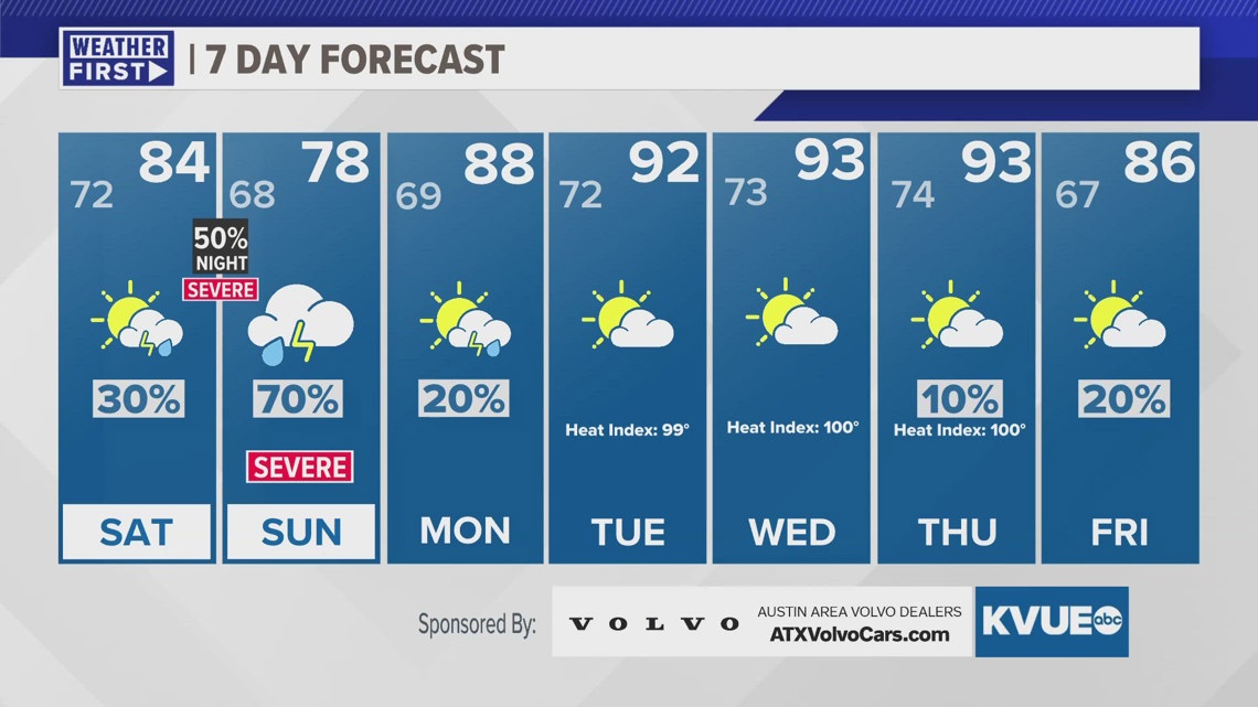
An active weather pattern continues through this weekend for Central Texas with several more round of rain and storms ahead. This means that the risk for more severe weather and flooding will stick with us through at least Sunday. After that, we really turn up the heat by the middle of next week.
For Friday evening the severe weather threat will be confined to the Hill Country. We’re primarily watching Mason, Llano, and Gillespie counties for a hail, wind, and tornado threat. It is not a guarantee that storms make it into the KVUE area at all, but if they do they could be severe. The risk for storms Friday evening in Austin is very low.

During the day on Saturday we don’t expect much stormy weather. It will be mostly cloudy, and there could be patchy drizzle or light rain showers through the day. The much higher storm chances begin Saturday night as storms begin to move into our KVUE area from the north.

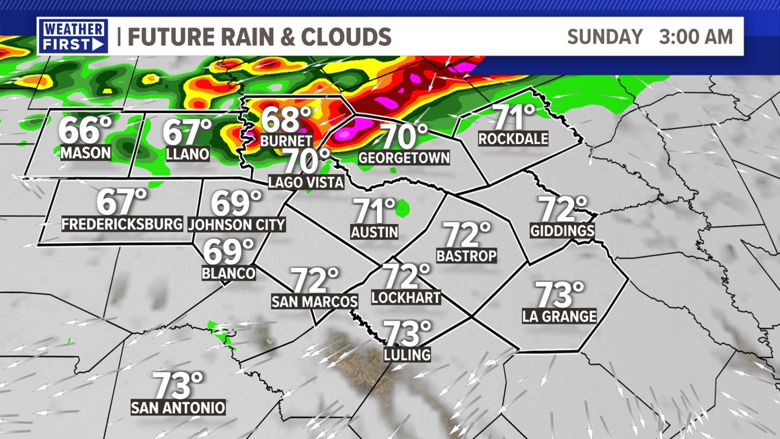
Overnight and into Sunday morning the rain and storms become widespread. Embedded pockets of heavy storms bring both a severe weather threat and a flood risk. Make sure you factor this in for any weekend plans, and make sure you have a reliable way to get weather alerts.

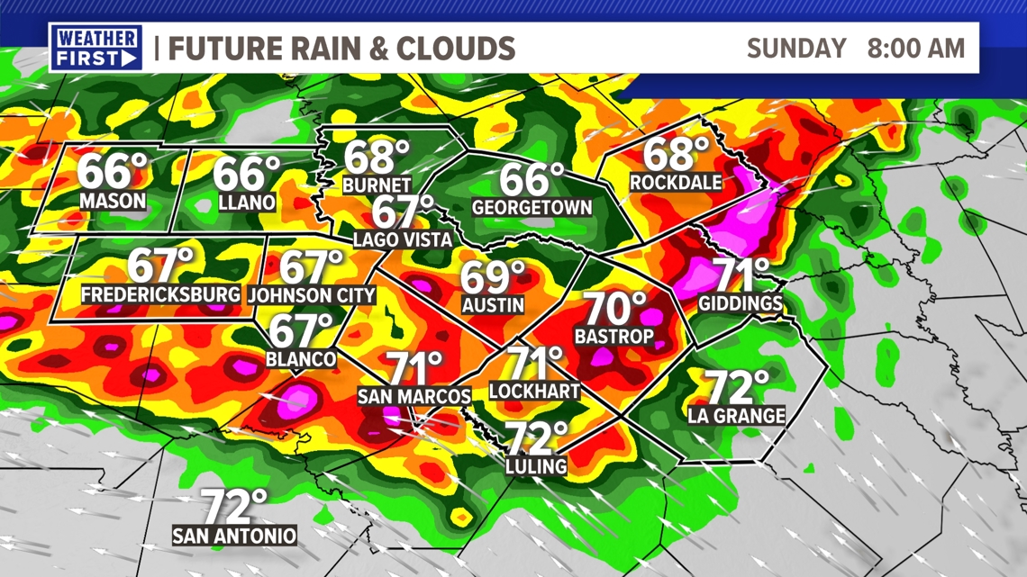
Rainfall totals of 1 to 3 inches look likely, but there could be isolated spots that see up to 5 inches or more. This is certainly enough rain, on top of what has already fallen in the previous days, to create a localized flooding concern.

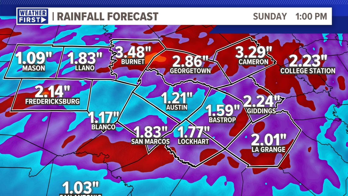
Rain chances really dwindle by the beginning of next week, and the heat quickly returns. High temperatures by the middle of next week will be in the low to mid 90s with feels like temperatures around 100 degrees.
The KVUE Weather Team will continue to closely monitor this developing forecast.
In the meantime, the extended forecast can be found below:

