- Here’s how Austin-area leaders are preparing for wildfire threats this summer
- Harris County sues Trump administration, cites threat to hurricane season preparedness
- Prescribed burn in Morrow Mountain aims to prevent future wildfires
- Prescribed burns aim to prevent wildfires in Stanly County
- Prepare for hurricane season with the Town of Leland Hurricane Expo
Where flooding is happening: List of rivers and streams that are out of their banks, as well as those that are close
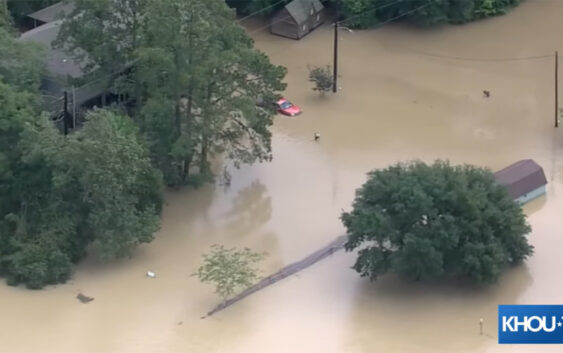
HOUSTON — We’re tracking high water all across the Houston area following days of heavy rain. And with more rain in the forecast, things are expected to get worse.
The Harris County Flood Control District is keeping tabs on rivers and streams that are out of their banks and those that are nearing it. Here is what they posted shortly after 11:30 a.m. Saturday.
You can also check the Harris County Flood Control map anytime. There are explainers on how to read it and what the different monitors mean. We have links here.
If you are in an area that’s flooded, you can get a free ride to safety. Just call 311.
FREE transportation services for evacuation are now available!
If you or someone you know requires transportation for evacuation, please contact 311 immediately. pic.twitter.com/syYCM9pKbl
— Houston OEM (@HoustonOEM) May 4, 2024