- New legislative panels will investigate ‘facts and circumstances’ of deadly Central Texas floods
- Heavy rain floods downtown Whiteville forcing local businesses to deal with damage again
- New legislative panels will investigate “facts and circumstances” of deadly Central Texas floods
- Springfield Middle School fully reopens next week, a year after devastating EF3 tornado
- Dozens rescued as remnants of typhoon hits Alaska while nor’easter brings flooding to East Coast
Timeline: Severe weather possible Wednesday evening into Thursday for Central Texas

Here’s the latest on the chance for strong storms this week.
AUSTIN, Texas — We’re tracking the potential for strong storms, mainly in the Austin metro and points north, for Wednesday evening as well as Thursday afternoon and evening. Thursday’s threat looks to be somewhat more substantial, but there are mitigating factors. Here’s the latest.
Wednesday evening
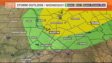
While most of Central Texas is under a 1 out of 5 “marginal” risk for severe weather, the Austin metro and points to the northeast are under a 2 out of 5 “slight” risk.
The threats for Wednesday and Thursday are the same. However, it’s important to note that this threat is “conditional,” which means that these storms may wind up not firing up at all, due to what’s called a “capping” in the atmosphere. This is why the futurecasts do not show much popping up.

Thursday afternoon and evening
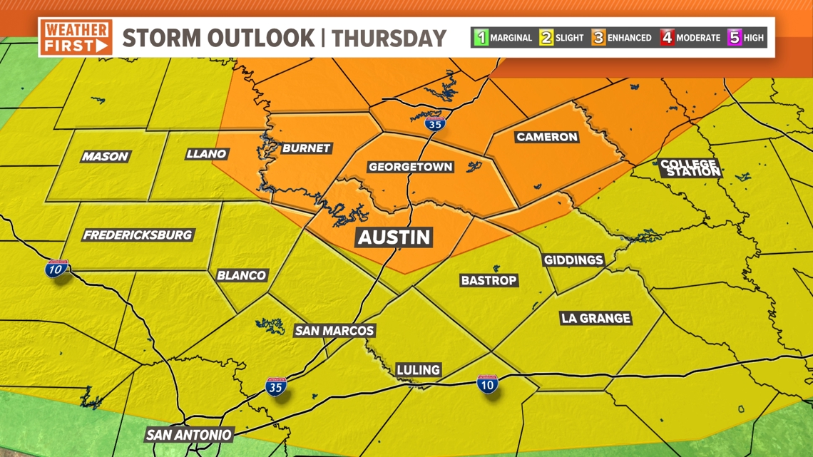
Thursday has the more significant chances of stronger storms, but as with Wednesday, there’s still a strong “capping” in the atmosphere, so it will be difficult for storms to get going.
We’re looking between 2 p.m. and 10 p.m. for the timing of any storm that pops up though. As for threat levels, most of the area is in the aforementioned “slight” risk, but the Austin metro and points north are in the “enhanced” risk for severe weather.
RELATED: The science behind Texas-sized hail


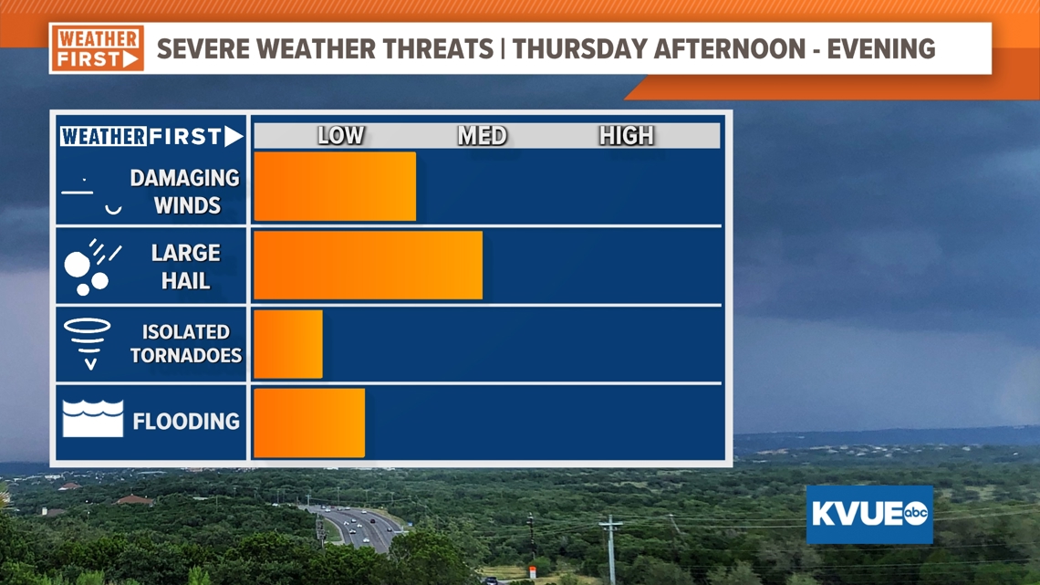
All modes are possible, with very large hail and damaging winds being the main threats, but an isolated tornado cannot be ruled out. With the conditional nature of these storms, we expect them to not be widely scattered, but as we have seen in the past, it only takes one storm to do damage.


Summary
To summarize, we’re tracking rounds of strong storm potential Wednesday evening as well as Thursday afternoon and evening. However, with a strong cap in the atmosphere, it will be difficult for storms to get going. But if they do, very large hail and damaging winds are possible.
With that in mind, please stick with KVUE for the latest as we track the storm potential.
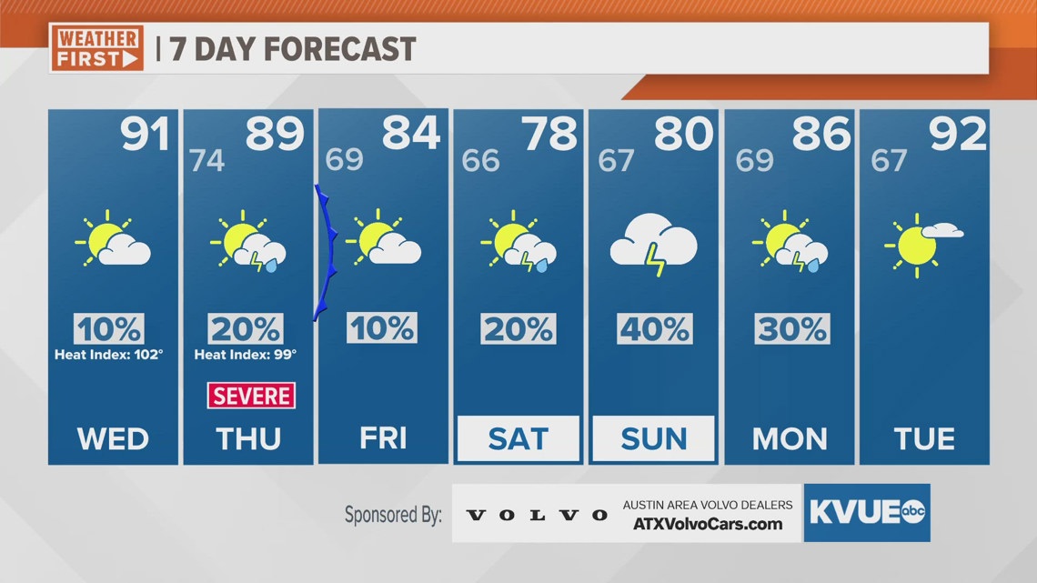
In the meantime, your seven-day outlook is below.

