- Harris County lawsuit cites threat to hurricane season preparedness
- Prescribed burns aim to prevent wildfires in Anson County
- Prescribed fires burning in Anson County
- National memorial to honor NC firefighter who died on duty during Hurricane Helene
- Gov. Josh Stein extends State of Emergency for western NC wildfires
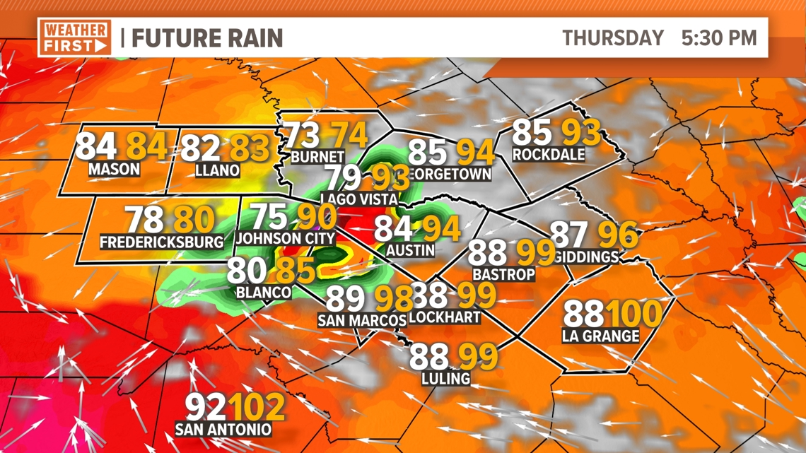
Timeline: Severe weather possible Thursday evening for Central Texas
Here’s the latest on the chance for strong storms late Thursday afternoon through the evening hours.
AUSTIN, Texas — We’re tracking the potential for strong storms, mainly in the Austin metro and points north, for Thursday afternoon and evening. The threat looks to be somewhat substantial, but there are mitigating factors. Here’s the latest.
Thursday afternoon and evening
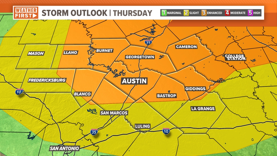
Thursday has a significant chance of strong storms, but there’s still a strong “capping” in the atmosphere, so it will be difficult for storms to get going.

We’re looking between 5 p.m. and 11 p.m. for the timing of any storm that pops up for Central Texas. As for threat levels, most of the area is in the “enhanced” – level 3 out of 5 – risk.
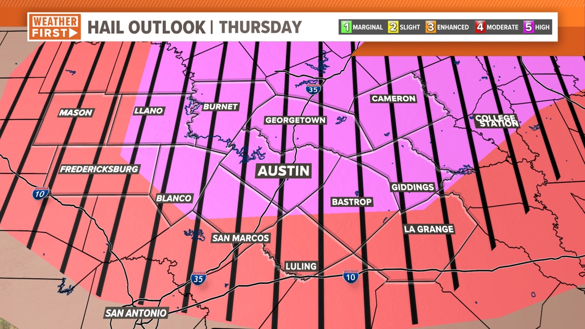
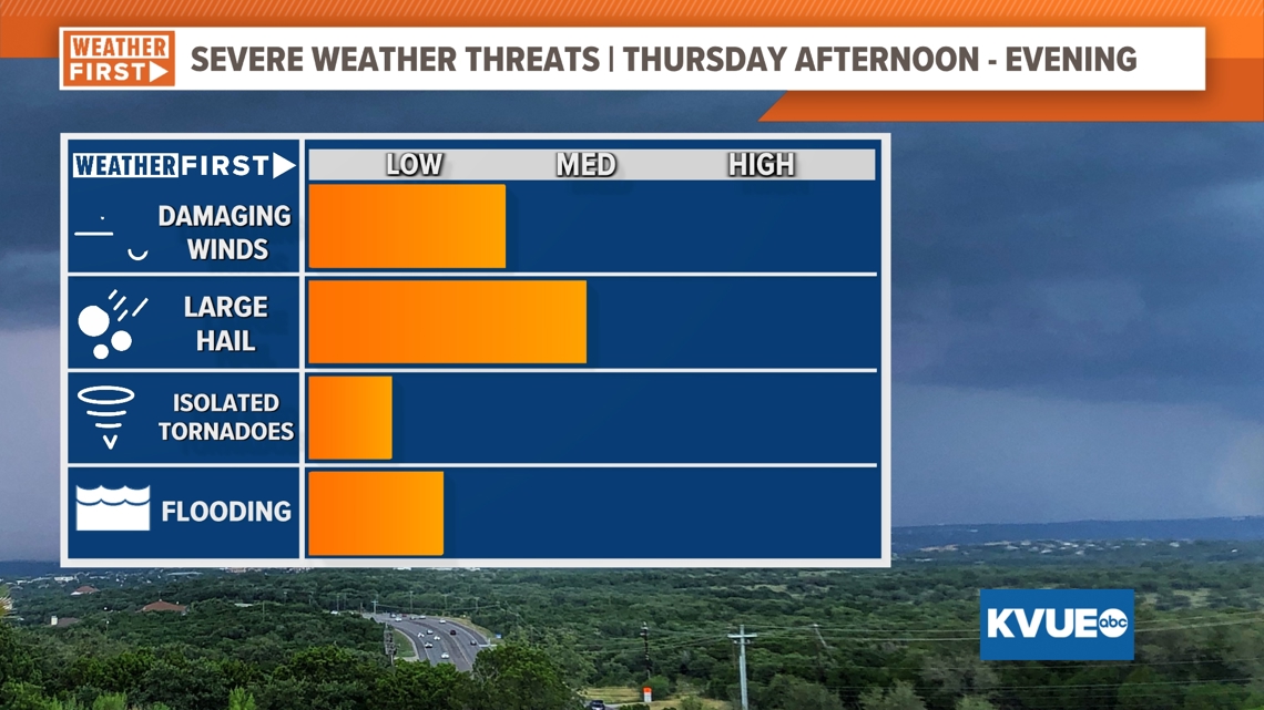
The main threat is very large hail, with damaging wind and isolated tornadoes also possible. When it comes to hail, the entirety of the KVUE area is in the “hatched” area for significant hail, meaning hail of 2 inches in diameter or more are possible with any storm that fires up.
RELATED: The science behind Texas-sized hail


Timeline
The latest high-resolution forecast model runs have the storm potential in the Hill Country lasting between 5 and 8 p.m. Between the hours of 7 and 10 p.m., we will need to keep a close eye on the I-35 corridor, including the Austin metro area, for any strong to severe storms. The Coastal Plains will need to be on alert between 9 and 11 p.m. before our severe weather threat winds down for the night.

With the conditional nature of these storms, we expect them to not be widely scattered, but as we have seen in the past, it only takes one storm to do damage.

Summary
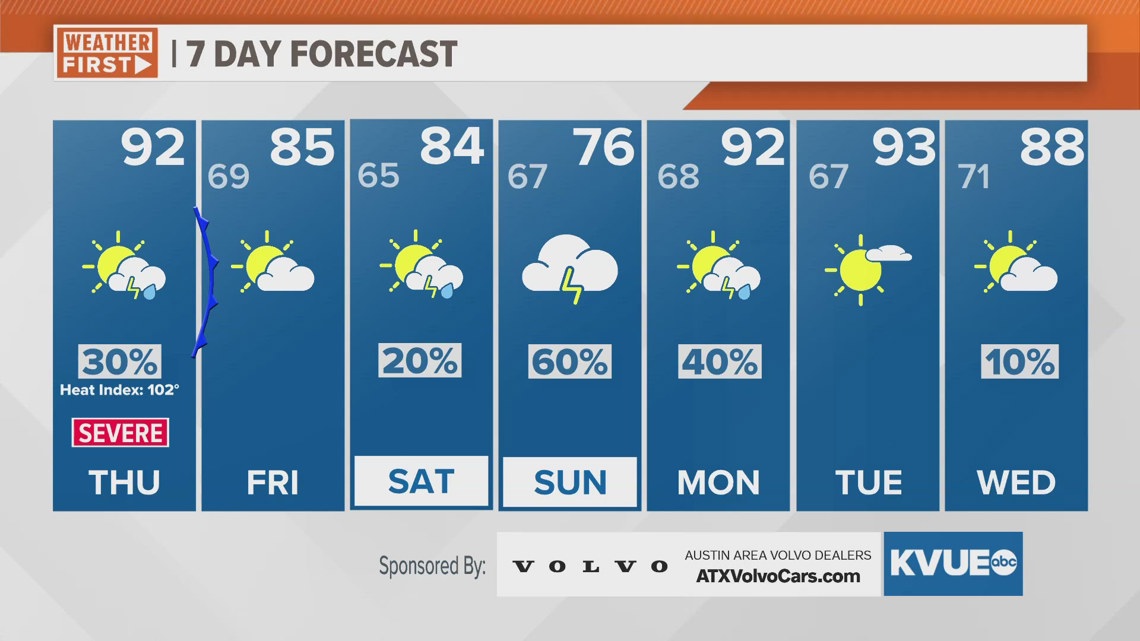
To summarize, we’re tracking rounds of strong storm from Thursday afternoon through the evening. The main areas of concern will be large or very large hail, but damaging wind and isolated tornadoes cannot be ruled out. Behind the cold front, expect some brief relief from the summer-like heat and humidity for Friday.
With that in mind, please stick with KVUE for the latest as we track the storm potential. In the meantime, your seven-day outlook is below.