- National memorial to honor NC firefighter who died on duty during Hurricane Helene
- Gov. Josh Stein extends State of Emergency for western NC wildfires
- Gov. Stein extends state of emergency for NC wildfire threat
- Governor Stein extends state of emergency for NC wildfire threat
- Governor Stein extends emergency in 34 NC counties amid wildfire threat
Tropical Storm Alberto makes landfall in Mexico, causes flooding along Texas coast

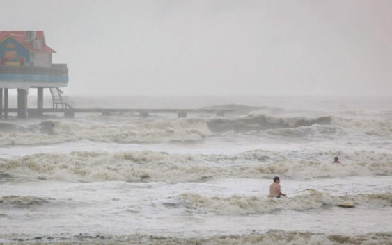
Tropical Storm Alberto brought rainfall and flooding to Mexico and the Texas Gulf Coast following its landfall.
But even before it made landfall in northern Mexico, folks in the Galveston County area were already seeing the storm’s effects with heavy rain and flooding.
And if you’re west of Dallas/Fort Worth, in the Hill Country, or in South Texas, chances are good it’s either overcast and darker than usual outside, or you’ve been getting a lot of rain over the past 24 hours.
This rain is part of the northernmost bands of Alberto. The storm is bringing high winds and rain, with a lot of it extending into Texas, where tidal flooding has been reported in parts of the Southeast and Gulf Coast. Further to the west, there’s a lingering danger of tornadoes, too.
Nicholas Price, a meteorologist with the National Weather Service in Corpus Christi, said the storm is expected to weaken as it makes its way across mountainous terrain in Mexico and into Texas.
“Locally, here, we just issued a few flash flood warnings for the area,” he said. “Those were strictly for this band that’s moving right over the Corpus area right now.”
» GET MORE NEWS FROM AROUND THE STATE: Sign up for Texas Standard’s weekly newsletters
Over the next few days, Price says he expects to see isolated showers that will lead to another inch or two of rain in Corpus.
“It’s a broad, low pressure system,” Price said. “It’s bringing in some of that moisture and it’s allowing some of these storms to form and continue to rain over the area.”
Despite the heavy rainfall, Price said the storms missed several reservoirs that would have been helpful in alleviating drought conditions.
“The reservoir unfortunately missed out on some of those beneficial rainfalls, though we did see some improvement with drought conditions across the area with some of this rainfall,” he said. “We did see some pretty decent rainfall totals – around 7 inches in Rockport and about 5 inches in Alice.”
Alberto is the first named storm of what is predicted to be an active hurricane season in the Atlantic.
“The National Hurricane Center put a forecast out that we were expecting an above average season. And to see a storm so early definitely can hint that may be what is to come,” he said. “But definitely make sure that everybody’s heeding the warnings and making sure that they stay prepared. Have evacuation plans in place to be able to know what to do in case one of these storms (hits near you).”
For the next few days, as Alberto continues to move north, Price recommended people stay weather aware.
“We could see some isolated flooding, flash flooding and maybe even a quick, spin-up tornado with any of these storms,” he said. “We had already seen some earlier this morning.”