- Seven months after Hurricane Helene, Chimney Rock rebuilds with resilience
- Wildfire in New Jersey Pine Barrens expected to grow before it’s contained, officials say
- Storm damage forces recovery efforts in Lancaster, Chester counties
- Evacuation orders lifted as fast-moving New Jersey wildfire burns
- Heartbreak for NC resident as wildfire reduces lifetime home to ashes
Tracking Hurricane Francine

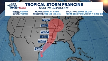
Francine is expected to make landfall midweek near Texas and Louisiana with wind, rain, and storm surge. Rain could reach the Carolinas this weekend.
CHARLOTTE, N.C. — Hurricane Francine is the sixth named storm in the Atlantic Basin during this hurricane season. On Monday, Francine formed in the southwest Gulf of Mexico as it became better organized in the warm waters of the Gulf.
Prior to developing into a named system, it was previously known as Potential Tropical Cyclone Six. This naming is used as an advisory product used by the National Weather Service’s National Hurricane Center whenever a tropical storm or hurricane conditions are expected to impact land within the next 48 hours.
Latest advisory on Francine
As of the 10 a.m. advisory Wednesday, Hurricane Francine is moving northward toward the Gulf Coast
- WINDS: Max sustained at 90 mph, gusts upwards of 105 mph
- MOVEMENT: Northeast at 13 mph
- LOCATION: About 210 miles southwest of New Orleans

Tropical storm and hurricane alerts are in effect for both Texas and Louisiana coasts. Dangerous storm surge and tropical-storm-force winds are expected to impact this region through midweek. Tropical-storm-force winds extend outward to some 160 miles from the center.
RAISE YOUR WEATHER IQ: Understanding the stages of hurricane development
Areas within the storm’s path should prepare for potentially life-threatening inundation from rising water moving inland from the coastline over the next two days.
Francine is forecast to become a hurricane before it makes landfall on Wednesday. The storm is on track to slowly move over land into the Mid-South region such as Arkansas and Tennessee.
Local Carolina Impacts


Rain could extend into parts of the Carolinas along a stalled front this weekend. Locally, prepare for higher rain chances all weekend starting Friday. Remnants from Francine could cause some flooding concerns for the western North Carolina mountains. Expect periods of rain in the forecast for Friday, Saturday, and Sunday. The rain will be coupled with cooler temperatures.
RAISE YOUR WEATHER IQ: What month has the most hurricanes?
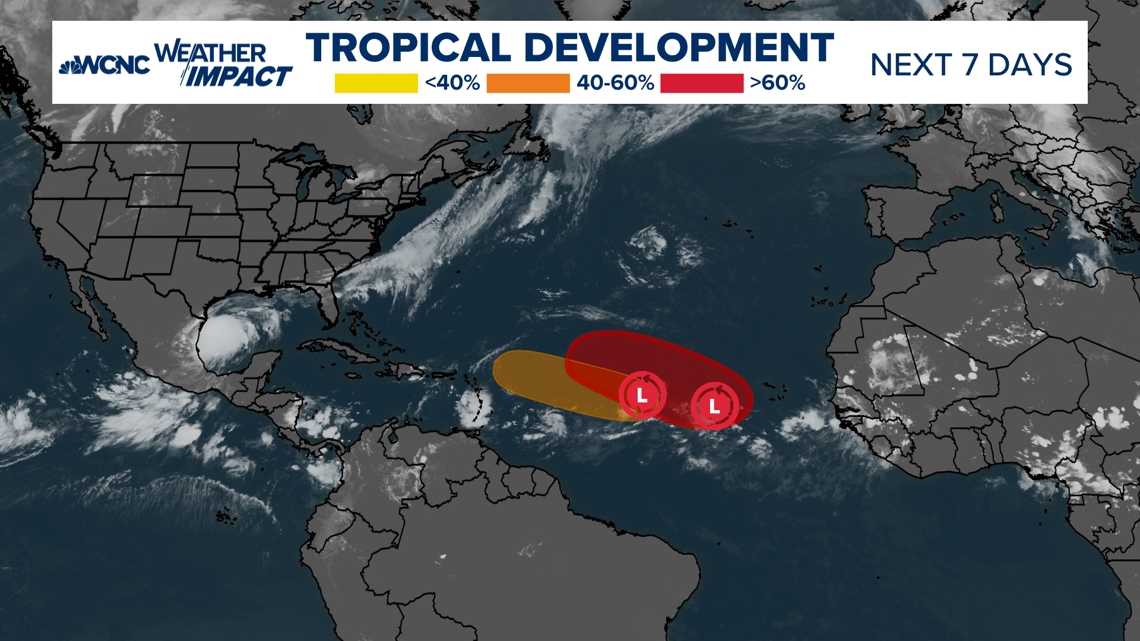
Two other tropical systems


Elsewhere in the tropics, there are two other systems in the central Atlantic. Both disturbances have an increasing chances of developing further, but neither are close to impacting land within the near future.
Contact KJ Jacobs at kjacobs3@wcnc.com and follow him on Facebook, X and Instagram.