- CenterPoint Energy accelerates infrastructure improvements ahead of hurricane season
- Carolina Hurricanes playoff tickets go on sale Thursday
- Ask the Meteorologist: Why do tornadoes target Tornado Alley, Dixie Alley?
- Nonprofit closes distribution site that aided thousands after Hurricane Helene
- Trump approves federal assistance amid Arkansas flooding
Did climate change have an impact on Hurricane Helene?

Warming ocean waters contributed to Helene’s intensity but others were classic weather set ups, like a predecessor rain event.
CHARLOTTE, N.C. — There have been a lot of questions, comments and misinformation floating around about Hurricane Helene and the storm’s ties to climate change.
Before we answer the question about whether climate change had an impact on Helene, let’s look at the facts we know about tropical systems and the Atlantic Basin.
- The oceans are getting warmer and so is the air.
- Warmer air holds more atmospheric moisture, which means heavier rain.
- Above-normal sea-surface temperatures allow for more rapid intensification.
With that said, did climate change have a contribution to Helene’s destruction? Yes.
Was it the only factor? No.
Rapid intensification
Hurricane Helene was a perfect example of the rapid intensification of a storm in the Gulf of Mexico. Helene went from a potential tropical cyclone with winds of 35 mph to a Category 4 hurricane with winds of 140 mph in less than three days.
Recently published studies show rapid intensification (an increase of ~35 mph or greater in a 24-hour period) and extreme rapid intensification (an increase of ~55 mph or greater in a 24-hour period) of tropical systems went up “significantly” between 1990 and 2021.
Helene was able to intensify so quickly due to warm sea-surface temperatures in the mid-to-upper 80s. Tropical cyclones need water temperatures at or above 80 degrees to form and get stronger. But the higher the number goes, the more fuel exists.
Atmospheric moisture
When water warms, it expands and takes up more space. When air warms, it holds more moisture. In fact, one degree Fahrenheit warmer is equivalent to 4% additional moisture content.
So, what does this mean when it comes to any rain event? Well, a rain event itself isn’t fueled by climate change, but when a rainfall event does happen …
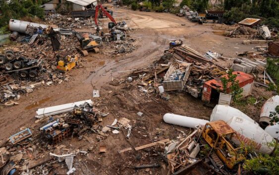
The rainfall is much heavier because there’s more moisture. And if the rain causes flooding, as we saw with Helene, that water takes up a lot more space because it’s warmer.
Helene was also a large tropical system so the western Carolinas had tons of tropical moisture before the storm ever arrived.
Predecessor rain event (PRE)
Now, let’s talk about what enhanced the storm that doesn’t have a direct tie to climate change: a predecessor rain event or PRE.
According to Cornell University, “predecessor rain events (PREs) are distinct mesoscale regions of heavy rainfall that develop approximately 1000 km poleward and in advance of landfalling tropical cyclones (TCs), and approximately 24–36 h before the passage of the main rain shield associated with the TC.”
To break it down, a PRE develops as a huge swath of tropical moisture, typically on the northern side of a tropical system. If this moisture encounters another synoptic or mesoscale feature, such as a stalled front, it can produce heavy and prolonged rainfall, which can lead to a higher risk of flooding.
As the Earth continues to warm, a PRE can produce more rainfall because of climate change. But again, climate change by itself, does not produce a PRE.
Geography of the Carolinas
On top of the aforementioned impacts, there is another thing unique to the Appalachian Mountain range that contributed to higher rainfall totals: the mountainous terrain.
First, based on the positioning of Helene, there was a southerly/southeasterly wind coming into the Carolinas. This is what we call upslope flow. In simpler terms, the wind direction shoved a bunch of tropical moisture into the mountain areas of the western Carolinas.
Secondly, due to the elevation and terrain changes, these same areas were at a higher risk of flash flooding, landslides and mudslides. All the heavy rainfall also led to swollen rivers, lakes and streams, which only exacerbated the flooding.
Contact Brittany Van Voorhees at bvanvoorhe@wcnc.com and follow her on Facebook, X and Instagram.