- Hurricanes lose to Panthers, fall down 2-0 in Eastern Conference Finals
- NOAA forecasts 60% chance of above-average hurricane season
- CenterPoint prepares for upcoming hurricane season by simulating response
- CenterPoint Energy simulates hurricane response, pledges improvements after Beryl failures
- Is your name on the list? These are the storm names for the 2025 Atlantic Hurricane Season
Heavy rain, flash flooding and thunderstorms through Wednesday

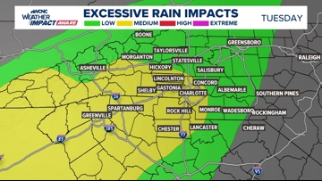
Up to three inches of rain in Charlotte could create localized flash flooding impacts.
CHARLOTTE, N.C. — Periods of heavy rain through Wednesday could create weather impacts including thunderstorms and localized flash flooding. Snow and wintry weather are also possible in the mountains.
The best chance for impacts is Tuesday night through Wednesday morning.
When
Rainy weather moved into the Charlotte area on Monday and heavier rain is forecast to impact the Tuesday evening commute and could linger through Wednesday’s morning rush hour.
“We will see some thunder likely,” WCNC Charlotte Weather Impact Chief Meteorologist Brad Panovich said in his weather vlog Tuesday morning. “So most of the day there will be scattered showers today. But the real action is this evening into the overnight hours when the heavy rain moves in.”
One highlight in the forecast is a line of storms that could move across the western North Carolina mountains and foothills on Tuesday night. After 8 p.m., the line of storms could be moving east through Taylorsville, Morganton, Hickory, Lincolnton, Gastonia and Shelby. Heavier rain could then arrive in Charlotte, Rock Hill, Fort Mill and communities along the I-77 corridor closer to 11 p.m.
Overall, the severe weather risk is low but the rain could still disrupt activities Tuesday night through Wednesday morning.
Heavy rain on Tuesday and Wednesday
Impacts
From Tuesday through Wednesday, heavy rain could coincide with localized flooding and a brief rumble of thunder. Creeks and streams could get slightly elevated while water may pool in low-lying areas and roads with poor drainage.

“We are going to see some minor flooding issues out there. So that’s why we want you to stay weather aware,” Panovich said. “So just be very cautious. There will be rapid runoff in creeks and streams. And basins that just have been changed a lot since Helene. So we don’t know exactly how some of this water is gonna move.”
It’s possible some of the heavier bands of rain could produce brief periods of thunder and lightning.
When the rain ends Wednesday, it could leave behind one and three inches of total rainfall accumulation.


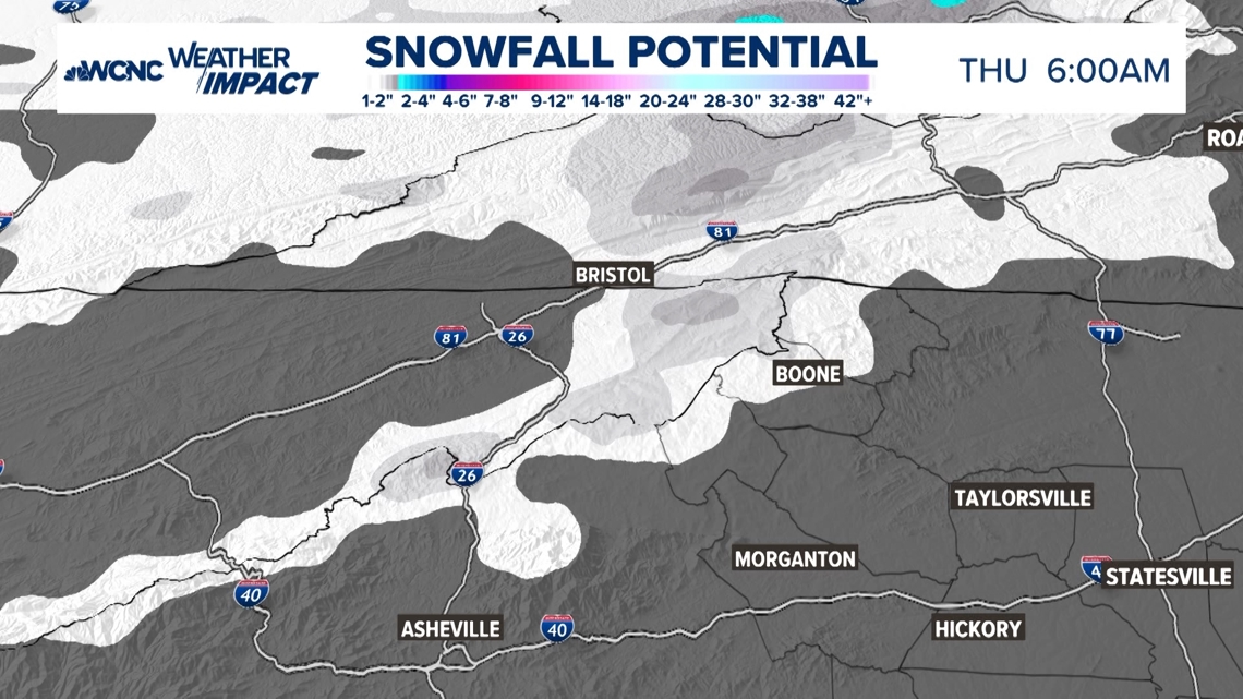
Colder air behind the rain could also produce snow and wintry weather in the North Carolina mountains Wednesday morning. Starting after 2 p.m. on Wednesday and continuing through Thursday morning, between 1-2 inches of snow is possible at the highest elevations along the North Carolina-Tennessee state line. Places like Boone and Blowing Rock could see between a coating and an inch.


Needs
Those traveling or living in low-lying areas should carefully watch for flooded roadways and waterways.
Gusty winds up to 30 mph could free holiday decorations and other outdoor items.
Those, especially in the North Carolina mountains, should prepare for the return of colder temperatures. The low temperature in Charlotte on Thursday morning will be near 30 degrees. In Boone at that same time, it could be 20 degrees.