- Report: Coastal flooding could threaten 1.4 million homes by midcentury
- Caught on camera | Tornado touches down in Missouri
- Carolina Hurricanes playoff tickets go on sale next week
- Storms kill 6 in the South and Midwest as forecasters warn of catastrophic rains, floods this week
- Weather Impact Alert: Cold front could trigger severe weather in Houston area this weekend | See timeline
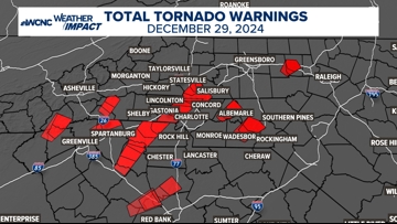
Why were there so many tornado warnings on Sunday, Dec. 29

A strong line of thunderstorms moved through on Dec. 29. This line was a textbook example of a well known weather phenomena: a QLCS.
CLOVER, S.C. — On Dec. 29, 2024 a strong line of thunderstorms raced across the area. It was moving so fast, that the worst of the weather only lasted for a few minutes, but that is all that it took to cause dozens of damage reports across the area.

The storm was moving so fast it was outrunning the issued warning times. The National Weather Service already confirmed tornadoes north of Columbia, but will be assessing the damage to confirm if some of the damage done across the greater Charlotte area was from a tornado or straight-line winds. Regardless, “wind is wind.”
But why were there so many tornado warnings?
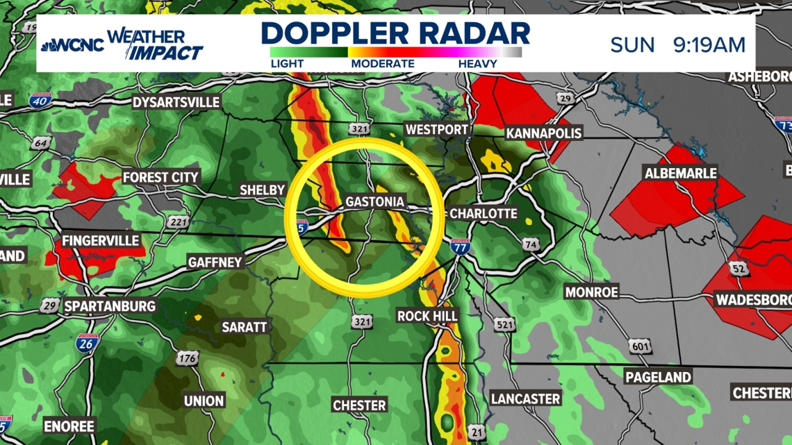
The reason is because this line of storms is more formally called a Quasi-Linear Convective System (QLCS). These QLSCs move fast, sometimes moving at 45 to 60 mph.
This is because the winds within the storms are driving it faster. Any QLCS can produce damaging winds, large hail, dangerous lightning, heavy rain and even tornadoes. Most of the tornadoes that happen in North Carolina (especially the western Carolinas) occur along a QLCS.


The above example shows one area that is being surveyed for a potential tornado. It was this space between the two lines of thunderstorms that was showing rotation and what prompted so many tornado warnings.
This line was moving so fast that most of these warnings were replaced by new warnings from York up through Rowan County. Sadly, one person died near the Iredell-Rowan county line when a tree fell on their truck.
This event was special because it had the perfect set up of moisture and wind shear, maximizing its wind energy potential. The only thing that helped slightly was the time of day. If this occurred in the middle of the afternoon, the wind damage could have been even more widespread.
Contact Chris Mulcahy at cmulcahy@wcnc.com and follow him on Facebook, X, Instagram and TikTok.