- NC Gov. Stein pledges continued Hurricane Helene recovery support in 100-day address
- Austin adopts new map that greatly expands area at risk of wildfire
- CenterPoint Energy accelerates infrastructure improvements ahead of hurricane season
- Carolina Hurricanes playoff tickets go on sale Thursday
- Ask the Meteorologist: Why do tornadoes target Tornado Alley, Dixie Alley?
Tornado warning for Union County, NC
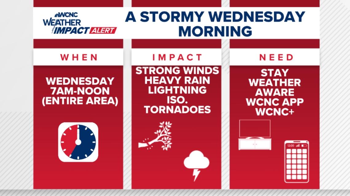
The WCNC Weather Impact Team is asking people to stay alert on Wednesday because of severe storms.
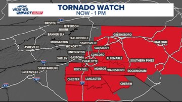
CHARLOTTE, N.C. — A tornado warning has been issued for Union County, North Carolina until 9 a.m.
A severe thunderstorm warning has been issued for Mecklenburg, Rowan, Cabarrus, and Union counties. Expect impacts from damaging winds through 9 a.m.
A previous tornado warning issued at 7:30 a.m. for Chester County was allowed to expire at 7:45 a.m.
The National Weather Service has issued a tornado watch for communities along and east of Interstate 77 through 1 p.m. This means weather conditions are primed for the possibility of severe thunderstorms and tornadoes.

When
The storm threat is a single line of storms known as a squall line.
Around 6:30 a.m., the line of storms brought heavy rain and gusty winds to locations such as Boone, Morganton, Hickory and Shelby. The line is moving east into Charlotte and other locations along the Interstate 77 corridor including Statesville, Gastonia, Mooresville, Cornelius, Davison and Rock Hill. The storms will then move off to the east and impact cities such as Salisbury, Concord and Monroe.

Fueled by instability and sunshine, the storms were at their strongest west of Charlotte. The storms are forecast to regain strength again Wednesday as they move east of Charlotte.
Thanks to the relatively cooler and more stable night, the storms were able to weaken some as they moved into the Carolinas early Wednesday morning.
Regardless, the line of storms is still producing a period of heavy rain and gusty winds.
Impact
Across Charlotte, the storms are bringing impacts from heavy rain, including reduced visibility and roadway flooding. The timing of the storms means the impacts are expected during periods of the morning rush hour commute. This prompted many area schools to cancel or delay classes.
Gusty winds could bring down tree branches and power lines, which could result in power outages. An isolated tornado is also possible. Damaging winds could result in tree or structural damage.

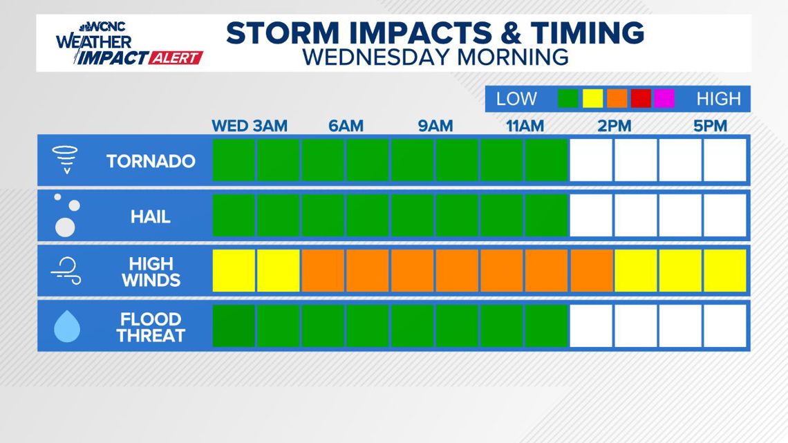
Need
The timing of the storms warrants allowing extra time for any necessary travel on Wednesday morning. Ideally, travel should be delayed to avoid the strongest portion of the storms.
Keep your phones and spare batteries charged, in the result you experience power outages.
Be sure to have multiple ways to receive severe weather alerts, especially during the overnight hours and while you drive.