- 'We gutted every building' | Chimney Rock rebuilding after Hurricane Helene
- 'We gutted every building' | Chimney Rock rebuilding after Hurricane Helene
- Debris from Hurricane Helene provides fuel, complicates containment for spring wildfires
- David & Nicole Tepper increase Hurricane Helene relief commitment to $750k
- David & Nicole Tepper increase Hurricane Helene relief commitment to $750k
Texas wildfire map | How to track the latest information and air quality
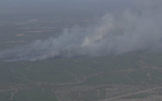
HOUSTON — As the Pauline Road Fire continues to burn across San Jacinto County, concerns are mounting over air quality impacts and the expanding threat to communities.
With strong winds and dry conditions fueling the wildfire, officials are closely monitoring smoke movement and advising residents to track air quality levels in Houston and other Southeast Texas cities.
Maps of wildfires across Texas:
As a wildfire burns San Jacinto County, officials are monitoring the air quality as smoke travels south.
According to the National Weather Service, poor air quality can aggravate health issues such as asthma, heart conditions, and other respiratory conditions. Seniors, children, and those with compromised immune systems should be particularly careful.
Those who are vulnerable like children, seniors, and those with respiratory issues should stay indoors if possible. If you have to go outside, limit it to strictly essential activities.
The Texas Commission on Environmental Quality produces air quality forecasts for the state.
You can check the air quality where you live here or in metro areas below: