- Seven months after Hurricane Helene, Chimney Rock rebuilds with resilience
- Wildfire in New Jersey Pine Barrens expected to grow before it’s contained, officials say
- Storm damage forces recovery efforts in Lancaster, Chester counties
- Evacuation orders lifted as fast-moving New Jersey wildfire burns
- Heartbreak for NC resident as wildfire reduces lifetime home to ashes
Cold front could trigger severe weather in Houston area this weekend | Timeline for potential storms
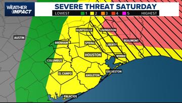
Southeast Texas braces for severe weather this weekend as a cold front brings storms.
HOUSTON — After a week of warm, muggy weather and gusty winds, Southeast Texas residents should prepare for a risk of severe weather heading into the weekend.
The KHOU 11 Weather Team has issued a Weather Impact Alert for Saturday as they track the potential for severe weather when a cold front moves through the area.
The Storm Prediction Center has placed all of Southeast Texas under a Level 2 risk, a “slight risk” on the five-tier scale, for severe weather.
Saturday’s storms could bring damaging winds, heavy downpours, hail, and the possibility of an isolated tornado, especially east of Houston, according to KHOU 11 Meteorologist Chita Craft.
“The timing right now looks to be from the afternoon into the early evening hours,” Craft said. “It’s still too early to pinpoint exactly where the strongest storms will develop, but the risk is there.”

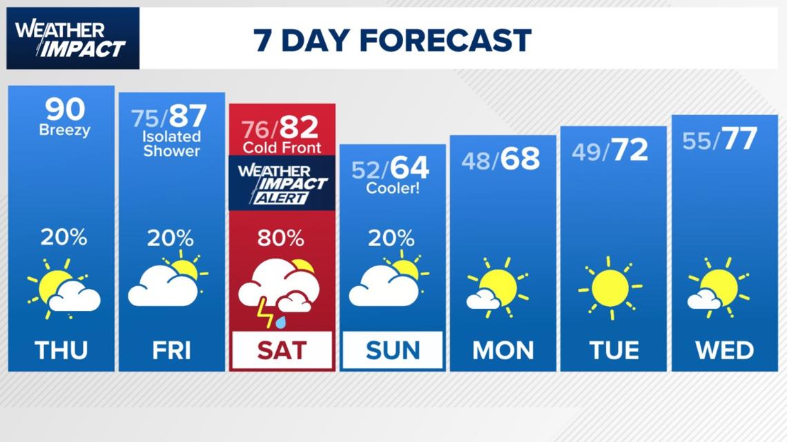
While Thursday’s weather is not expected to include severe storms locally, strong winds are already being felt across the region. Gusts between 35 and 40 mph are expected throughout the day, along with unseasonably warm temperatures. Houston could tie or break a daily record high Thursday afternoon, with temperatures reaching 90 degrees.
The severe weather threat on Thursday is focused well north of Houston, stretching from North Texas into Arkansas and Tennessee.
Locally, rain chances remain slim until Saturday, when the cold front arrives. After the front passes, cooler and drier conditions are expected to return. Morning temperatures could drop into the 50s on Sunday and even the 40s by Monday and Tuesday.
“We’ll be watching Saturday closely,” Craft said. “Make sure you have a way to receive weather alerts, especially if you have plans later in the day.”

Timeline for potential severe weather Saturday, April 5
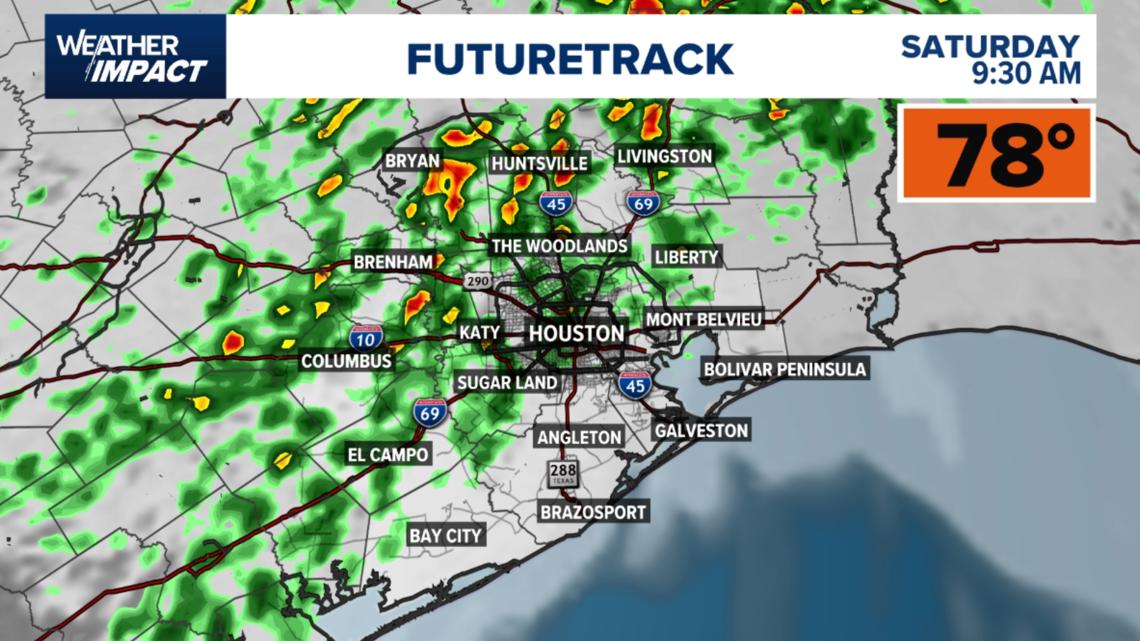
9:30 AM – Showers & Storms Begin: Scattered showers and thunderstorms will start to develop across Southeast Texas Saturday morning. Some of these storms could produce brief heavy rain and gusty winds, especially north of Houston toward Bryan, Brenham, and Huntsville.

3 PM – Strong Storms Possible: By mid-afternoon, storms are expected to intensify. The Futuretrack shows a line of strong storms pushing through the Houston metro area, including Katy, Sugar Land, and The Woodlands. These storms could produce heavy downpours, strong winds, and possibly hail.

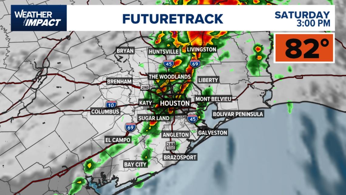
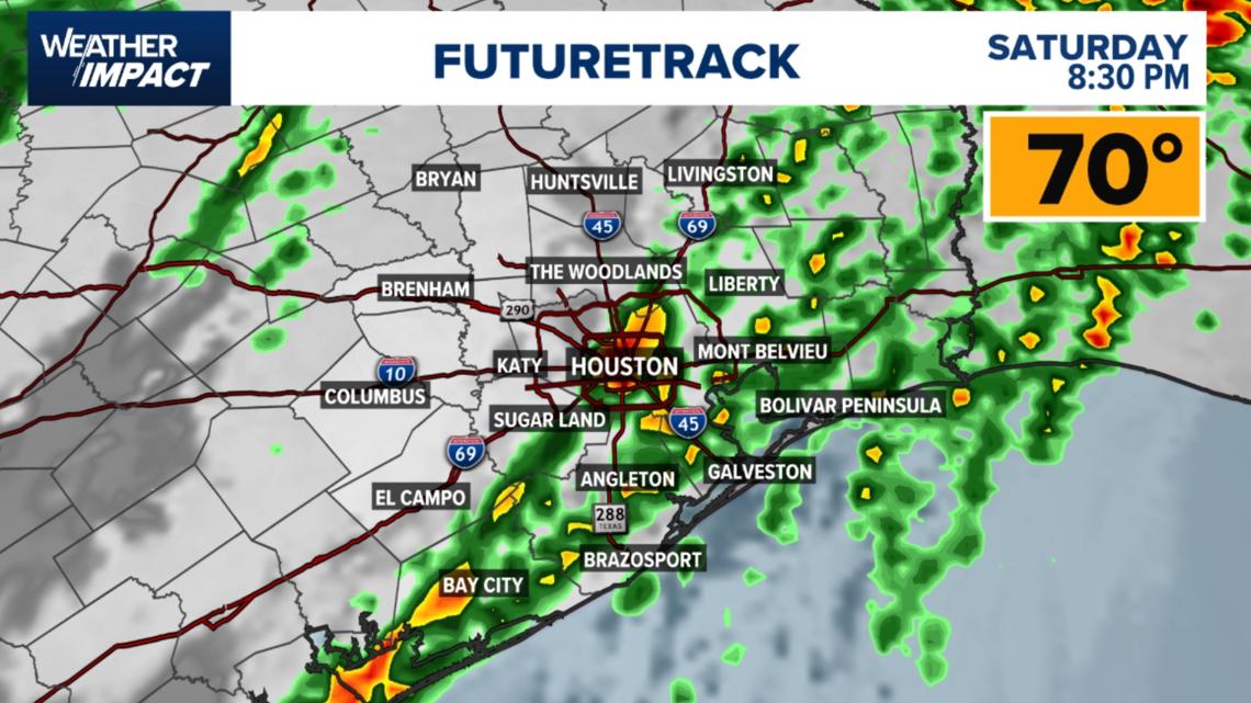
8:30 PM – Storms Move East, Cooler Air Arrives: By Saturday evening, the line of storms will shift east toward Liberty, Mont Belvieu, and Bolivar Peninsula. Rain and storms will begin to taper off in Houston and surrounding areas as cooler, drier air moves in behind the front.

