- Here’s how Austin-area leaders are preparing for wildfire threats this summer
- Harris County sues Trump administration, cites threat to hurricane season preparedness
- Prescribed burn in Morrow Mountain aims to prevent future wildfires
- Prescribed burns aim to prevent wildfires in Stanly County
- Prepare for hurricane season with the Town of Leland Hurricane Expo
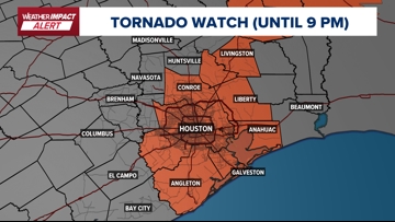
Weather Impact Alert: Tornado Watch issued for much of Southeast Texas until 9 p.m.
Southeast Texas braces for severe weather this weekend as a cold front brings storms.
HOUSTON — After a week of warm, muggy weather and gusty winds, Southeast Texas residents should prepare for a risk of severe weather heading into the weekend.
Active watches and warnings:
- The National Weather Service has issued a Tornado Watch until 9 p.m. for much of Southeast Texas, including Harris, Fort Bend, Montgomery, Brazoria, Galveston, Chambers, Liberty, Polk, and San Jacinto counties

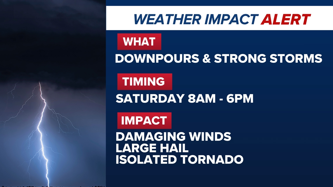
The KHOU 11 Weather Team has issued a Weather Impact Alert for Saturday as they track the potential for severe weather when a cold front moves through the area.

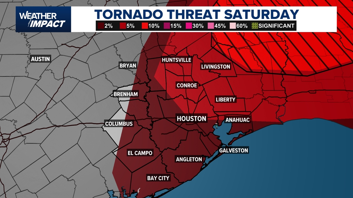
The Storm Prediction Center has placed all of Southeast Texas under a Level 2 risk, a “slight risk” on the five-tier scale, for severe weather.
Saturday’s storms could bring damaging winds, heavy downpours, hail, and the possibility of an isolated tornado, especially east of Houston, according to KHOU 11 Chief Meteorologist David Paul.
“The timing right now looks to be from the late morning into the early evening hours,” Paul said. “It’s still too early to pinpoint exactly where the strongest storms will develop, but the risk is there.”

After the front passes, cooler and drier conditions are expected to return. Morning temperatures could drop into the 50s on Sunday and even the 40s by Monday and Tuesday.
“We’ll be watching Saturday closely,” Paul said. “Make sure you have a way to receive weather alerts, especially if you have plans later in the day.”
Timeline for potential severe weather Saturday, April 5
9:30 AM – Showers & Storms Begin: Scattered showers and thunderstorms will start to develop across Southeast Texas Saturday morning. Some of these storms could produce brief heavy rain and gusty winds, especially north of Houston toward Bryan, Brenham, and Huntsville.

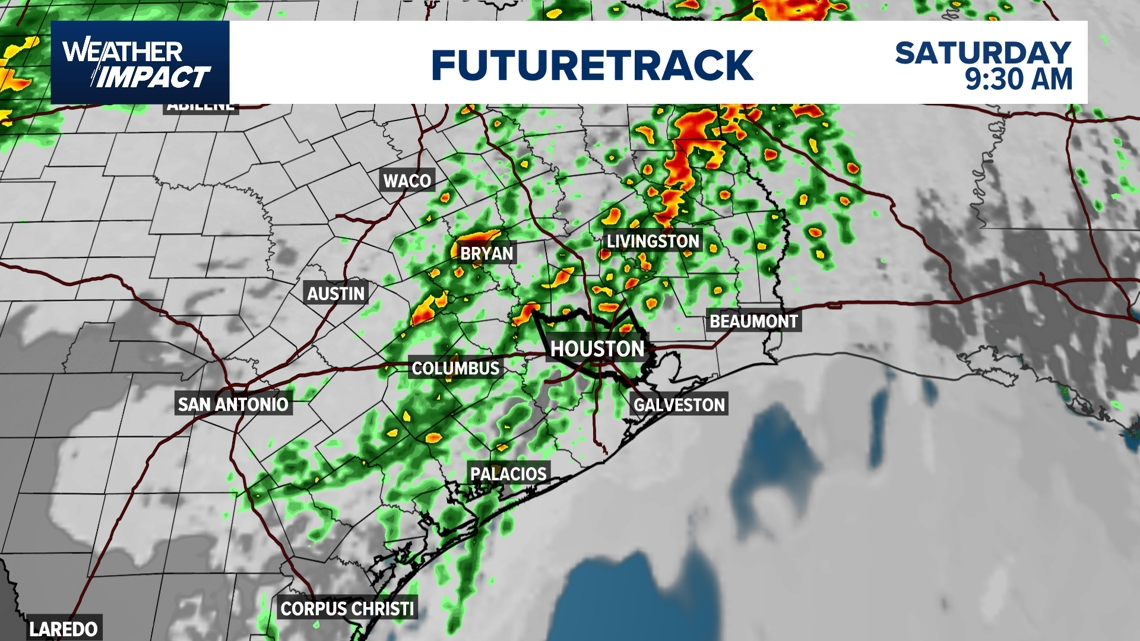
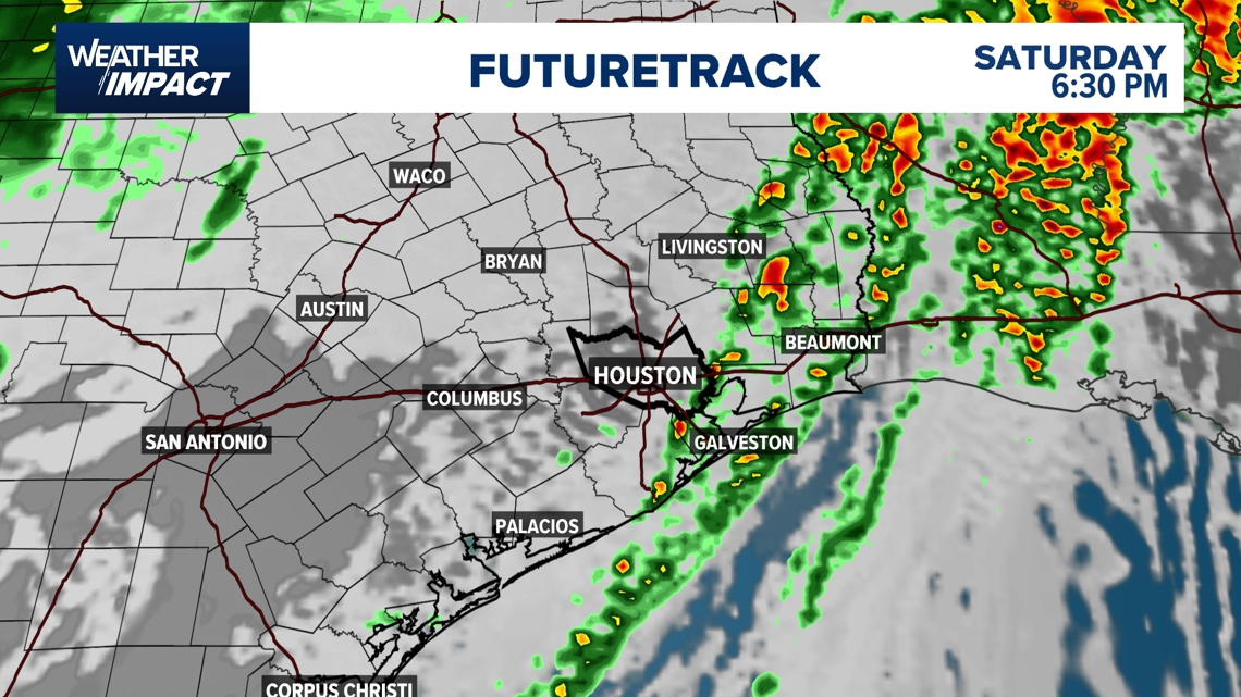
3 PM – Strong Storms Possible: By mid-afternoon, storms are expected to intensify. The Futuretrack shows a line of strong storms pushing through the Houston metro area, including Katy, Sugar Land, and The Woodlands. These storms could produce heavy downpours, strong winds, and possibly hail.

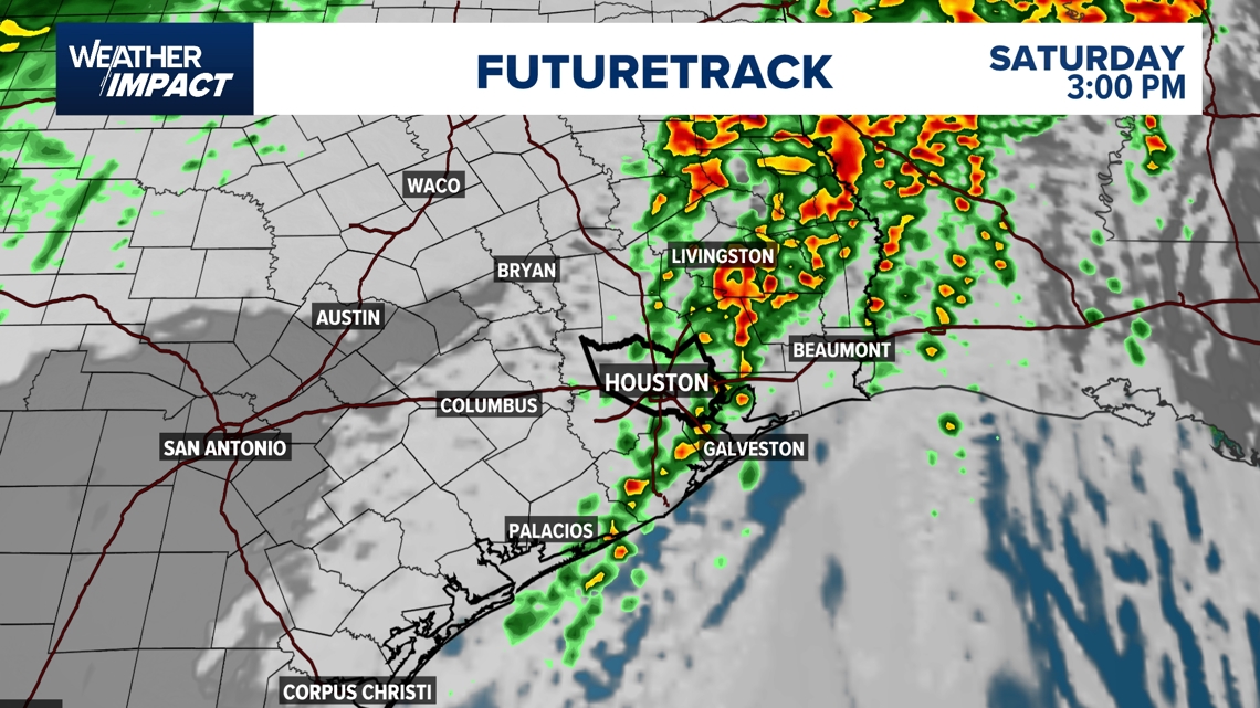
6:30 PM – Storms Move East, Cooler Air Arrives: By Saturday evening, the line of storms will shift east toward Liberty, Mont Belvieu, Galveston and Bolivar Peninsula. Rain and storms will taper off in Houston and surrounding areas as cooler, drier air moves in behind the front.

