- Rocky Point wildfire is fully contained
- Weather Impact Alert in effect for storms that continue to push through Houston | Flash Flood Warning issued
- Wildfire in Rocky Point prompts evacuations
- Fake job seekers are flooding the market, thanks to AI
- One set of evacuation orders lifted in Caldwell County after wildfire contained
Weather Impact Alert in effect for storms that continue to push through Houston | Flash Flood Warning issued
Rain chances stay high for the city and coastal spots on Monday, with drier weather farther north.
Chita Craft, Pat Cavlin, Chris Ramirez, David Paul, Kim Castro
9:27 AM CDT April 3, 2025
9:43 AM CDT April 21, 2025
HOUSTON — Storms continue to move through the Houston area, leaving high water on roads across town. With the storms this morning, the KHOU 11 Weather Team has issued a Weather Impact Alert through 10 a.m.
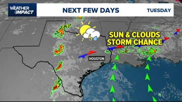
You can track storms on live radar above.
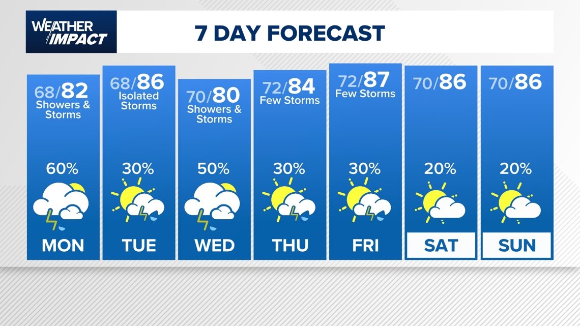
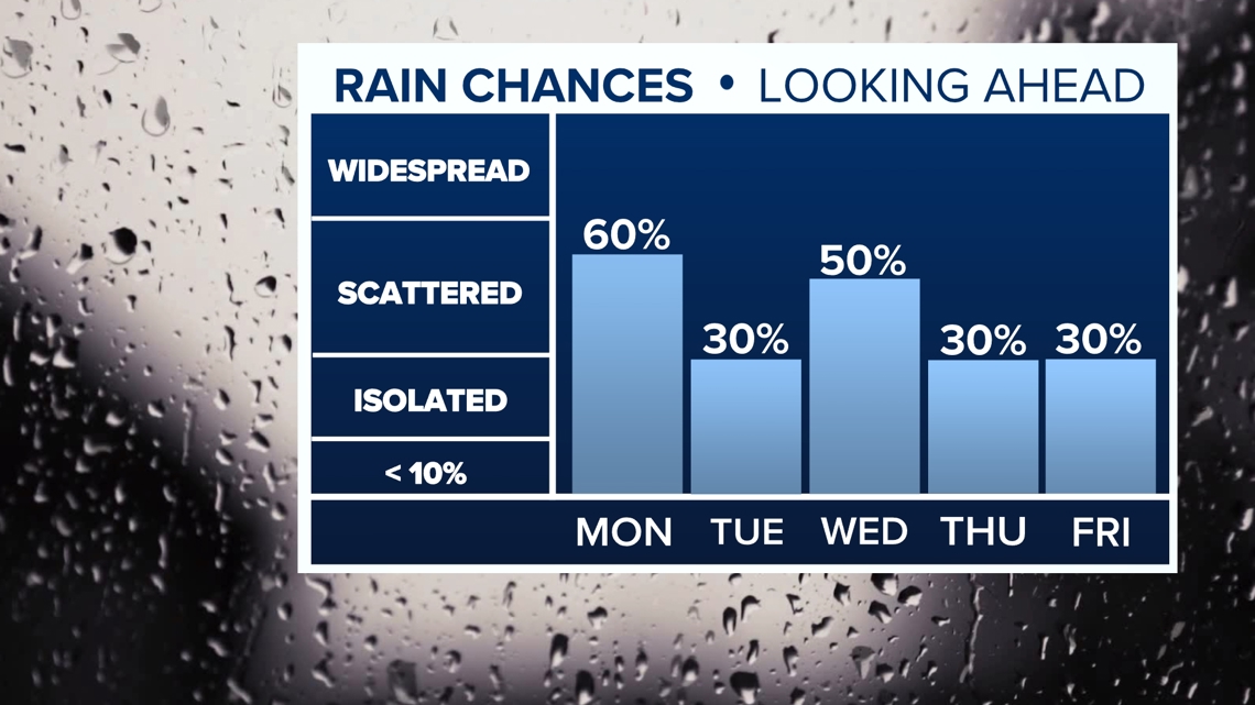
For Monday, expect mainly cloudy skies with showers and storms possible through the afternoon. Areas north and west of the city will likely be the driest with sunshine, while the city and areas to the south will see the best chance for rain. High temperatures should stay in the low 80s.
The good news is that rain chances aren’t expected to remain high every day this week. In fact, on Tuesday, more sunshine and drier weather is expected, with only an isolated chance for a few showers.

Rain chances do increase again for Wednesday, before dropping again later in the week. The trend points towards gradually drier weather towards the end of the week and next weekend.

Overall, the next 7 days look very early summer like with off and on storms with high humidity and warm overnight temperatures. Afternoon highs should be a few degrees warmer than normal in the mid 80s.