- After Hurricane Beryl, Texas lawmakers push for generators at senior living facilities
- 20-million-gallon detention basin in Meyerland designed to help prevent flooding
- Firefighters report significant progress on McDowell County wildfire
- How to watch the FireAid benefit concert for LA wildfire relief
- FireAid, a benefit for LA wildfire relief, is almost here. Here’s how to watch and donate
Weather Aware: The potential impacts of Hurricane Helene in the Carolinas
Any rain in the next few days will soak the ground ahead of the tropical moisture, which will move in later this week. Stay Weather Aware for these impacts.
CHARLOTTE, N.C. — A cold front moving in from the northwest is expected to bring showers and storms to the Charlotte area on Wednesday while the Carolinas are bracing for potential impacts from Tropical Storm Helene in the coming days.
When will the Carolinas see the impact?

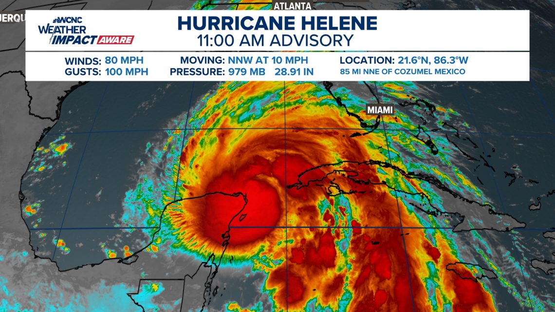
As of 11 a.m. Wednesday, Helene became a hurricane with maximum sustained winds of 80 mph. The storm is located about 85 miles north-northeast of Cozumel, Meixco. Helene is moving north-northwest at 10 mph. The storm is expected to move into the extremely warm Gulf waters where it will experience rapid intensification.
The forecast cone for Helene remains largely unchanged from previous models. Once the storm system moves into the Gulf of Mexico on Wednesday, it is expected to rapidly become a hurricane. It could possibly make landfall in the Big Bend area of Florida Thursday night, and could at that point be considered a major hurricane.
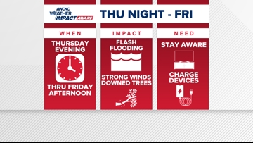
By 9 a.m. Friday morning, Helene’s forecast cone indicates it will pass through Georgia and western South Carolina and move into North Carolina and eastern Tennessee. The greater Charlotte area is forecast to see heavy rain early Friday morning through early afternoon.

Any rain in the next few days will soak the ground ahead of the tropical moisture.
What impacts to expect

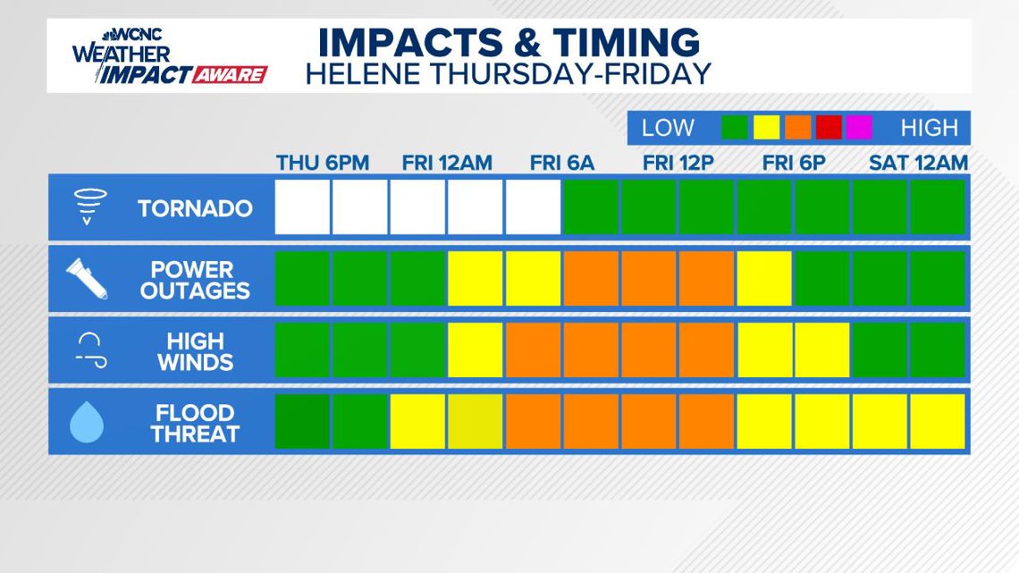
Expect rain totals up to 10 inches in the mountains and up to 5 inches in the Charlotte area, as well as a chance of tropical storm force winds on Friday. Panovich said this could lead to tree and power line issues on Friday.
Panovich said we should see better weather ahead for the weekend, as the wind and rain will move out fairly quickly.
What you need to know to stay safe
In the event of a severe storm, stay Weather Aware by:
- Seeking shelters indoors away from lightning and gusty winds
- Watching for flooded creeks and streams
- If you encounter a flooded roadway: turn around, don’t drown
- Monitoring radar for quick-moving thunderstorms that could disrupt outdoor plans
When temperatures get high in the Carolinas, it’s important to stay Weather Aware by:
- Limiting your time outside/take breaks
- Staying hydrated
- Seeking shade when available
- Checking on the elderly and pets