- Another $500M for Hurricane Helene relief in North Carolina passes key hurdle
- Crews battle wildfire in McDowell County, NC
- Wildfire in McDowell County, NC is 20% contained, officials say
- California governor asks Congress for nearly $40 billion for Los Angeles wildfire relief
- North Buncombe High School students lead recovery efforts for NC farmers post-Hurricane Helene
By the numbers: Reasons why Florence was a historic storm
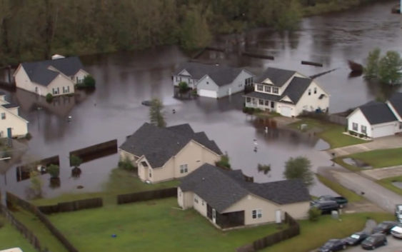
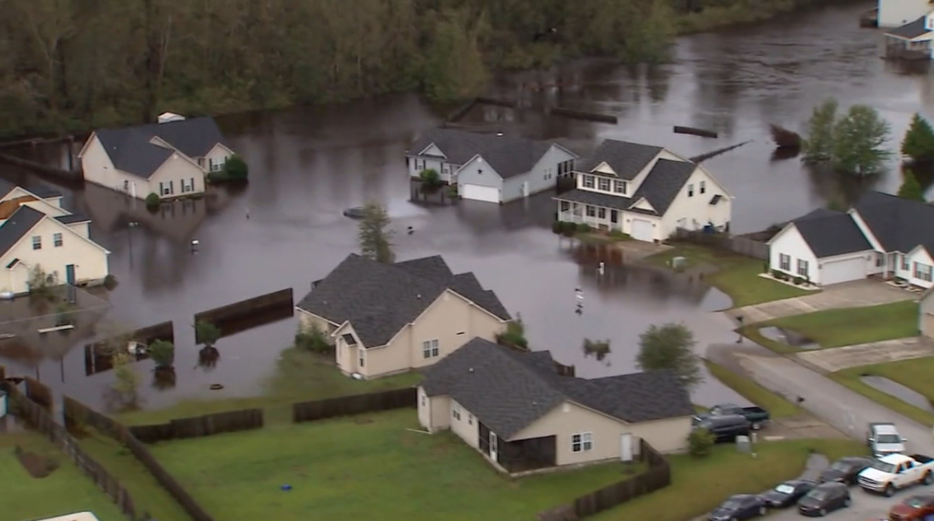
WILMINGTON, NC (WWAY) — Hurricane Florence came ashore Friday, September 14 around 7:15 in the morning near Wrightsville Beach. The storm brought life-threatening storm surge, catastrophic flash-flooding, historic river flooding, strong winds and several tornadoes to North Carolina.
It’s taken the National Weather Service weeks to survey all the damage left behind.
– Advertisement –
Primarily storm total reports show Elizabethtown saw the most rain in southeastern NC, picking up 35.93″. Hampstead reportedly saw 29.52″, Oak Island 26.98″, Wilmington 23.02″, Whiteville 22.58″, Burgaw 22.06″, and Sunset Beach 10.24″.
PENDER COUNTY: NWS says the worst flooding event in local history happened during and after Florence as flash flooding closed many roads and inundated neighborhood. More than 5,000 structures were flooded and that houses outside of the 500-year floodplain were inundated with 3-4 feet of water. On the Northeast Cape Fear River, the gauge at Burgaw reached 25.58 feet early on Sept. 19, exceeding the crest from Floyd (1999) by over three feet.
BLADEN COUNTY: Flash flooding closed many roads and highways during and immediately after the hurricane. The Cape Fear River crested two to six feet higher than during Hurricane Matthew (2016), setting a new record stage at Lock and Dam #1. The Town of Kelly was evacuated due to life-threatening flooding that happened when a 30-ft wide breach opened in a dike built in 1945.
NEW HANOVER COUNTY: The Cape Fear River at downtown Wilmington reached 8.28 at 3:30 p.m. on Sept. 14 during Florence’s storm surge. This exceeded it’s previous record stage set just two years earlier during Matthew, and flooded portions of Water Street over two feet deep. Widespread flash flooding on Sept. 14 and 15 closed many roads and inundated neighborhoods. The NorthChase community was particularly hard hit with up to three feet of water entering homes. New Hanover County and the City of Wilmington were isolated from the outside world for several days as every access route including I-40, U.S. highways 17, 74, 76, and 421 were all closed due to flooding. More than 22 million gallons of untreated sewerage overflowed into area waterways. A coal ash storage pond at a decommissioned power plant overtopped, and an earthen dam at Sutton Lake breached in multiple spots, allowing the lake water to flow into the river.
BRUNSWICK COUNTY: Widespread flash flooding developed on Sept. 14 and 15, flooding neighborhoods and closing roads. Extremely high water in Town Creek flooded 30 homes in the Stoney Creek neighborhood. Sanford dam at Boiling Spring Lakes, built in 1961, breached around 7 p.m. September 15, destroying Alton Lennon Drive and flooding one structure. In Southport, the Dutchman Creek bridge was damaged and a water main was washed out in the same area.
COLUMBUS COUNTY: Soules Swamp flooded the southern part of Whiteville. Water depth reached more than four feet in some businesses, much higher than with Hurricane Matthew. Fair Bluff was flooded by the Lumber River, separating the town into two due to flooding, and water was reported to be nine feet deep in one business in Riegelwood. The Coast Guard rescued 116 people from floodwaters in the Crusoe community on Sept. 18. Numerous trees, boats, and docks broke loose in the high way and battered homes along the shoreline in Lake Waccamaw.
According to NWS, at least seven tornadoes spawned across New Hanover, Pender, Columbus, and Brunswick counties during Florence. Two EF-0 tornadoes touched down near Bayshore in the early morning hours of Sept. 16. An EF-1 tornado touched down near Sidney in Columbus County early morning on Sept. 17. Two tornadoes, one EF-0 and one EF-1, was reported near Silver Lake. Both happened around 5 a.m. Sept. 16. The EF-1 forced the WWAY crew to take shelter in Leland. Two tornadoes were reported in Pender County. An EF-1 in Hampstead and an EF-0 near Burgaw. No facilities or injuries were reported because of those tornadoes.
September 2018 was one for the record books in Wilmington for many different reasons.
ILM saw the wettest weather event in history as Florence dropped 23.02″ of rain from Sept. 13 through Sept. 16. It was also the wettest month, 23.41″, surpassing what we saw during September 1999 when Hurricane Floyd made landfall near Bald Head Island. The second highest wind gust was recorded of 105 mph. Hurricane Helene in 1958 brought wind gusts of 135 mph. Florence also produced the fourth lowest barometric pressure in Wilmington of 965.5 millibars. September 2018 was the second warmest September in history with an average temperature of 79.2 degrees. Lastly, as of September 30, it’s the wettest year in Wilmington with 86.7″ of rain.
Read more of the preliminary report of Hurricane Florence from the National Weather Service in Wilmington.