- NC burn ban lifted statewide as rain improves wildfire conditions
- Western NC wildfire risk will 'get worse, not better' Ag Commissioner says, pressing lawmakers for help
- Watering trees is a must to protect them from severe weather and drought
- At least 4 dead, hundreds rescued after deadly floods ravage South Texas
- Today on Texas Standard: Deadly floods swamp South Texas, shatter records
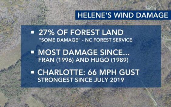
Wind damage from Helene could be worst since Fran and Hugo
We’re learning more about Helene’s historic impact about seven weeks after it blew through North Carolina.
A recent report from the North Carolina Forest Service says that 27% of the affected forestland had at least some tree damage. In this report, they say this may be the most damaging wind event since Hurricane Fran in 1996 and Hurricane Hugo in 1989.
The North Carolina State Climate Office says that the wind gust seen in Charlotte was the strongest in five years.
Our state’s Climate Office is one of the largest in the country.
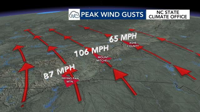
Its EcoNet stations revealed some of the stronger gusts that happened during the height of Helene. Mount Mitchell registered a 106 mph gust, while Frying Pan Mountain observed a 87 mph gust.
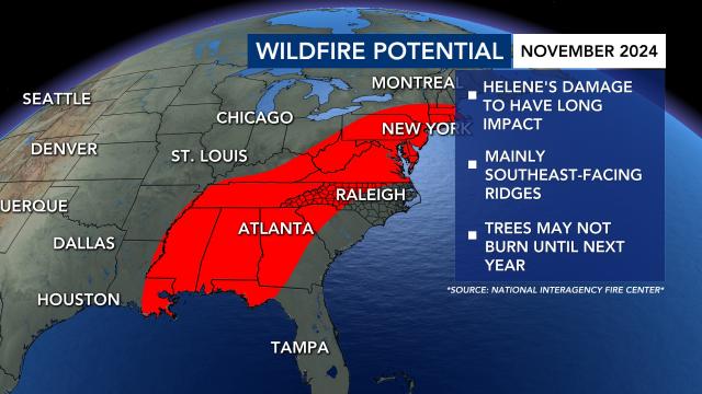
Leaves on the ground and downed trees from the storm could become additional fuel to future forest fires. The National Interagency Fire Center shows that there is a risk for most of the Eastern U.S. this November.
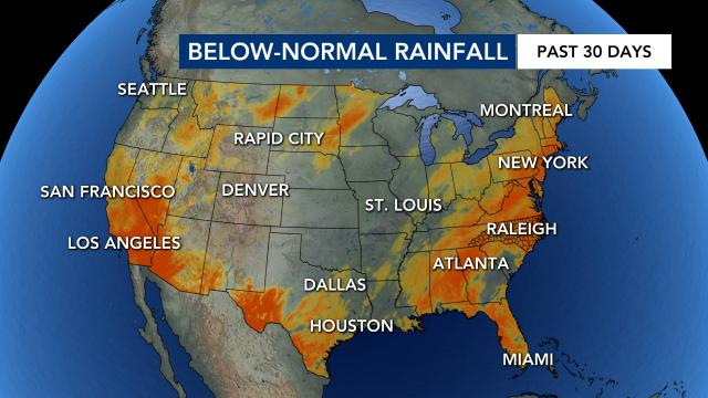
We’ve seen that playing out recently in states like New Jersey. Part of that has to do with the below-normal rainfall that’s been seen in the wake of Helene.
The NIFC does note that some of the fallen trees from Helene won’t be “cured enough” to ignite further fires this year.
However, they will be by next year. It’s a sign of the long-lasting impact that Helene’s wind damage will have on the western half of North Carolina.
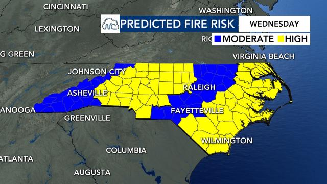
In the short-term, the Climate Office’s daily outlook shows the higher threat in the Foothills and Piedmont Wednesday.
Rain chances rise Thursday, which should hopefully extinguish any threat for the time being.
