- As city leaders consider expanding at-risk zone for wildfire damage, home builders say it could raise costs
- Is your neighborhood at high wildfire risk? | Here's how to check the city's wildfire risk map
- 'Be prepared now': Brad Panovich updates severe weather risk for Sunday
- 'Be prepared now': Brad Panovich updates severe weather risk for Sunday
- As anxiety around wildfires grows, Austin plans to add tens of thousands of acres to risk map
Severe weather threat this weekend
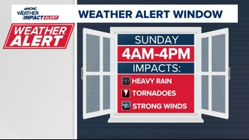
A risk of damaging winds and isolated tornadoes means you should stay alert for severe storms early Sunday.
CHARLOTTE, N.C. — The WCNC Weather Impact Team is asking you to stay alert to severe weather Sunday. A passing line of storms could bring damaging winds and isolated tornadoes to the Carolinas.
When

The severe weather threat is forecast between 4 a.m. and 4 p.m. Sunday.
Storms moving through the South on Friday and Saturday will make their way into the Carolinas during the early morning hours of Sunday. Similar to the storm threat on March 5, the severe weather threat will move from west to east along a squall line.
The severe weather should arrive after Charlotte FC’s home game Saturday night, according to WCNC Weather Impact Chief Meteorologist Brad Panovich. Fans are advised to expect gusty winds and warming temperatures throughout the course of the match, though.
Impact

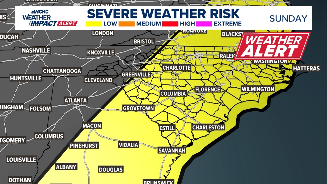
The impact of this severe weather is heavy rain, damaging winds and tornadoes. There is approximately a 15% chance of seeing severe weather across the Carolinas.
Need
In order to receive timely severe weather alerts, be sure to have multiple ways to receive weather alerts. One of those ways can be the WCNC Charlotte mobile app. Since the storms could arrive during the early morning hours, be sure to have a weather radio or other tool to awaken you in the event of a nearby storm.