- As city leaders consider expanding at-risk zone for wildfire damage, home builders say it could raise costs
- Is your neighborhood at high wildfire risk? | Here's how to check the city's wildfire risk map
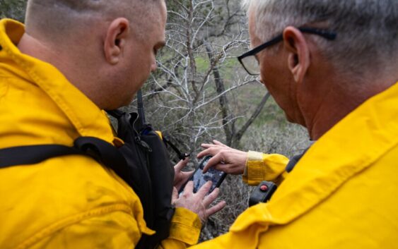
- 'Be prepared now': Brad Panovich updates severe weather risk for Sunday
- 'Be prepared now': Brad Panovich updates severe weather risk for Sunday
- As anxiety around wildfires grows, Austin plans to add tens of thousands of acres to risk map
As anxiety around wildfires grows, Austin plans to add tens of thousands of acres to risk map
Austin plans to greatly expand the amount of land, and therefore homes, considered at risk of wildfire damage.
Council members are scheduled to discuss updating rules surrounding Austin’s WUI, or Wildland-Urban Interface, later this month. This is the area where wilderness and development meet, and where there is a higher risk that a fire burning in a wooded area could jump to homes and businesses.
The move would put 71% of the city’s land parcels in a zone vulnerable to burning should a wildfire break out, according to a presentation in January by the Austin Fire Department. That amounts to about half of all city land, up from 38% a decade ago.
The discussion comes as experts have grown increasingly convinced conditions are ripe for Austin to have a devastating wildfire. Summers have grown hotter and droughts more extreme. Austin ranks fifth in the nation on a list of cities with the highest number of homes at risk of being damaged by wildfires.
The four cities that rank above Austin are all in California.
“We’re sitting on the edge of a major catastrophic fire,” said Randy Denzer, a former battalion chief with the Austin Fire Department. “This isn’t too far-fetched.”
One zone gets bigger
Austin’s current wildfire risk map was drawn in 2015.
The risk area forms a ring around the city, acting as a buffer between wildland and human habitation.
This map is sectioned into three zones. Buildings within Zone A have a higher chance of being destroyed during a wildfire, while Zones B and C have a smaller chance.
Historically, homes in West Austin have had the greatest risk of wildfire damage. New risk areas appear to include much of South Austin and neighborhoods just west of downtown.
Patricia Lim
/
KUT News
In this latest map, Austin’s Fire Department has proposed to significantly widen Zone C, expanding it to cover nearly half of the land in the city. This amounts to five times the land acreage considered at risk in the 2015 map.
The department says this better reflects the potential danger caused by embers, which can travel miles during wildfires, potentially igniting homes previously considered insulated from fire damage.
“The proposed expansion reflects national best practices and wildfire studies which show that structure fires are most often started by embers penetrating the house or landing on combustible material adjacent the structure,” André de la Reza, AFD’s assistant chief over the prevention division said by email.
The department would not agree to an interview for this story, and said speaking publicly about the changes before the council discusses them would be “premature.” Instead, the department answered some written questions, but not all.
In his response, de la Reza said fires that broke out in the last two decades demonstrate how dangerous embers can be and that the department might need to widen its wildfire risk area.
De la Reza pointed to the Pinnacle Fire in Southwest Travis County in 2011. While the fire burned only 100 acres, it destroyed 10 homes. Firefighters attributed the destruction to winds that carried embers for several blocks, “igniting homes far in advance of the fire,” according to a report from the Texas A&M Forest Service.

Michael Minasi
/
KUT News
But some fire experts have taken issue with what they say is the city’s overemphasis on protection instead of prevention.
“Embers only occur … when you have a large fire,” said Bob Nicks, a battalion chief with the Austin Fire Department and head of the firefighters’ union. “So, the goal shouldn’t be just to build houses stronger so the embers don’t harm them. The goal should be to keep the fire small.”
Nicks said he wants to see more of a focus on fuel mitigation, or trimming brush and trees on private property, which would choke future fires of potential fuel.
The department said fuel mitigation is handled separately.
“Fuel mitigation is a separate matter. The WUI Code is critical because 90% of homes that catch fire in a wildfire event are from embers, as opposed to direct flame or radiant heat,” de la Reza said by email. “Embers, which are spread by high winds, are a byproduct of all fires.”
Impacts to what gets built
Adam Mosier builds almost exclusively in neighborhoods at risk of wildfire damage. In Austin, these tend to be wealthier areas, where homes affront wooded hills and sell for millions of dollars.
On a recent afternoon, Mosier stood outside a new one-story home in a neighborhood less than a mile from Austin’s west side highway and inside the city’s wildfire risk area.
He pointed to the stucco siding, tempered windows and a metal roof — just a few of the features, he said, that make this home more likely to withstand a fire compared to others nearby.
In 2020, Austin adopted its first set of building rules designed to protect homes from wildfires. The regulations, which change depending on the zone a homeowner lives in, require builders of new and remodeled homes to “harden” them against burning.
They accomplish that by building with fire-resistant materials, installing windows less likely to crack in extreme heat and following strict rules on how to install vents so embers can’t fly inside and ignite a house from within.

Michael Minasi
/
KUT News
These requirements will now cover a much larger part of the city. Anyone building a new home or renovating a current one, including replacing at least half of a roof, will have to build according to the city’s fireproofing rules.
Builders say this could add cost to construction, which could then be passed on to potential buyers.
“It is going to make homes in 60% of the city more expensive and not by just a couple hundred bucks,” said Scott Turner, a local homebuilder.
The city is trying to ease that concern by loosening some regulations, especially in Zone C. The fire department has proposed reducing some rules around roof and vents, among others.
But a 2018 study from a nonprofit research group, Headwaters Economics, found that it is possible to build fire-resistant homes for the same price as typical homes.
Researchers looked at parts of homes that are generally vulnerable to fires, including roofs, exterior walls and decks and found it cost roughly $81,000 to build these parts of a typical home, and $79,000 to use fire-resistant materials. The part of the home that was most expensive to make fire-resistant was the roof. A roof built to withstand fires costs about $6,000 more than a roof on a typical home.
Impacts to insurance costs
The risk of damage to someone’s home because of a wildfire can raise the cost of insurance, experts say.
“Between the growing wildfire risk plus hail … this has generated those increasing rates,” said Ian Giammanco, a managing director at the Insurance Institute for Business and Home Safety.
Giammanco said insurance companies consider wildfire maps like the one the city is set to adopt when adjusting rates.
Even before this proposed change to the city’s map, homeowners in areas at risk of wildfire damage have had to stomach rising insurance costs.
According to census data, the average annual cost of an insurance policy in Southwest Austin rose by 23% between 2022 and 2023. The average cost of an insurance policy went from $2,033 a year to $2,646 a year.
“I wouldn’t go as far to say as soon as these maps come out it’s going to change people’s rates,” said Rich Johnson, communications director for the Insurance Council of Texas. “[Insurance companies] may have been ahead of it or aware of it already.”
Johnson said it’s possible insurance companies have already adjusted policies based on this new wildfire risk information.