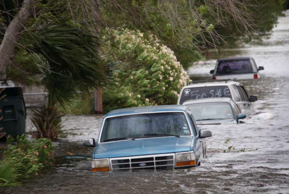
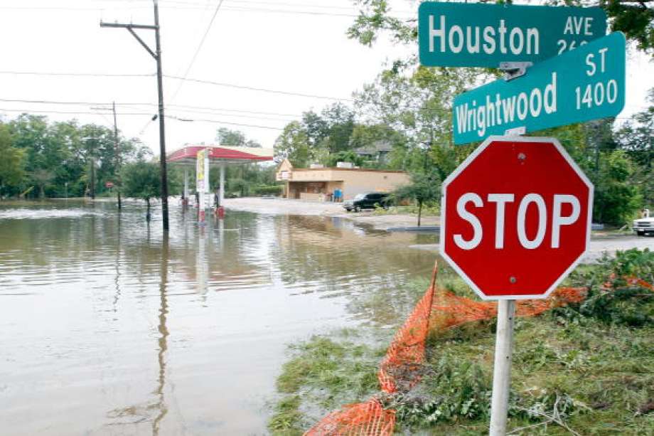
- At least 4 dead, hundreds rescued after deadly floods ravage South Texas
- Today on Texas Standard: Deadly floods swamp South Texas, shatter records
- North Carolina radio station was a critical lifeline after Hurricane Helene. Then it became the voice of recovery.
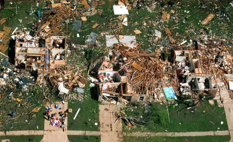
- As storms approach, Rock Hill residents look back on last April's devastating hailstorm
- As storms approach, Rock Hill residents look back on last April's devastating hailstorm
Satellite images show hurricanes lined up in Atlantic Ocean
-
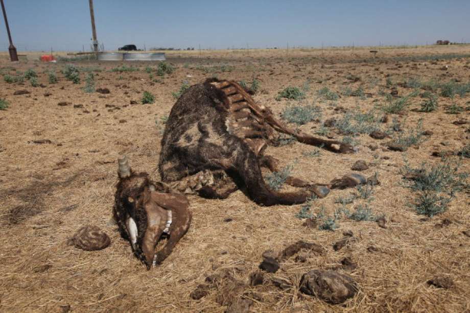
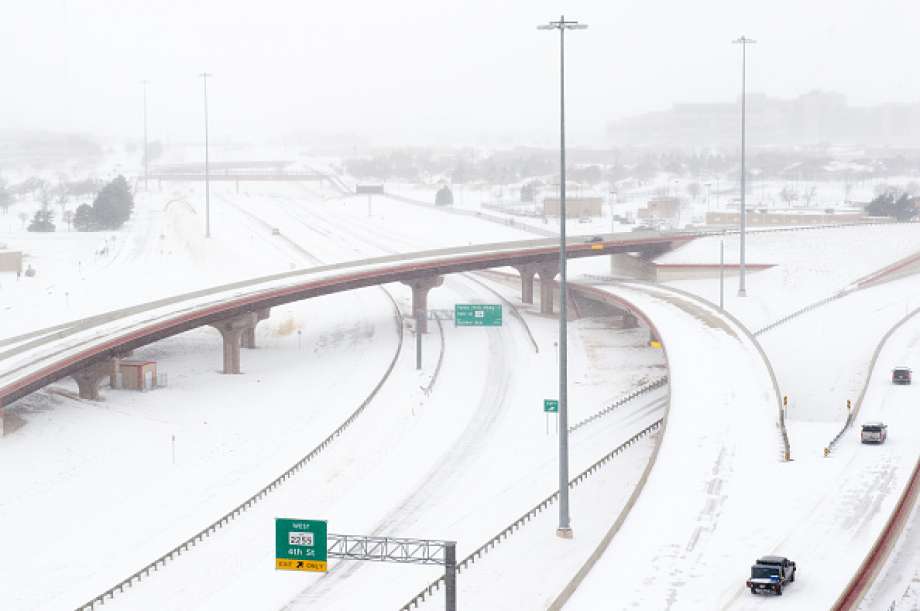
PHOTOS: Wild Texas weather
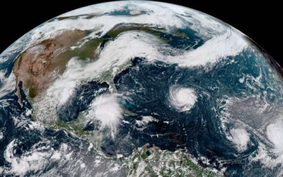
This enhanced satellite image provided by NOAA shows Hurricane Florence, third from right, in the Atlantic Ocean on Sunday, Sept. 9, 2018. At right is Tropical Storm Helene, and second from right is Tropical Storm Isaac.
>>>See what some of Texas’ weather-setting days looked like…
PHOTOS: Wild Texas weather
This enhanced satellite image provided by NOAA shows Hurricane Florence, third from right, in the Atlantic Ocean on Sunday, Sept. 9, 2018. At right is Tropical Storm Helene, and
Photo: Associated Press


PHOTOS: Wild Texas weather
This enhanced satellite image provided by NOAA shows Hurricane Florence, third from right, in the Atlantic Ocean on Sunday, Sept. 9, 2018. At right is Tropical Storm Helene, and second from right is Tropical Storm Isaac.
>>>See what some of Texas’ weather-setting days looked like…
PHOTOS: Wild Texas weather
This enhanced satellite image provided by NOAA shows Hurricane Florence, third from right, in the Atlantic Ocean on Sunday, Sept. 9, 2018. At right is Tropical Storm Helene, and
Photo: Associated Press
Mother Nature never ceases to make destructive weather look beautiful from afar.
The National Oceanic and Atmospheric Administration on Monday was displaying a satellite image of a series of hurricanes and at least one unnamed storm lined up in the Atlantic Ocean like cars in a school’s parent pick-up lane.
HOUSTON’S OUTLOOK: Houston area under flash flood watch from afternoon until Tuesday morning
The Houston area has weather troubles of its own as the city is under a flash-flood watch until Tuesday morning.
Additionally, a storm system is expected to move into the Gulf of Mexico this week, but that tropical wave hasn’t yet developed into something stronger. The forecast will become clearer in the coming days. The National Hurricane Center has placed a 50 percent chance of it developing into a tropical storm or tropical depression.
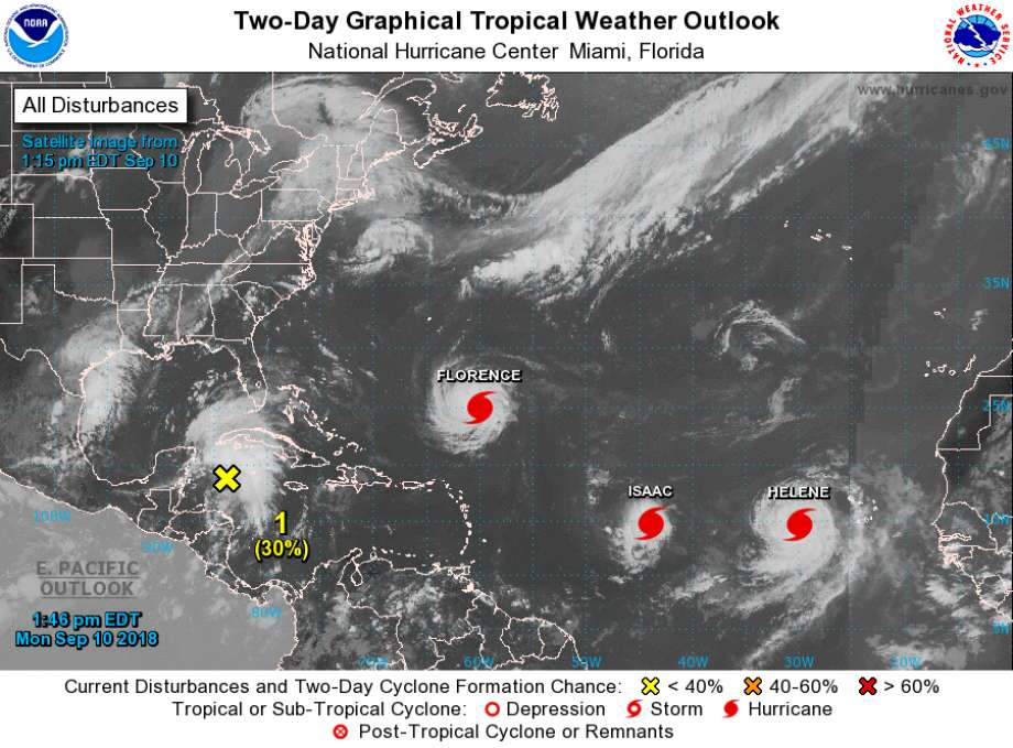
Photo: NOAA
This new satellite image taken on Monday afternoon shows Florence, Isaac, and Helene in the Gulf of Mexico along with a tropical wave just south which is being monitored by meteorologists.
Otherwise all eyes are on the Atlantic Ocean and eastern seaboard as Hurricane Florence, a Category 4 hurricane, appears to be eyeing the coast of North Carolina.
GROWING STRONGER: Florence intensifies as it nears US Southeast
Hurricane Florence was upgraded twice Monday, with NOAA noting that it will likely continue to strengthen as it makes its way to the East Coast.
Also seen behind Florence are hurricanes Isaac and Helene, though they as of now aren’t thought to be a threat to the mainland United States.
Craig Hlavaty covers Houston history and pop-culture. Read him on our breaking news site, Chron.com, and on our subscriber site, HoustonChronicle.com. | craig.hlavaty@chron.com