- Fake job seekers are flooding the market, thanks to AI
- One set of evacuation orders lifted in Caldwell County after wildfire contained
- 'We gutted every building' | Chimney Rock rebuilding after Hurricane Helene
- 'We gutted every building' | Chimney Rock rebuilding after Hurricane Helene
- Debris from Hurricane Helene provides fuel, complicates containment for spring wildfires
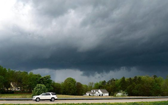
Severe storms expected in Carolinas today, bringing threat of damaging winds and hail
Know your thunderstorm types
Ever heard of the term ‘supercell’ but didn’t know what it was? Learn about these powerful storms responsible for most tornadoes in the United States and other thunderstorms in this video from NWS.
Ever heard of the term ‘supercell’ but didn’t know what it was? Learn about these powerful storms responsible for most tornadoes in the United States and other thunderstorms in this video from NWS.
Upstate South Carolina and much of North Carolina are expected to see hazardous weather Monday afternoon, as severe thunderstorms roll in from the west with a “potential for wind damage and large hail,” says the National Weather Service.
All parts of Upstate South Carolina and the Piedmont of North Carolina will see some severe weather, and possible flash flooding, forecasters say.
“The primary threat is high wind gusts, with some threat from hail, and a more remote threat from rotating storms,” says the National Weather Service. “Rainfall could be, locally, heavy enough to cause isolated flash flooding, especially if storms train over the same area.
Much of the bad weather is expected after 1 p.m. and will last until midnight, say forecasters.
There is a 60 percent chance of thunderstorms during the day in the Charlotte and Raleigh, N.C., and Columbia, S.C., areas Monday, and an 80 to 90 percent chance after dark, say forecasters.
Around an inch of rain could fall tonight in Charlotte and in Columbia, says the National Weather Service.
Columbia could see strong winds Monday from 5 p.m. to 9 p.m.
“The storms may also produce heavy rainfall with the potential for multiple storms to move repeatedly across the same areas,” says the National Weather Service. “This could lead to isolated flash flooding, especially across the mountains and foothills.”