- Austin adopts new map that greatly expands area at risk of wildfire
- CenterPoint Energy accelerates infrastructure improvements ahead of hurricane season
- Carolina Hurricanes playoff tickets go on sale Thursday
- Ask the Meteorologist: Why do tornadoes target Tornado Alley, Dixie Alley?
- Nonprofit closes distribution site that aided thousands after Hurricane Helene
Timing for Wednesday's severe weather threat in Central Texas
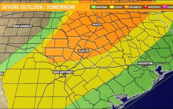
AUSTIN, Texas — An upper-level area of low pressure will move through the state on Wednesday allowing for another round of numerous showers and thunderstorms, some of which will be strong to severe.

KVUE
The Storm Prediction Center has issued an “Enhanced Risk” for severe weather (3 out of 5 on the severe weather scale) for most of the area, including the City of Austin.
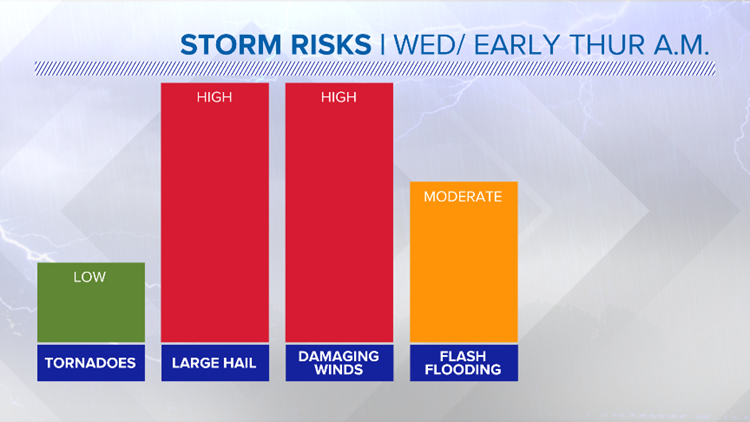
Large hail, possibly as large as 2 inches in diameter, looks to be the primary threat. Severe storms producing damaging winds and isolated tornadoes will also be possible late Wednesday through the early morning hours of Thursday. Heavy downpours could also trigger minor street and creek flooding.

kvue
RELATED:
55 homes destroyed after EF3 tornado rips through Franklin
At least 8 killed, dozens injured as storms sweep across the South
Severe weather swept through Central Texas Saturday
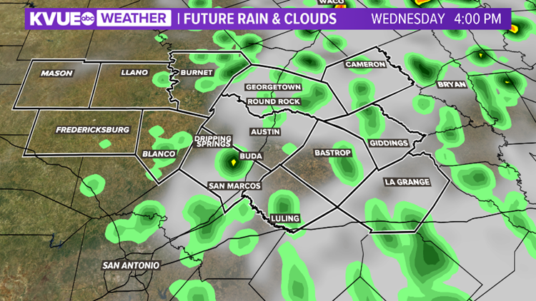
Timeline: Scattered showers will move into the region Wednesday morning. Most of this activity will be light. Scattered showers and isolated storms will be possible through the afternoon hours. If we see some sunshine and get enough daytime heating, an isolated strong to severe storm will be possible.

kvue
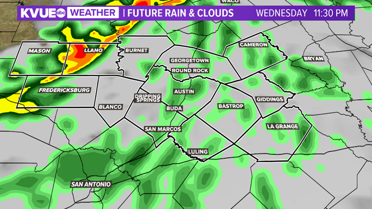
The greatest threat for widespread showers and storms will be Wednesday night through the early morning hours on Thursday. A line of storms will develop late in the evening in the Hill Country and push to the east overnight.

kvue
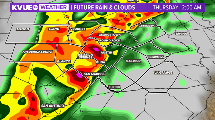
The heaviest rainfall will move into Austin between midnight and 2 a.m. Thursday morning. This activity will likely be strong and could be severe.

kvue
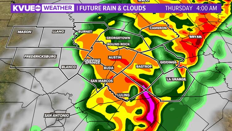
The line of heavy rainfall and strong to severe storms will then move east of Interstate 35 after 4 a.m.

kvue
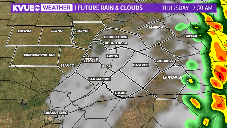
Storms will exit most of the area by sunrise Thursday. Clearing skies, breezy and cooler conditions settle in our area on Thursday with highs in the low 70s.

kvue
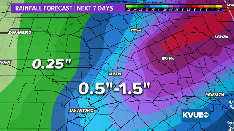
Rainfall amounts of up to an inch and a half will be possible, with isolated higher totals.

kvue
Stay weather aware with the KVUE Storm Team as confidence builds in the days ahead. Also, be sure to prepare your “safe place” in your home or work in the event of a weather emergency.
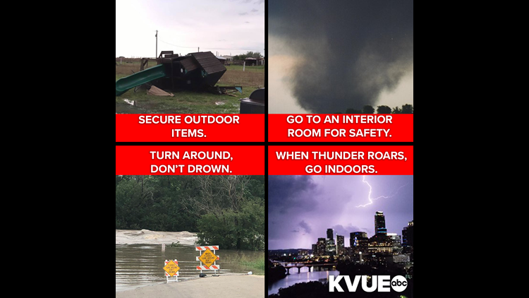

Prepare for severe weather.
KVUE
Stay up to date on the weather by downloading the KVUE News app now. And follow KVUE on Facebook, Twitter, YouTube and Instagram for updates.
PEOPLE ARE ALSO READING:
Notre Dame fire: Catastrophic blaze spreads to landmark tower in Paris
Maine Marine shot and killed by fellow Marine on South Carolina base