- National memorial to honor NC firefighter who died on duty during Hurricane Helene
- Gov. Josh Stein extends State of Emergency for western NC wildfires
- Governor Stein extends state of emergency for NC wildfire threat
- Governor Stein extends emergency in 34 NC counties amid wildfire threat
- Texans can buy emergency preparation supplies tax-free April 26-28 ahead of severe weather season
Thunderstorm watch issued for northwestern NC; severe weather headed for Triangle
Raleigh, N.C. — Severe storms to our west are expected to roll into Raleigh Tuesday evening, according to WRAL meteorologist Elizabeth Gardner.
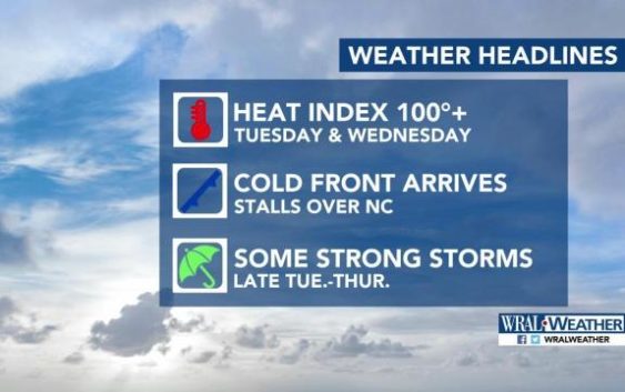
The Triangle is under a level two threat for severe weather, and damaging winds, large hail and heavy rain are possible. At 1 p.m., a thunderstorm watch was issued for North Carolina’s northwestern counties, including Mecklenburg, Alamance, Person and Forsyth.
Areas north of the Virginia border are under a level 3 risk for severe weather Tuesday, and storms will begin there around 3 p.m. According to Gardner, storms will arrive in the Triangle later, around 6 p.m., and will linger until early Wednesday.

In addition to the storms, Tuesday and Wednesday will be hot and humid, with heat index levels above 100 degrees each day.
While Tuesday’s high is 95 degrees, the humidity levels will make it feel as hot as 105 degrees outdoors.

Wednesday has a 60 percent chance of rain, and by Thursday evening the Triangle could see more than half an inch of rain.
Wednesday’s high will be in the lower 90s before highs stay in the upper 80s the rest of the week.
