- 'A little emotional': Hurricanes equipment manager got seconds in goal, memory to last a lifetime
- WMO retires three hurricane names after devastating 2024 season
- Beryl removed from future hurricane naming lists
- Hurricane names Helene, Milton and Beryl are now retired
- Hurricane Helene's name retired after deadly 2024 impact on US
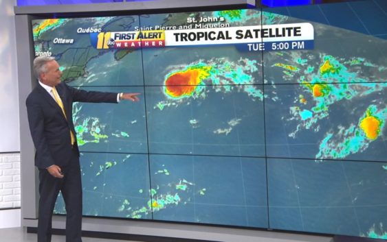
Tropical Storm Chantal racing east across North Atlantic

Moderate to strong vertical wind shear is currently impacting Chantal, pushing most of the deep convection to the east of the center of circulation. This wind shear will likely prevent Chantal from strengthening over the next couple of days.
However, Chantal is expected to slow its forward speed by the weekend and will turn toward the south and southwest. As it slows and makes this turn, Chantal will start to encounter some warmer water and lighter wind shear and may be able to strengthen a bit. However, Chantal will not directly impact any land over the next several days.
We are also tracking a couple of tropical waves in the basin. The main two waves are found near 35 west and 60 west. Another tropical wave may be emerging from the west coast of Africa, while a forth wave is moving through Central America. These waves are moving west at an average speed of 6-8 degrees longitude per day.
None of these waves are expected to develop over the next several days due to the presence of strong wind shear and dry, dusty air. However, the tropical wave moving through Central America will send some tropical moisture northward over the weekend and could produce locally heavy rainfall over parts of Texas, Louisiana and Mississippi, late this week into the weekend.
By AccuWeather Senior Meteorologist Rob Miller
Copyright © 2019 WTVD-TV. All Rights Reserved.