- Lighter winds help crews fighting wildfires in South and North Carolina
- Austin is at a 'potentially historic' risk of wildfires Tuesday. Here's how to prepare.
- South Carolina's governor declares State of Emergency as massive wildfire grows to 1,600 acres
- Staying weather alert: How to find your safe place during severe weather
- Wildfires persist across Carolinas amid windy, dry conditions
Tropical Storm Karen forms east of the Windward Islands
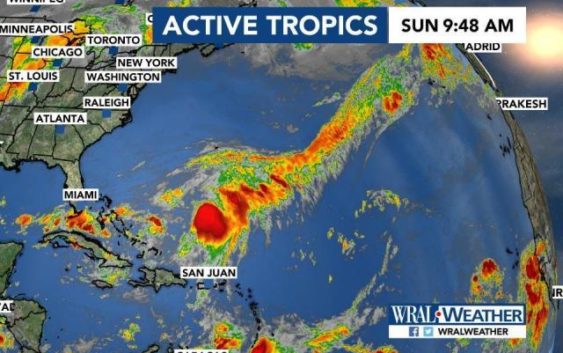
Tropical Storm Karen formed Sunday just east of the Windward Islands and has sustained winds of 40 mph. A tropical storm warning has been issued for Trinidad and Tobago, along with Grenada and its dependencies.
A tropical storm warning means that tropical storm conditions are expected somewhere within the warning area, in this case within the next 12 hours. A tropical storm watch has been issued for St. Vincent and the Grenadines.
A tropical storm watch will likely be required for Puerto Rico and the Virgin Islands later Sunday, and tropical storm warnings may be issued for other areas in the Windward Islands later this morning.
On the current forecast track Karen is forecast to move across the Windward Islands on Sunday afternoon and tonight.
The storm is then forecast to turn to the northwest Monday and north Tuesday. Karen will then approach Puerto Rico and the Virgin Islands on Tuesday as a tropical storm.