- Long-term closures begin on I-10 Katy Freeway to elevate road, prevent flooding
- Texas firefighters helping battle California wildfires
- Western NC teams helping both hurricane and wildfire victims
- New wildfire warnings issued and more power is shut off as winds rise in Southern California
- In wake of wildfires, Spurs' Chris Paul, Victor Wembanyama give JJ Redick's sons their game-worn jerseys
FORECAST: Tropical Storm Arthur forms

CHARLOTTE, N.C. — We’ve got a quiet, mild night ahead with lows dropping into the low 60s. Expect another warm day Sunday with high in the middle 80s again and a few more clouds will start to work in due to approaching lows from the west and a possible subtropical storm from the SW.
Tracking the Tropics: The first named storm of the season formed tonight. Tropical Storm Arthur’s forecast track has shifted a little farther east, as of this update. It could brush the North Carolina coast Monday, producing rough surf, dangerous rip currents, and heavy rain.
There are Tropical Storms Watches in effect for parts of the coast. Expect dangerous surf and rip currents along the coast over the next few days.
Our best chance for rain and storms will be Monday into Tuesday of next week, but more clouds and scattered rain showers will stick around middle to late next week. This is also our biggest threat of severe weather this week. Right now our viewing area is under a low risk for storms but our status could be upgraded as this system draws closer.
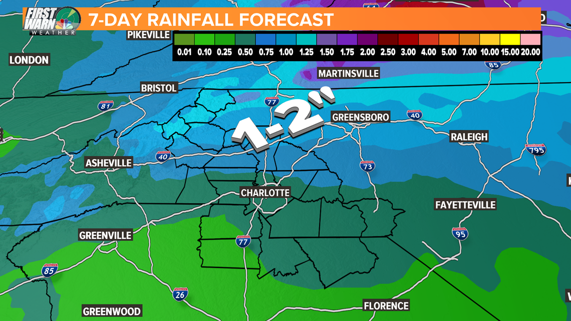
Once the low arrives it will linger through most of next week. This will keep it cooler and cloudier with scattered rain on Wednesday and Thursday. By Friday it should be clearing to the north. Rain totals at this time do not seem to be threatening, but a solid inch across the area this week is likely.
Have a great rest of your weekend!