- South and Midwest face potentially catastrophic rains and floods while reeling from tornadoes
- Deadly 2024 hurricanes prompt WMO to retire three names
- Body recovered in North Carolina identified as East TN man who has been missing ever since Hurricane Helene
- Report: Coastal flooding could threaten 1.4 million homes by midcentury
- Caught on camera | Tornado touches down in Missouri
What roads are prone to flooding in Corpus Christi?

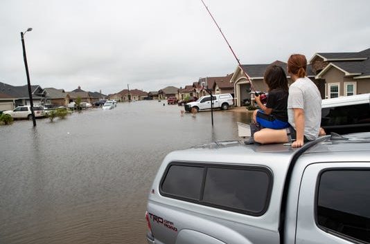
Corpus Christi has a long history of flooding.
Update on July 23, 2020: As a tropical depression approaches the mid-Texas coast, meteorologists warn that even if it develops into Tropical Storm Hanna the greatest risk will be flooding. Historically flooding, not wind, poses the most lethal danger in storms. The local offices of the National Weather Service predict between four to six inches of rain may drop in the Coastal Bend.
Here’s a list of roads in Corpus Christi that are prone to flooding, according to the city’s Emergency Management:
On North Padre Island:
- Newport Pass
- Zahn Road
Flour Bluff area:
- Matlock at Redmond
- Waldron Road at SPID
- Montreal at Manitoba
- Flour Bluff Drive at Glenoak
- Retta at Glenoak
- Flour Bluff Drive to Roscher
Corpus Christi:
- Ennis Joslin at SPID
- Roddfield Road at SPID
- Freds Folly at Slough
- Bay at Yorktown Blvd.
- Carancahua Street between Comanche and Coopers Alley
- Staples at SPID
- Everhart at SPID
- Kostoryz at SPID
- Brawner Parkway at Kostoryz
- Brawner Parkway from Kostoryz to Devon Street
- Lawnview at Texan Trail
- Port at Crosstown Expressway
- State Highway 286 at Farm to Market Road 2444
- Staples Street from Booty to Six Points
- Ayers at 6th Street
- Staples Street at Booty
- Baldwin Boulevard at Morgan Avenue
- Morgan Avenue at State Highway 286
- Buford Street at 3rd Street
- Staples Street at Furman
- Staples Street at Coleman
- Agnes from McBride to Highway 358
- Agnes at NPID
- Clarkwood at Agnes
- Gilliam at Agnes
- Kinney at Water
- Staples Street at Blucher
- Mesquite Street at John Sartain
- Leopard Street at Crosstown Expressway (286)
- Lipan Street at Mexico Street
- Port Avenue at Leopard
- Leopard Street at Palm
- IH 37 Access Roads and Navigation Boulevard
- Navigation Boulevard from Leopard Street to IH 37
- Brownlee at IH 37
- Huges at Water
More: Live Storm Tracker: See active storms in the Atlantic
More: Prepare for the storm before hurricane season starts
More: Know the terminology: Hurricanes, storms, depressions
Read or Share this story: https://www.caller.com/story/weather/2017/08/24/what-roads-prone-flooding-corpus-christi/596695001/

