Watch live: Beach cameras show waves, dark clouds as Hurricane Laura approaches

-
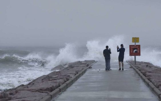
Josue Blanco, left, and Alex Mendez photograph waves generated by Hurricane Laura as they crash into the rock groin at 37th Street in Galveston, Texas on Wednesday, Aug. 26, 2020. Forecasters say Laura is rapidly intensifying and will become a “catastrophic” Category 4 hurricane before landfall. It’s churning toward Texas and Louisiana, gathering wind and water that swirls over much of the Gulf of Mexico. (Jennifer Reynolds/The Galveston County Daily News via AP)
Josue Blanco, left, and Alex Mendez photograph waves generated by Hurricane Laura as they crash into the rock groin at 37th Street in Galveston, Texas on Wednesday, Aug. 26, 2020. Forecasters say Laura is
Photo: Jennifer Reynolds, AP
Hurricane Laura is expected to make landfall late Wednesday or early Thursday.
The National Weather has upgraded the storm to an “extremely dangerous Category 4 hurricane,” noting that the storm surge could penetrate up to 30 miles inland.
“Unsurvivable storm surge with large and destructive waves will cause catastrophic damage from Sea Rim State Park, Texas, to Intracoastal City, Louisiana,” the service wrote Wednesday.
READ MORE: Hurricane Laura evacuees are starting to arrive in San Antonio. Here’s what happens next.
More than half a million people have been ordered to evacuate their homes near the Texas-Louisiana state line, including the cities of Beaumont, Galveston and Port Arthur.
Live cameras along the Texas Coast reveal high waves and dark clouds as the storm approaches.
Here are several beach cams in the Galveston area: