- Weather Impact Alert: Heavy rain could lead to flooding across Carolinas
- North Carolina legislators fleshing out details on $500M in additional Hurricane Helene relief
- Dangerous travel conditions: Ice, snow and flooding possible
- How photos lost in disasters like Hurricane Helene find their way home, with a little help from people who care
- Dangerous travel conditions, ice/snow and flooding possible in the mountains Tuesday and Wednesday
Cars stall in Raleigh flash flooding as heavy rain moves across area
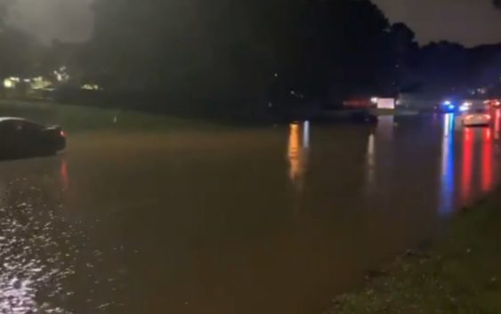
WAKE COUNTY, N.C. (WTVD) — Heavy rains across central North Carolina caused many cars in Raleigh to stall and become trapped in floodwater.
Chris Hohmann said the doppler is estimating 2 to 5 inches in the Triangle but more in other spots.
Chris Hohmann said the doppler is estimating 2 to 5 inches in the Triangle but more in other spots.
Incredible doppler estimates of rain tonight! 2-5″ in the Triangle, but 6-9″ in a couple of spots near the VA border and in Johnston county. Numerous road closures and some water rescues tonight. #ABC11 pic.twitter.com/F5H1gUWTw1
— Chris Hohmann (@HohmannABC11) September 1, 2020
DeJuan Hoggard spoke to drivers who got stuck on Millbrook Road Tuesday night.
Tim Pulliam also experienced floodwaters near downtown Raleigh.
WATCH:
A Flash Flood Warning is in effect for Wake and Johnston counties until 3:15 a.m.
Copyright © 2020 WTVD-TV. All Rights Reserved.