- Report: Coastal flooding could threaten 1.4 million homes by midcentury
- Caught on camera | Tornado touches down in Missouri
- Carolina Hurricanes playoff tickets go on sale next week
- Storms kill 6 in the South and Midwest as forecasters warn of catastrophic rains, floods this week
- Weather Impact Alert: Cold front could trigger severe weather in Houston area this weekend | See timeline
Central North Carolina under severe weather risk as remnants of Sally approaches

After hammering parts of the Gulf Coast with torrential rainfall, Hurricane Sally weakened into a tropical storm Wednesday at 2 p.m. The storm then, again, weakened to a tropical depression at 11 p.m.
Despite how much the storm has weakened in the past day, Meteorologist Chirs Hohmann says we can’t factor out the potential risk of isolated tornados for the southeast region of the Triangle on Thursday.
Sally hit the U.S. as a Category 2 storm early Wednesday morning.
As the high-pressure area to the north of North Carolina slid to the east and away from the coast, Sally made landfall near the Alabama/Florida border and began to push inland. These are the two big factors in the forecast for North Carolina for the rest of the week.
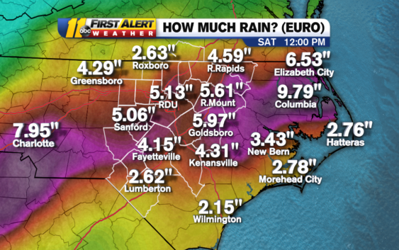
The European forecast model is predicting up to nearly six inches of rain for parts of the area through Saturday. The model predicts almost 10 inches near the coast.
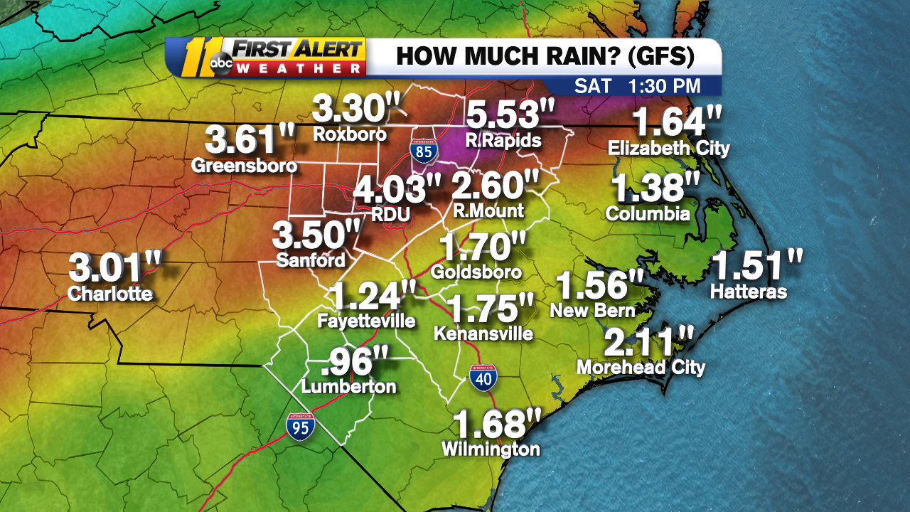
The American (GFS) model isn’t predicting as much rain, but still a considerable amount, anywhere from 1 inch to 5.5 inches through Saturday.

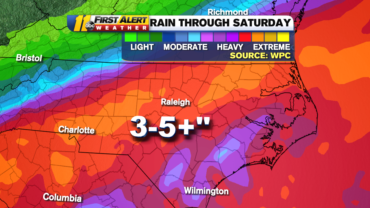
The Weather Prediction Center, a branch of the National Weather Service, predicted 3 to 5 inches of rain for our area through Saturday.

A Flash Flood Watch is in effect for the entire ABC11 viewing area through 8 p.m. Friday.
A Flash #Flood Watch has been issued for our entire viewing area for Thursday and Friday. As the remnants of #Sally move through, they will bring the potential for 3-6+” of rain to our region. #ncwx #vawx pic.twitter.com/5I4M6tf8bB
— 𝘿𝙤𝙣 𝙎𝙘𝙝𝙬𝙚𝙣𝙣𝙚𝙠𝙚𝙧 (@BigweatherABC11) September 16, 2020
Temperatures on Friday will stay in the low to mid 70s. We’ll clear out over the weekend with highs near 70. We’ll remain dry through the start of fall on Tuesday.
WATCH: Barbara Gibbs speaks to her sister living on Gulf Coast as Hurricane Sally moves in
WATCH: Hurricane Sally hammers Alabama coast
Copyright © 2020 WTVD-TV. All Rights Reserved.