- Weather Impact Alert: Heavy rain could lead to flooding across Carolinas
- North Carolina legislators fleshing out details on $500M in additional Hurricane Helene relief
- Dangerous travel conditions: Ice, snow and flooding possible
- How photos lost in disasters like Hurricane Helene find their way home, with a little help from people who care
- Dangerous travel conditions, ice/snow and flooding possible in the mountains Tuesday and Wednesday
Heavy rain causes flooding on I-440, other major roads
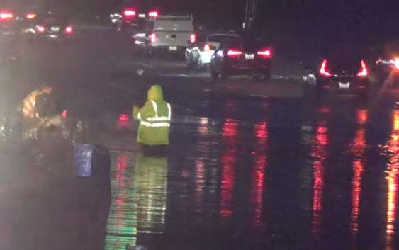
RALEIGH, N.C. (WTVD) — After a day of heavy rainfall Wednesday, more precipitation fell throughout the ABC11 viewing area Thursday morning, causing major problems on some roads.
The entire viewing area is under a Flash Flood Watch until 7 p.m.; that’s because even more rain is expected to fall in the coming hours. The heaviest rain for Thursday is expected to fall between 10 a.m. and 2 p.m.
WATCH: Your First Alert Forecast
Areas along the I-95 corridor got the heaviest rain Wednesday and are due for another soaking.
On I-440, two lanes of traffic were closed due to ponding. ABC11 cameras captured crews working to remove a car from waist-deep water.
In Nash County, a stretch of Highway 301 was closed near Rocky Mount. In Johnston County, Old Route 22 near Beulatown Road was underwater. Parts of Interstate 95 were closed on Wednesday night.
Schools opted to move all classes online in Johnston, Nash, Wilson and Edgecombe counties due to area flooding.
In western North Carolina, there were mudslides and water rescues underway on Thursday morning.
Copyright © 2020 WTVD-TV. All Rights Reserved.