- Fake job seekers are flooding the market, thanks to AI
- One set of evacuation orders lifted in Caldwell County after wildfire contained
- 'We gutted every building' | Chimney Rock rebuilding after Hurricane Helene
- 'We gutted every building' | Chimney Rock rebuilding after Hurricane Helene
- Debris from Hurricane Helene provides fuel, complicates containment for spring wildfires
Rain ends, but flooding danger lingers throughout NC
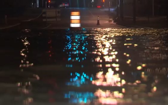
RALEIGH — Central and Eastern North Carolina is still dealing with the fallout from heavy rainfall over the last two days. We’re in First Alert Mode, telling you what areas to watch out for as rivers rise onto low-lying roads and neighborhoods.
Several rivers, including the Haw, Cape Fear, Neuse and Tar, are expected to flood and become a problem over the weekend. The Tar River in Tarboro is expected to crest Sunday morning at 31.7 feet on Sunday morning.
The Neuse River could crest at 22 feet in Smithfield on Saturday morning while the Cape Fear River could crest on Saturday night.
River Flooding will be a problem over the next 48 hours. Here are some of the hot spots. Purple-Major Flooding expected at that point. #Flooding pic.twitter.com/iky1t4TOUd
— 𝘿𝙤𝙣 𝙎𝙘𝙝𝙬𝙚𝙣𝙣𝙚𝙠𝙚𝙧 (@BigweatherABC11) November 13, 2020
Many parts of central North Carolina are still under a Flood Warning through the morning commute, expected to end at 8:45 a.m. A stretch of Interstate 95 in Johnston County is still closed.
Near Smithfield, all lanes of I-95 North are closed at Exit 102 (Micro Road) due to flooding. The closure is expected to last into Friday afternoon.
Around 5 a.m., power lines were down on Lead Mine Road in Raleigh between Millbrook and Lynn roads. Traffic cones were set up to alert drivers.
For the latest traffic alerts, follow ABC11’s Kim Deaner on Twitter (@kimdeanerabc11).