- What happens to the debris left behind by Hurricane Helene?
- Carolina Hurricanes games during Thanksgiving week to air on Fox 50, WRAL
- Did climate change have an impact on Hurricane Helene?
- Artist's hurricane relief ornaments bring hope to NC families this Christmas
- Artist's hurricane relief ornaments bring hope to NC families this Christmas
Gov. Cooper declares state of emergency due to deadly flooding in NC

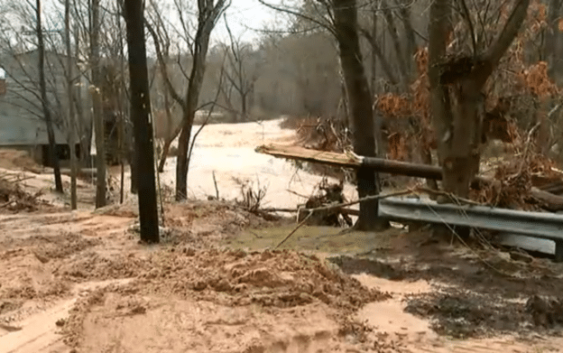
RALEIGH, NC (WWAY) — Flood warnings remain in effect Friday morning for much of central North Carolina and along rivers across the state, after a cold front interacting with moisture from Tropical Storm Eta caused widespread heavy rainfall yesterday across North Carolina.
While many rivers across western and central NC will crest Friday or are currently receding, rivers across eastern North Carolina will continue to rise through the weekend.
“This storm has already claimed several lives, and everyone should exercise caution by avoiding flooded roads and areas along swollen creeks and rivers,” Governor Roy Cooper said. “Our prayers go out to the families and friends of those who were injured or killed by these devastating floods.”
Three people were killed at a flooded campground in Hiddenite. A state search and rescue task force arrived Thursday night in Alexander County to assist in the search for two people who went missing from the same campground. One death has been reported in Wake County, where a child drowned in a creek. The State Highway Patrol reports several additional fatalities from weather-related collisions or accidents in Iredell, Alexander, Rockingham and Person counties.
Governor Cooper declared a statewide State of Emergency Friday. Local states of emergency have been declared in Alexander, Burke, Catawba, Iredell and Yadkin counties. Damage assessments will be conducted in the coming days to determine if areas qualify for state or federal disaster declarations.
Numerous water rescues occurred Thursday across the state. The National Weather Service is estimating more than 9 inches of rain fell in Rocky Mount and Harrisburg. Many other areas saw estimated rainfall amounts between 4 inches and 9 inches, exceeding weather forecasts.
Flooding prompted hundreds of road closures, including a few interstate shutdowns and bridge washouts. As of Friday morning, the N.C. Department of Transportation reported more than 430 state-maintained road closures. The closures included hundreds of secondary roads from the mountains to the coast and stretches of highways including I-95 north in Johnston County, I-795 in Wilson, U.S. 311 near the Virginia line in Rockingham County, N.C. 73 in Richmond County and N.C. 209 in Madison County, where state crews worked on Friday to repair the road damaged when a slope failed. Also, numerous bridges were damaged or closed due to flooding.
State transportation officials urged people to avoid traveling through flooded roads and never go around barricades. Motorists should continue to be careful as travel could be hazardous through the weekend and into next week.
Eta is now an extratropical low pressure system as it races northeastward and away from the North Carolina coast. Some minor street flooding is possible with this morning’s high tide across southeastern North Carolina. High tides and surf may remain elevated into the weekend.
Major flooding is forecast along the Neuse River and Contentnea Creek and moderate flooding is forecast along the Cashie, Dan, Cape Fear, Northeast Cape Fear, Lumber, Tar, South Fork Catawba, Yadkin and South Yadkin Rivers.
Visit the state’s Flood Inundation Mapping and Alert Network at fiman.nc.gov for the latest river observations and flood forecasts for rivers and streams near you. DriveNC.gov provides current information from the N.C. Department of Transportation on road closures across the state.