- Artists transform hurricane aftermath into hoop-inspired masterpieces at Charlotte exhibit
- NC's cost for Hurricane Helene damage is nearly $60 billion, state says
- State to develop drone program to better respond to disasters like Helene, Florence
- South Carolina residents face deadline to get storm debris out to the curb after Hurricane Helene
- SCDOT to pick up Hurricane Helene debris for a final day in South Carolina
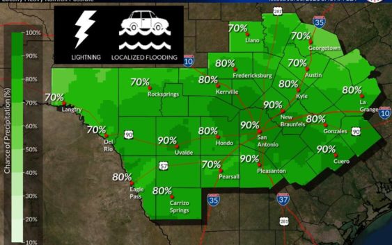
Showers, thunderstorms to continue in San Antonio with flooding in some areas

San Antonio is getting its fair share of rain, as is a great portion of Texas.
National Weather Service
The National Weather Service is advising residents to stay safe as scattered showers and thunderstorms are expected to continue in San Antonio.
Portions of Bexar County may see ongoing flooding Tuesday as showers and thunderstorms will take place throughout the day and into the rest of the week, according to the latest forecast from NWS. While the intensity of the rain is tapering off as storms move into the Hill Country, Tuesday will still be a wet one in the Alamo City.
If you have to be on the road, NWS is advising drivers to check the latest updates for closed low water crossings. Portions of northwest Bexar County, including areas west of Interstate 10, have had more reported flooding and closings.
A flash flood warning is in effect for Helotes, Lackland Air Force Base, and Leon Valley until noon on Tuesday.
The agency is reminding residents to “turn around, don’t drown” with continuous updates, pointing out that drivers may not be able to tell how deep the water is, how fast it is moving, or the condition of the road. NWS even shared a country-inspired tune with the catchy lyric as a means of getting San Antonians to heed the advice.
Read more from Sarah
