- Fake job seekers are flooding the market, thanks to AI
- One set of evacuation orders lifted in Caldwell County after wildfire contained
- 'We gutted every building' | Chimney Rock rebuilding after Hurricane Helene
- 'We gutted every building' | Chimney Rock rebuilding after Hurricane Helene
- Debris from Hurricane Helene provides fuel, complicates containment for spring wildfires
A look at how summer storms create localized damaging winds
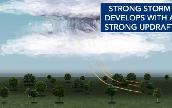
It should not surprise many of you that summer in North Carolina involves the heat, humidity and afternoon storms. We have seen it all this past week with heat index values climbing into the triple digits the past few days and severe storms producing localized downbursts, which caused damage on Wednesday.
While the heat and humidity are easier to understand, those “pulse-severe,” localized storms are a bit more complex.
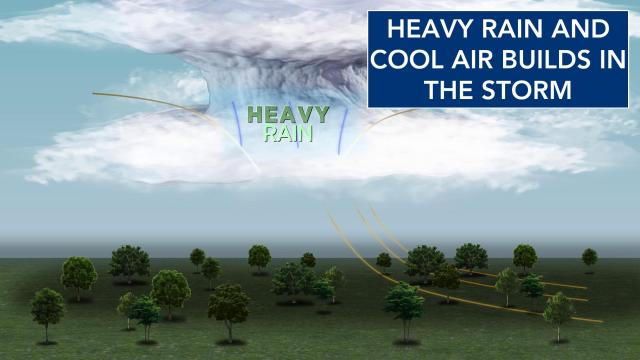
In general, storms develop quite easily in the Carolinas in the summer due to hot temperatures near the ground, cooler air above the ground and abundant tropical moisture. Once a column of air heats up it starts to rise, due to being a bit warmer than the surrounding environment. As that column of air rises it begins to cool, allowing the abundant moisture to condense and collect into raindrops.
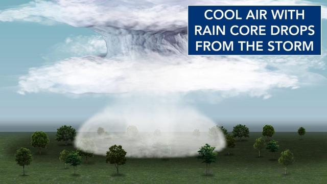
Over time, sometimes within 15 minutes, those rain droplets continue to grow in size and weight. As raindrops become heavier, they begin to fall and evaporate slightly on the way down. Between the formation and evaporation of raindrops, the column of air cools and begins to sink, due to now being cooler than the surrounding environment.
That column of air continues to cool as more raindrops develop and evaporate. This persistent cooling process allows the column of air to sink faster and faster as its central temperature gets cooler and cooler than the surrounding environment.
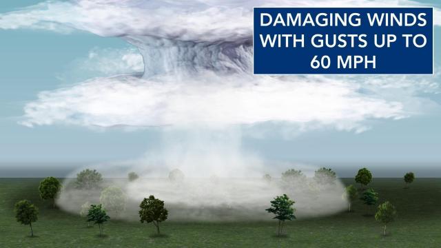
Eventually, that column of air and rain, falling very fast, reaches the ground and is forced outwards. Depending on the speed of the downdraft, the wind from it can create localized damaging winds as wind gusts can reach up to 60 mph. We saw that this past Wednesday and have that potential many afternoons through June, July and August.
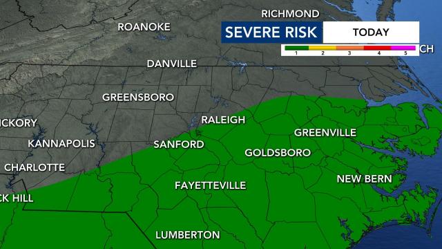
We have that chance for strong to severe storms and localized damaging wind gusts Friday as hot temperatures, abundant tropical moisture and cooler air aloft are all in place. The storm threat is mainly around the Triangle and southeast towards the coast, but due to the atmospheric dynamics in place, really anyone has the chance for a strong to severe storm.
No matter where the storms pop up and how strong the become, you can turn to WRAL’s Severe Weather Team to always alert you.
You can receive alerts to your phone through the WRAL Weather app and get additional information on TV on WRAL News.
