- Trump makes more debunked claims about FEMA as he surveys storm damage in North Carolina
- Hundreds rescued, sheriff stranded on truck roof after deadly flooding in New Mexico
- In North Carolina, Trump and Harris navigate a hurricane and a rollercoaster governor’s race
- In North Carolina, Trump and Harris navigate a hurricane and a rollercoaster governor's race
- Family of Tennessee employee who died in Hurricane Helene flooding files wrongful death lawsuit
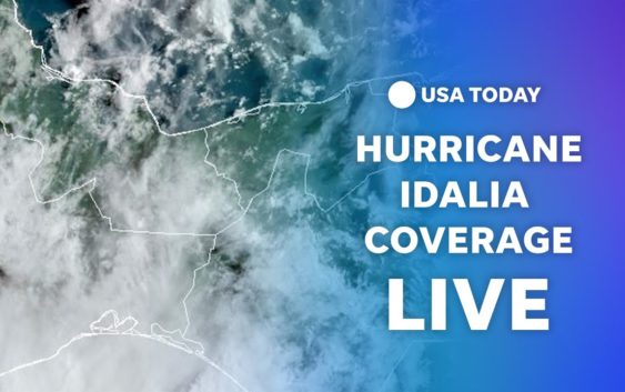
Hurricane Idalia slams Georgia after pounding Florida with 'catastrophic' surge: Live updates
CEDAR KEY, Florida − Historic Hurricane Idalia was powering across the Georgia border Wednesday after making landfall earlier in the day along Florida’s Big Bend as a Category 3 tropical cyclone, driving “catastrophic” storm surge and flooding for hundreds of miles.
The storm’s center was 25 miles north of Valdosta, Georgia, by noon, heading north-northeast at 20 mph with sustained winds of 85 mph − weakening over land but still a hurricane.
“Catastrophic storm surge occurring along the coast of the Florida Big Bend and damaging winds spreading inland over northern Florida,” the National Hurricane Center said in its morning update. An update hours later said the winds had spread to Georgia.
Swells that were affecting the eastern and central Gulf Coast from Florida to Louisiana were expected to increasealong the southeastern Atlantic coast and were “likely to cause life-threatening surf and rip current conditions,” the hurricane center said.
Radar imagery indicated the eye of Idalia made landfall along the coast of Florida’s Big Bend near Keaton Beach in Taylor County around 7:45 a.m. mph. More than 275,000 homes and businesses were without power.
Authorities said the worst damaged appeared to be in Taylor County, southeast of Tallahassee and one of the most rural and economically challenged areas of the state. Two businesses reportedly caught fire, some had roofs torn off and the county’s Emergency Operations Center had to evacuate to more secure facilities.
Florida Gov. Ron DeSantis said he hoped to visit some of the state’s hardest hit areas late Wednesday or Thursday.
“There are as of now no confirmed fatalities,” DeSantis said, but added that “we’re still assessing what is going on on the ground in the places that had the initial impact.”
Georgia Gov. Brian Kemp declared a state of emergency for his state ahead of Idalia’s march into his state.
“Georgians in the expected impact area can and should take necessary steps to ensure their safety and that of their families,” Kemp said, adding that emergency management officials were “well positioned to respond to whatever Idalia may bring.”

Developments
∎ Idalia is forecast to be a tropical storm while moving near the coasts of northeastern South Carolina and North Carolina Wednesday night and Thursday.
∎ Hurricane warnings have been issued from Altamaha Sound Georgia to Edisto Beach South Carolina.
Follow the path of Idalia
This forecast track shows the most likely path of the center of the storm but does not illustrate the full width of the storm or its impacts, and the center of the storm is likely to travel outside the cone up to 33% of the time.
Flooding and fear on Hudson Beach
North of Tampa in flood-stricken Hudson Beach, Donn Stofan stood alongside Old Dixie Highway about 11:30 a.m. in flood-stricken Hudson Beach, wracked with worry over his buddy’s safety blocks deep within the neighborhood-wide flood zone.“He’s supposedly on his rowboat with his two dogs and his son,” the the retired Spring Hill electrician said, standing on the Clark Street asphalt by a flooded commercial plaza.“He was out about an hour ago, and he went back to get more stuff. I have his two cats and his clothing he got out the first time,” Stofan said. “Everything is underwater where he lives.”As Stofan spoke, a Florida Fish and Wildlife Conservation Commission airboat roared to life and floated south down Old Dixie Highway, carrying two first responders.“I’m shaking. I’m a nervous wreck. My wife is almost crying over there,” he said, gesturing toward higher ground.
− Rick Neale, Florida Today
Threat of tornadoes, heavy rains remains
Tornadoes were possible across central and northeast Florida into southeast Georgia, the hurricane center said. The tornado threat will increase through the afternoon across coastal South Carolina and continue into Wednesday night for coastal North Carolina.
Idalia was forecast to produce 4 to 8 inches of rainfall and up to 12 inches in some isolated areas from portions of North Florida through central Georgia and South Carolina, then through eastern North Carolina into Thursday. Flash, urban and moderate river flooding with “considerable impacts” were possible, the hurricane center said.
Another danger Idalia brings:Tornadoes are a threat: Here’s what to know.
Idalia is about the size of Colorado
Idalia was about 350 miles across, and the hurricane-force winds are about 50 miles in diameter. Idalia covers an area about the size of Colorado, which measures 380 miles wide. At 8 a.m. Wednesday, minutes after landfall in Keaton Beach, Florida, Idalia’s tropical-storm force wind field covered an area of about 96,211 square miles. That’s a little smaller than the state of Colorado, which measures about 104,000 square miles. At that time, Idalia’s hurricane-force wind field was 7,850 square miles, about the size of New Jersey, which has about 7,354 square miles of land.
− Jennifer Sangalang and Jeffrey Meesey, Tallahassee Democrat
‘Near apocalpytic scene’ on Cedar Key
A weather service tide gauge at Cedar Key reported a water level of 6.8 feet above “mean higher highwater, which is an approximation of inundation in that area,” the weather service said. Michael Bobbitt, a clam fisherman who decided to stay on Cedar Key to help rescue people who have refused to leave, told USA TODAY just after 6 a.m., “it’s a near apocalyptic scene here.” Bobbitt said storm surge from Hurricane Idalia “completely swallowed our boat ramps,” all of Dock Street and First Street, where the historic downtown begins, and is racing farther inland.
He added that “worst case scenario” predictions of storm surge in Cedar Key may very well occur as Hurricane Idalia, now a category 4, continues toward the Big Bend coast.
In Tarpon Springs, some shops hope for business as usual
More than 150 miles south of where Idalia made landfall, floodwaters from the Anclote River swamped the Tarpon Springs Sponge Docks, a popular tourist destination. City workers closed vehicle access just shy of the main drag, Pinellas Avenue, where high-clearance vehicles were forced to traverse a flooded stretch of roadway. Elsewhere in town, street lamps remain lighted in the historic downtown district as some shopkeepers made preparations to open for the day.
Tarpon Springs resident Ken Kruse had mostly shrugged off numerous warnings about Hurricane Idalia’s approach. But by 9 a.m. Wednesday, rising waters from the Anclote River had overwhelmed his street, Grand Avenue, with thigh-high floodwaters, swamping vehicles parked alongside his six-unit apartment complex.“Around 6 o’clock, it looked like it was about to go into my car. It was going to be past the door jamb,” he said as a man atop a stand-up paddle board floated down the street. “So I got out and moved my car to higher ground. And the rest is history. It just kept coming in.”Tarpon Springs first responders shut down an array of streets surrounding Kruse’s neighborhood, near the downtown business district. A green Pinellas County Sheriff’s Humvee with two deputies tried driving past Kruse’s apartment complex, but had to retreat because the water.
− Rick Neale, Florida Today

Two hurricanes, one satellite image
Hurricane Franklin is still churning in the Atlantic and now that storm and Hurricane Idalia are visible in the same satellite image. It’s the first time since 1950 the Atlantic basin − which consists of the Atlantic Ocean, Caribbean Sea and Gulf of Mexico − has had two Category 2 hurricanes with maximum sustained winds of 110-plus mph in August simultaneously, according to Philip Klotzbach, meteorologist at Colorado State University specializing in Atlantic basin seasonal hurricane forecasts.
− Cheryl McCloud, USA TODAY NETWORK – Florida
Fleeing Taylor County, hunkering down in a shelter
Harold Weaver has spent 55 of his 60 years in Taylor County. He’s weathered storms, big and small, but he’s not taking a chance with Hurricane Idalia. Weaver didn’t want to risk staying in his apartment behind the sawmill in Perry, Florida, which is just 20 miles from the Gulf of Mexico. He has his 4-year-old grandson, Karim, to worry about. He and his family took a shuttle from Perry to Tallahassee to weather the storm in one of the seven shelters in Tallahassee
“This one is too big,” Weaver said. “I had a gut feeling, I need to get out.”
Forrest Allen and his wife, Sheila, traveled to Rickards High School on Tuesday afternoon from Taylor County where officials issued a mandatory evacuation order and closed shelters.
“We have an old house and it’s not in the best condition,” Forrest Allen said. “We did the best we could with boarding up the windows, but we really don’t know where we stand.”
− Ana Goñi-Lessan and Alaijah Brown, Tallahassee Democrat
Weather Channel meteorologist Jim Cantore seen on Cedar Key
The Weather Channel meteorologist Jim Cantore, famous for being in the middle of major storm events, was reporting from Cedar Key. “We have water entering homes” and it will get worse, Cantore reported shortly after the storm made landfall about 80 miles to the northwest in Keaton Beach.
Cantore’s arrival was highly anticipated after he tweeted Sunday that he was trying to determine where he would set up for the storm. Sunday was the day Idalia officially formed as a tropical storm after swirling out in the Caribbean as Tropical Depression Ten.
Access to Clearwater Beach roadways shut down
In Clearwater, 20 miles east of Tampa, access to Clearwater Beach, Gulf Boulevard and the causeway were closed. Residents leaving the islands won’t be allowed to return until storm impact subsides, the city said on its website.
“We are seeing issues with flooding and debris in the roads from #Idalia,” Clearwater police tweeted. “Our best advice is for everyone to stay home and off the roads for several hours.”

Major flooding underway
TAMPA − Flooding shut down much of Gulf Boulevard, the roadway connecting Pinellas County’s barrier islands. Access to the Pinellas barrier islands was closed, the Pinellas County Sheriff’s Office announced shortly before 6 a.m. Other coastal roadways were also seeing flooding, some traffic signals were out, and wind was gusting from 40- 60 mph, authorities said. Residents on the islands may still evacuate.
The storm’s eye has already passed off-shore on its way to landfall in the state’s Big Bend. But flooding in the Tampa Bay region has just begun, ahead of this afternoon’s high tide expeced around 2 p.m. A gauge in St. Petersburg has reached major flood level with the water more than five feet above Tuesday’s high tide and rising.
“Flooding conditions could continue even after winds from Hurricane Idalia have subsided,” the emergency alert said.
− Dan Glaun, Fort Myers News-Press
Downtown deserted ahead of the storm
In Cedar Key’s quaint downtown and Dock Street area, the streets lined with restaurants and local shops on stilts were deserted. Metal and wood boards were nailed over windows and doors of beloved eateries, clashing with the pastel signage of restaurants bearing the names Tipsy Cow, Steamers and Duncan’s on the Gulf.
It’s one of a cluster of islands in the Gulf Coast known for its wildlife, and it has about 800 residents and only one road going in or out.
Jordan Keeton, 39, owns 83 West, the largest restaurant on the island. It juts out over the Gulf of Mexico and both floors are surrounded by windows. He and his family and friends were moving out the last of the most valuable items, including a wooden bench shaped like a boat, which has been with the restaurant for over 50 years, he said.
“Our house is rated at a (Category) 5. I’m not worried about it there,” he said.. “This one, not so much. So we’ll see what happens.”
Contributing: James Call, Tallahassee Democrat; Dinah Voyles Pulver