- CenterPoint Energy accelerates infrastructure improvements ahead of hurricane season
- Carolina Hurricanes playoff tickets go on sale Thursday
- Ask the Meteorologist: Why do tornadoes target Tornado Alley, Dixie Alley?
- Nonprofit closes distribution site that aided thousands after Hurricane Helene
- Trump approves federal assistance amid Arkansas flooding
Tracking weekend rain and minor flooding concerns for Central Texas
Wet weather works its way into the forecast for the first half of the weekend. Here’s what we can expect.
AUSTIN, Texas — It would be fantastic if the weather across Central Texas this week could stick around forever. However, we are tracking wetter and cooler changes past midweek.
While high pressure will dominate the majority of the U.S. by Wednesday, a large band of moisture will soon push in from the Pacific Coast later this week to bring Texas more rainfall.

Timeline: Friday night and Saturday
On the bright side, this event is not expected to last four straight days like last week. The main time frame, which is subject to change a bit, will be from 5 p.m. Friday to 5 p.m. Saturday.
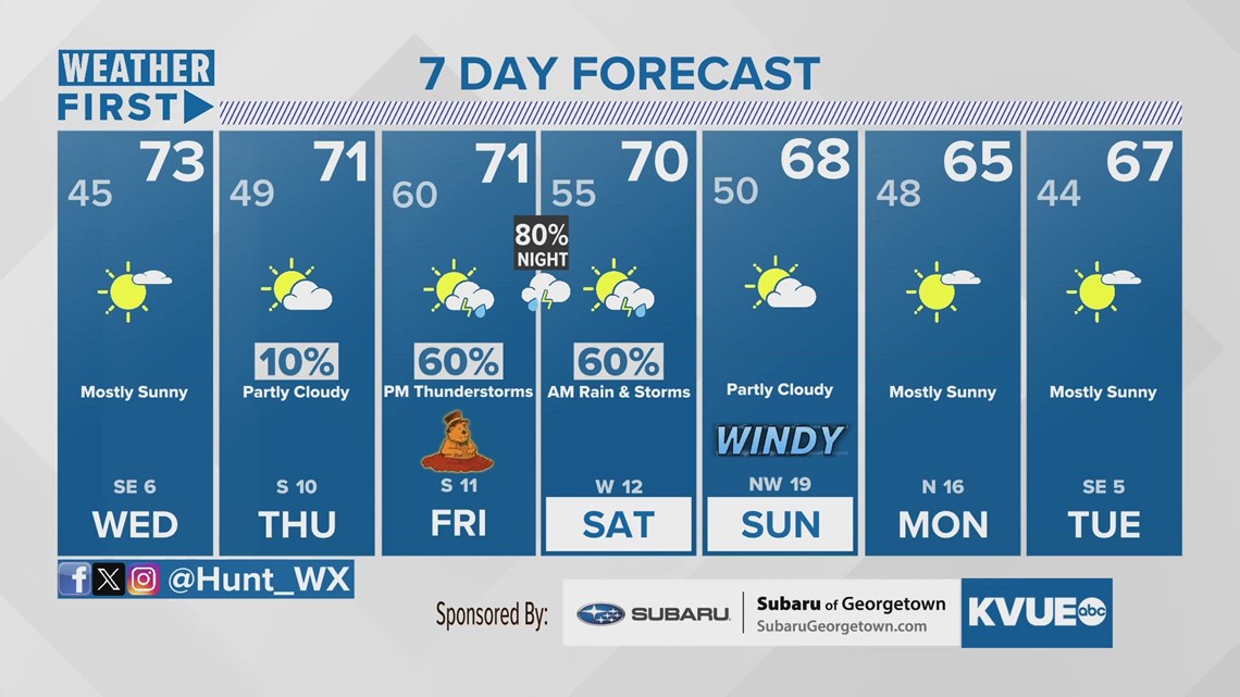
While we do have about a 10% chance of showers Thursday morning, those light rains are expected to have very little impact on the region.
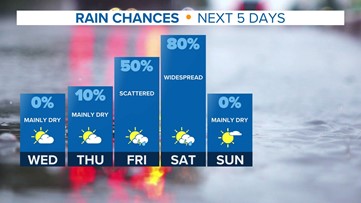
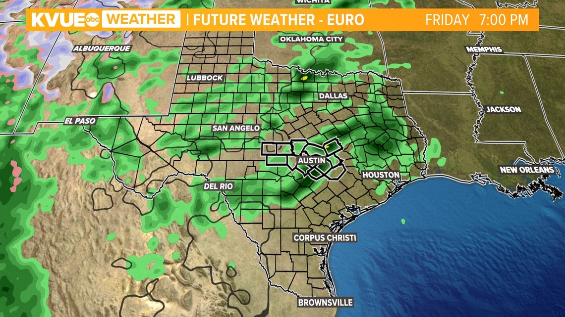
Friday, the moisture will be kicked up a notch, with generally cloudy and potentially foggy conditions expected in the morning. By Friday afternoon, showers will gradually become more widespread across Central Texas. Pockets of heavy rain or a few isolated thunderstorms may be possible around dinner time. Wet conditions will be maintained overnight.

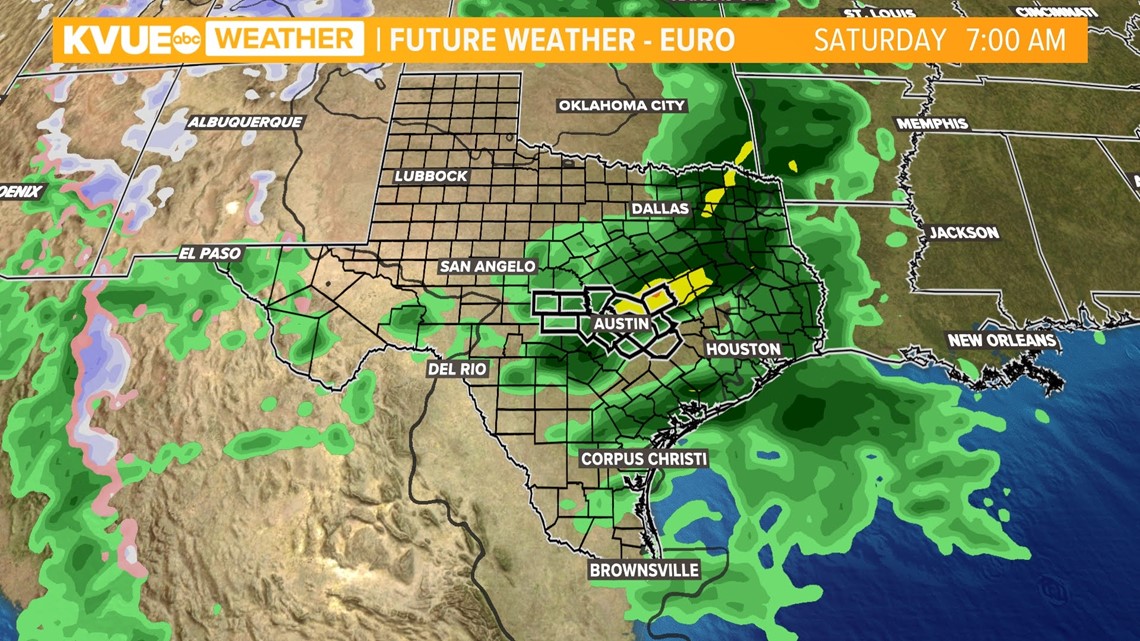
You may be woken up by rumbles of thunder Saturday morning, as the most active weather is set to move west to east across Austin then. Rains could be ongoing through the early afternoon, but models are trending on the drier side for Saturday evening. So if you have dinner plans that night you won’t need the umbrella anymore.

Breezy winds will usher in clear conditions for Sunday. Winds are forecast to gust anywhere from 30 to 35 mph for the moment. Details on windy weather will become more clear by the end of the work week.
Greatest risks: Heavy rain at times
While we are not tracking a drawn-out rain event like last week, we will have a flood risk associated with this rain event. The Weather Prediction Center has already issued a marginal risk for excessive rainfall Friday night and Saturday morning.

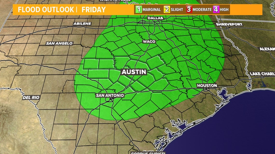
The is a level one out of four threshold for flooding. Our ground is still largely saturated from last week’s downpours, especially east of I-35. Although the flood threat is low, we still need to look out for flooded roads and possible flash flooding during this next rain event.
The Austin area is expected to receive a widespread 0.25 to 0.5 inches of rain. Areas along and east of I-35 will once again be favored with the heaviest rain. Isolated totals could be more like 1 to 2 inches.

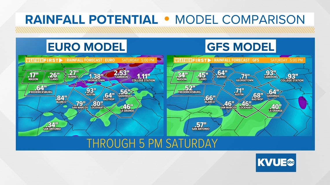
Another similarity to our rainfall from last week is that the Hill Country is expected to see the least amount of rain.
Beneficial rainfall?
Heavy rains from last week were able to eliminate drought for our far east counties, but extreme drought still plagues the I-35 corridor and Hill Country counties.

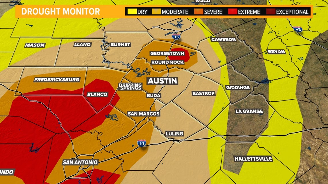
Rain this weekend will of course not exacerbate drought further, but it will not be enough to significantly eliminate severe and extreme drought in our central and western areas.
Here is another look at the seven-day forecast. This weather blog will be updated throughout the week, as our active weather moves closer.

