- CenterPoint Energy accelerates infrastructure improvements ahead of hurricane season
- Carolina Hurricanes playoff tickets go on sale Thursday
- Ask the Meteorologist: Why do tornadoes target Tornado Alley, Dixie Alley?
- Nonprofit closes distribution site that aided thousands after Hurricane Helene
- Trump approves federal assistance amid Arkansas flooding
La Niña watch issued: What it means for hurricane season and North Carolina

The National Oceanic and Atmospheric Administration issued a La Niña watch on Thursday.
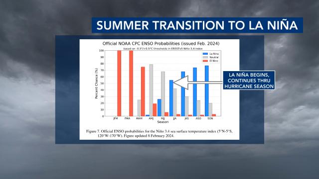
We remain in an El Niño period for now, but it is weakening. We are expected to briefly go into an El Niño neutral period during the spring and then La Niña could take over during the June-July-August time frame.
It’s very common to have a quick transition from an El Niño to a La Niña. NOAA cites “cooler-than-average ocean waters are widespread at depth and expanding eastward” in the Pacific and seasonal prediction models in great agreement as the reasons for the La Niña watch.
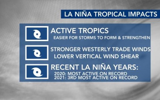
A La Niña often means an active Atlantic hurricane season. 2020 was the most active season on record and it was a La Niña year. Also, 2021 was the third most active season on record and also a La Niña year.
“It’s easier for storms to form and easier for them to strengthen,” WRAL meteorologist Kat Campbell said. “One of the reasons why is we have stronger westerly trade winds and that lowers the vertical wind shear.”
Stronger westerly trade winds during a La Niña allow upwelling, or cooler-than-normal sea surface temps along the equatorial Pacific. We also have lower vertical wind shear during a La Niña, and this allows storms to form and strengthen. Stronger vertical wind shear tears tropical systems apart.
“It’s not a guarantee that we will have a La Niña for the tropical season, but all signs are pointing in that direction,” WRAL meteorologist Aimee Wilmoth said.
