- Report: Coastal flooding could threaten 1.4 million homes by midcentury
- Caught on camera | Tornado touches down in Missouri
- Carolina Hurricanes playoff tickets go on sale next week
- Storms kill 6 in the South and Midwest as forecasters warn of catastrophic rains, floods this week
- Weather Impact Alert: Cold front could trigger severe weather in Houston area this weekend | See timeline
Flood risk and severe weather threat for Central Texas Saturday night and Sunday
We’re expecting multiple rounds of strong storms. Here’s the latest on the timeline and rainfall totals.
AUSTIN, Texas — An active weather pattern continues through this weekend for Central Texas with several more round of rain and storms ahead. This means that the risk for more severe weather and flooding will stick with us through at least Sunday. After that, we really turn up the heat by the middle of next week.
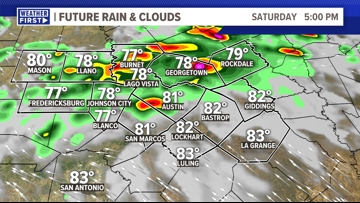
During most of the day on Saturday, we don’t expect much stormy weather. It will be mostly cloudy, and there could be patchy drizzle or light rain showers through the day. However, by the late afternoon and evening, some stronger storms may start to develop. The highest storm chance during the evening will be across the Hill Country and northern Interstate 35 corridor.

After scattered rain during the evening, a much more widespread line of storms will push into Central Texas overnight. This line of storms will bring a higher chance for severe weather. Strong winds and hail are the main concerns, but an isolated tornado cannot be ruled out.
This round of storms will also kick off a flooding concern that continues into the day on Sunday.

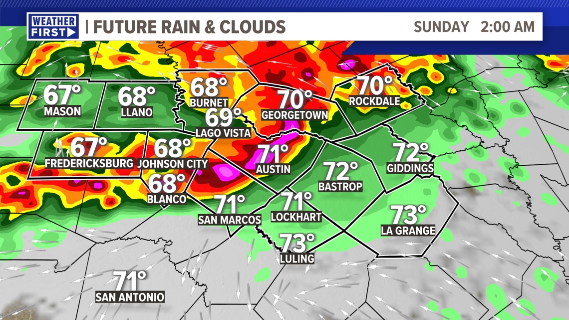
The first round of rain and storms will clear to out east by early Sunday morning, but then we have lingering showers and storms through the rest of the morning.
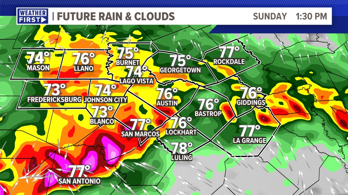
Even for the late morning and afternoon we will likely have another round of rain and storms move through Central Texas. The severe threat might be slightly lower with second round, but the flood threat will certainly continue.

Rainfall totals of 1.5 to 3 inches look likely, but there could be isolated spots that see up to 5 inches or more. This is certainly enough rain, on top of what has already fallen in the previous days, to create a localized flooding concern.

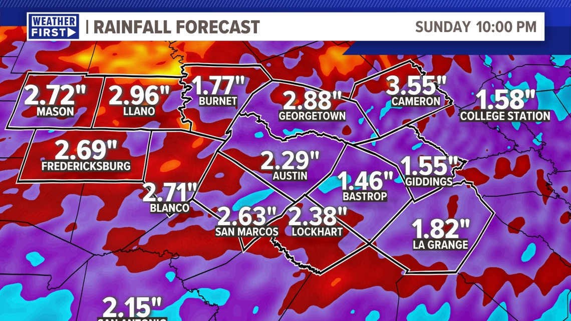
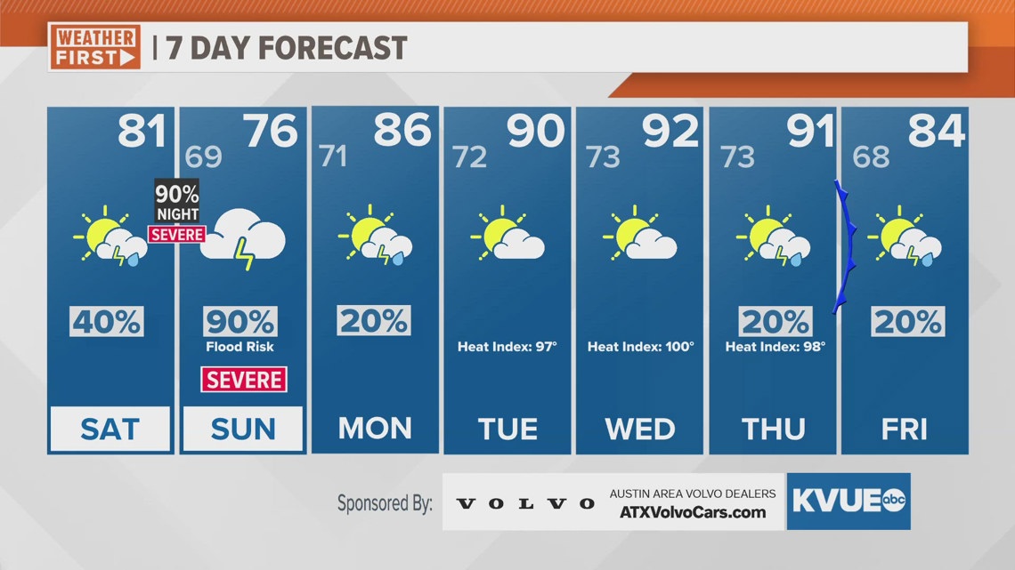
Rain chances really dwindle by the beginning of next week, and the heat quickly returns. High temperatures by the middle of next week will be in the low to mid-90s with feels-like temperatures around 100 degrees.
The KVUE Weather Team will continue to closely monitor this developing forecast.
In the meantime, the extended forecast can be found below:

