- Severe weather possible for Houston this weekend | Weather Impact Alert issued
- Impact Plastics not responsible for workers killed in Helene flooding, TOSHA says
- 'A little emotional': Hurricanes equipment manager got seconds in goal, memory to last a lifetime
- WMO retires three hurricane names after devastating 2024 season
- Beryl removed from future hurricane naming lists
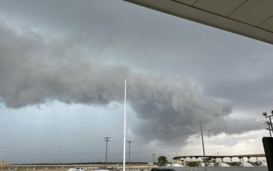
Parts of Texas under tornado watch amid strong, massive storm

A weather system sweeping across the Central and Southern plains Monday, May 6, could bring tornadoes and severe weather to sections of North Texas. The western portion of North Texas, including cities like Wichita Falls, are under a tornado watch until 11 p.m. Monday night.
Extreme severe weather expected to bring numerous tornadoes, including some which exceed an EF-3 rating, is forecast Monday night for much of Oklahoma and areas of North Texas, according to information from the National Weather Service.
“A regional outbreak of severe weather with multiple intense (EF3+), long-tracked tornadoes, as well as very large hail and severe thunderstorm gusts, is expected over parts of the South Central Plains from this afternoon through evening,” a National Weather Service severe weather warning reads. A map accompanied the statement showing much of the Central United States under some level of severe storm threat, spanning the length of the U.S. from South Dakota down to the Texas-Mexico border.
While much of the tornado activity is isolated to Oklahoma and Kansas, a National Weather Service meteorologist told MySA areas of North Texas could be in the line of trouble.
“We do currently have a tornado watch for a small section of western North Texas that includes the counties adjacent to the Red River there from Wichita Falls [and] northwest towards Quanah,” National Weather Service Meteorologist Todd Lindley told MySA. “All types of severe weather will be possible within that area and areas close to those particular counties through the evening. We’ll have the potential for severe storms with large hail, damaging winds, heavy rainfall, and also tornadoes.”
Lindley said there were a series of storm systems across North Texas and Oklahoma through Monday, but this stronger system across the Southern Plains, combined with moisture, instability, and sufficient wind shear in the atmosphere, is creating patterns that are conducive to tornadoes. Areas north the Dallas-Forth Worth metroplex could see some severe storms too, should any develop, according to National Weather Service Metrologist Juan Hernandez. Hernandez told MySA those areas of North Texas could see large hail and damaging winds as a result of this strong storm system sweeping through the area.
The severe storm weather will likely bypass the Texas Panhandle as the dry air moves further east of the Panhandle bringing with it the chance for severe storms.
“Most thunderstorm chances will be to our east where a tornado watch has been issued thanks to the positioning of the dryline and the Pacific front. Still can’t rule out a chance for a storm over the next hour or two for the far southeast Texas Panhandle,” the National Weather Service Amarillo office said in a statement.