- Weather Impact Alert: Heavy rain could lead to flooding across Carolinas
- North Carolina legislators fleshing out details on $500M in additional Hurricane Helene relief
- Dangerous travel conditions: Ice, snow and flooding possible
- How photos lost in disasters like Hurricane Helene find their way home, with a little help from people who care
- Dangerous travel conditions, ice/snow and flooding possible in the mountains Tuesday and Wednesday
Austin area at risk of severe thunderstorms, hail, isolated tornado
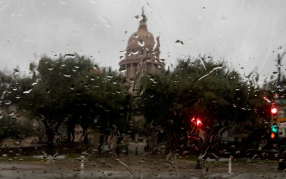
The Austin area could see strong to severe thunderstorms Thursday from around 3 to 9 p.m. The National Weather Service reports the main threats are large hail and damaging winds, but a “tornado or two” is also possible.
Counties facing the highest severe thunderstorm risk include Travis, Williamson, Burnet and parts of Hays and Bastrop.
There is no watch or warning for thunderstorms or tornadoes at this time. The NWS recommends keeping an eye on the forecast and making sure you have multiple ways to receive emergency weather alerts.
Scattered storms are expected in Central Texas over the weekend, bringing cooler temperatures.
Follow the latest updates from the National Weather Service below: