- 'A little emotional': Hurricanes equipment manager got seconds in goal, memory to last a lifetime
- WMO retires three hurricane names after devastating 2024 season
- Beryl removed from future hurricane naming lists
- Hurricane names Helene, Milton and Beryl are now retired
- Hurricane Helene's name retired after deadly 2024 impact on US
Low-end severe weather risk for Wednesday

After an active Tuesday evening, storms will be more isolated for the middle of the workweek.
AUSTIN, Texas — Widespread storms developed across Central Texas late Tuesday evening. These storms produced a couple of severe thunderstorm warnings in the Hill Country but were mainly under severe limits.
Behind the storms, a “wake low” developed, producing strong to damaging winds. These are straight line winds not associated directly with the thunderstorms, but rather, they develop behind the storms.
These winds were observed as high as 57 mph at Camp Mabry in Austin.
All wind alerts which were in effect Wednesday morning have expired.
As for the storms, they have moved out of the KVUE viewing area and continue to push east. We are mainly watching strong wind potential in the wake of the storms.
These storms brought beneficial rainfall to spots that desperately need it. This includes parts of Gillespie and Blanco counties, which are under “extreme” drought and were able to pick up 1 to 3 inches or more of rainfall.
Many of these spots also feed into Lake Travis, which certainly needs the water!
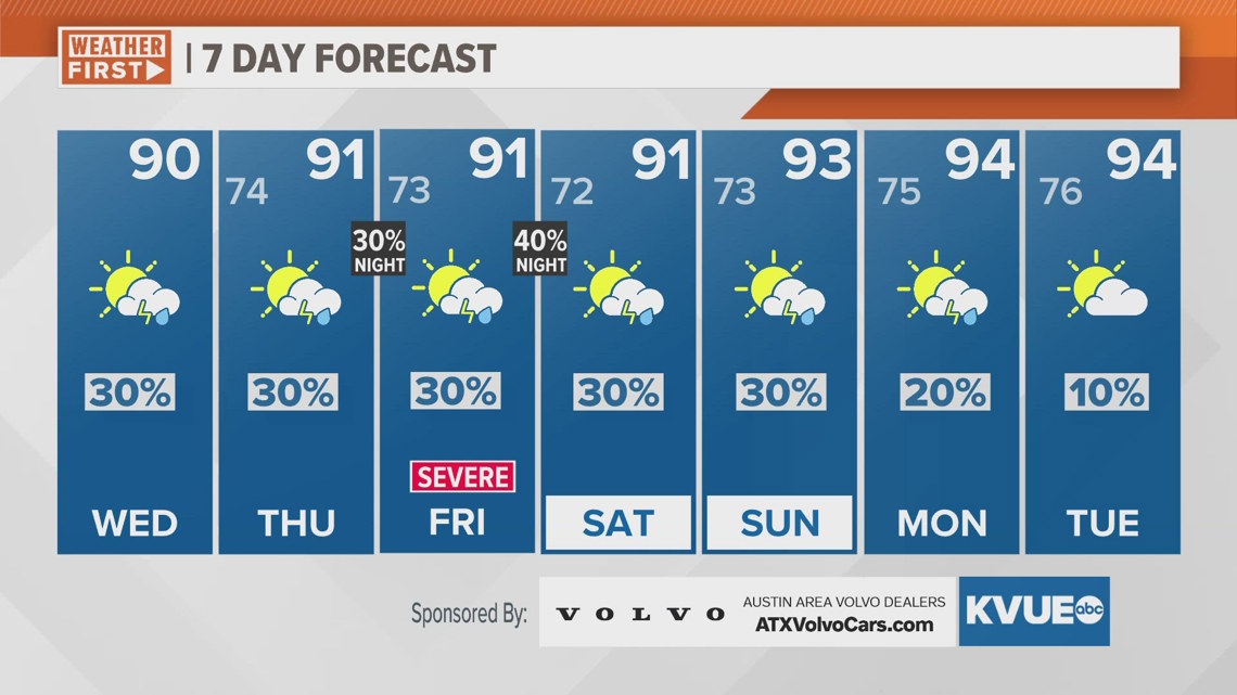
The weather turns mainly dry Wednesday, but overall, an unsettled weather pattern continues through the rest of this week and through the weekend with more rounds of storms possible. This could include more severe weather and flooding.
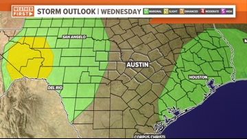
The Wednesday morning update from the Storm Prediction Center removed most of Central Texas from the risk of severe weather.

Forecast models still hint at isolated strong storms in the Western Hill Country and the far Eastern Coastal Plains.
The KVUE Weather Team will continue to monitor this developing forecast.
In the meantime, the extended forecast can be found below:

