- Another $500M for Hurricane Helene relief in North Carolina passes key hurdle
- Crews battle wildfire in McDowell County, NC
- Wildfire in McDowell County, NC is 20% contained, officials say
- California governor asks Congress for nearly $40 billion for Los Angeles wildfire relief
- North Buncombe High School students lead recovery efforts for NC farmers post-Hurricane Helene
Tropics could help bring beneficial rainfall – but also minor flooding – to Central Texas
Here’s the where, when and how much rain could fall this coming week.
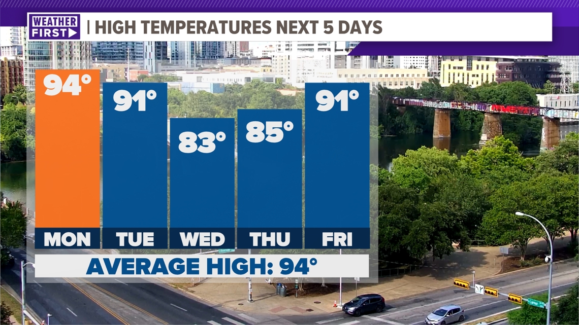
AUSTIN, Texas — We’ve had such a hot and dry stretch across Central Texas these past few days, but we expect that to change in a big way.
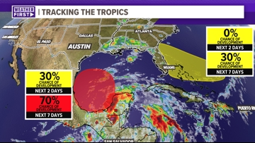
This is due to a tropical system that is setting up shop in the Bay of Campeche that has a 70% chance of development as we head into next week. The first name on the 2024 storm list is Alberto, and the chances of that forming start to ramp up as we start next week.

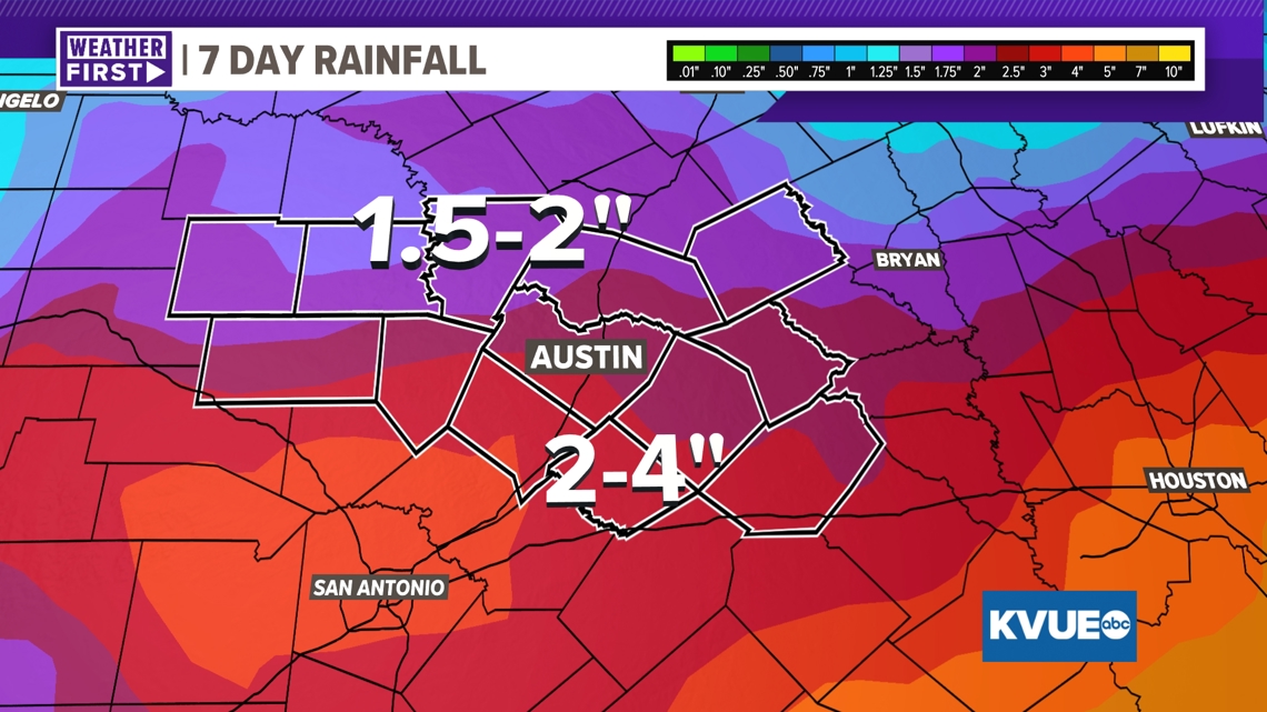
This system looks to start to make its journey off to the northwest, which could lead to greater rainfall totals for Central Texas overall. Most models show around 1 to 2 inches of rain with spots – mainly in Texas’ southern counties – showing totals that could get up to four inches of rain. Some models are projecting even higher totals, which would create a flooding concern, but these higher totals are only being shown by one model, so we’ll not necessarily read into it at this time.

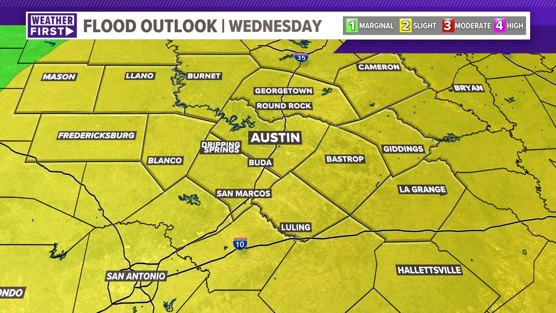
However, with the latest model data now coming into agreement, we can now concretely say that there is a minor flooding concern through the middle of next week. All of the KVUE area is now under a 2 out of 4 “slight” risk for excessive rainfall on Wednesday, which could lead to flash flooding.

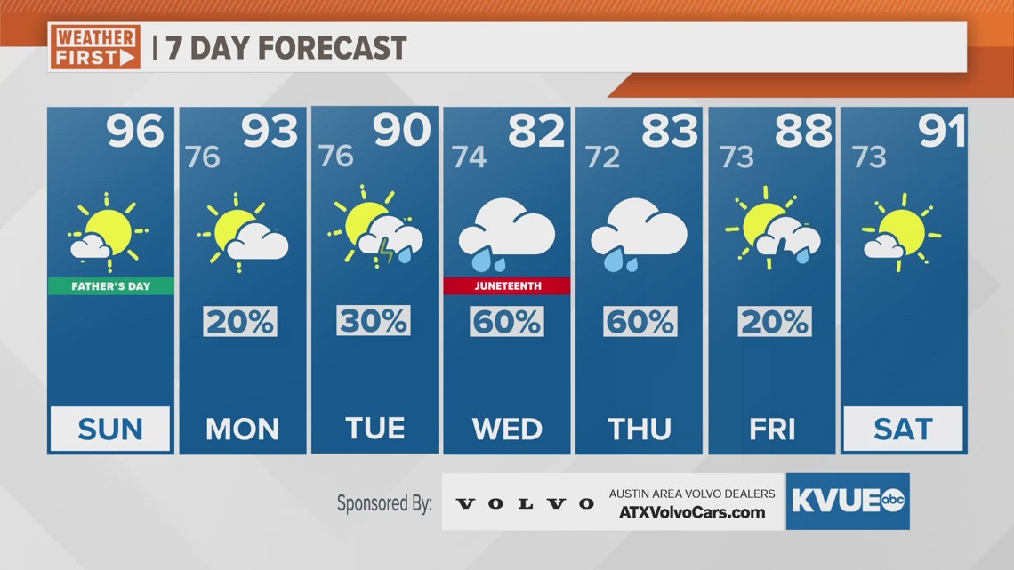
A collateral effect of the expected rainfall will be cooler temperatures as we head into the middle of next week. Wednesday is Juneteenth and Thursday is the summer solstice. We’re tracking highs in the mid-80s – well below average for both days.

With that, stick with KVUE as we continue to track this tropical system, especially as this may carry large drought implications for some of our southern counties, especially in the Hill Country.
Your seven-day forecast is below.