- Another $500M for Hurricane Helene relief in North Carolina passes key hurdle
- Crews battle wildfire in McDowell County, NC
- Wildfire in McDowell County, NC is 20% contained, officials say
- California governor asks Congress for nearly $40 billion for Los Angeles wildfire relief
- North Buncombe High School students lead recovery efforts for NC farmers post-Hurricane Helene
Tropics could help bring beneficial rainfall, minor flooding to Central Texas
Here’s the where, when and how on the rain we could see this week.
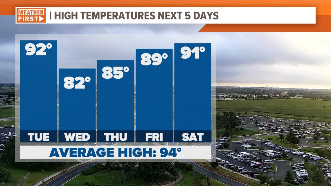
AUSTIN, Texas — We’ve had a hot and dry stretch across Central Texas these past few days, but we expect that to change in a big way.
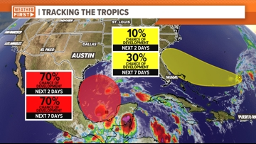
This is due to a tropical system that is setting up shop in the Bay of Campeche that has a 70% chance of development on either Monday or Tuesday. If this does become a tropical storm, it will be our first of the season and will be called Alberto.

This area of low pressure is expected to move west-northwest through the Gulf of Mexico and mainly impact Mexico, South Texas and the Texas coastline. However, local impacts are expected, with widespread rain and the potential for flooding.
Most models show around 1.5 to 2.5 inches of rain with spots – mainly in Texas’ southern counties – showing totals that could get up to 4 inches of rain. Some models are projecting even higher totals, which would create a flooding concern.

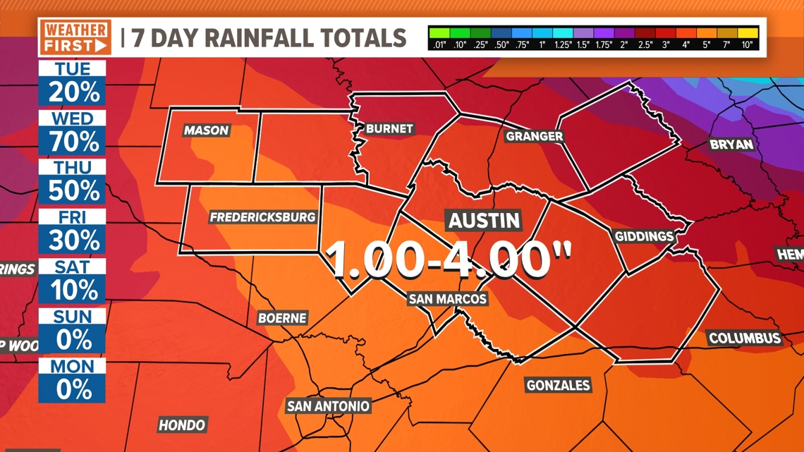
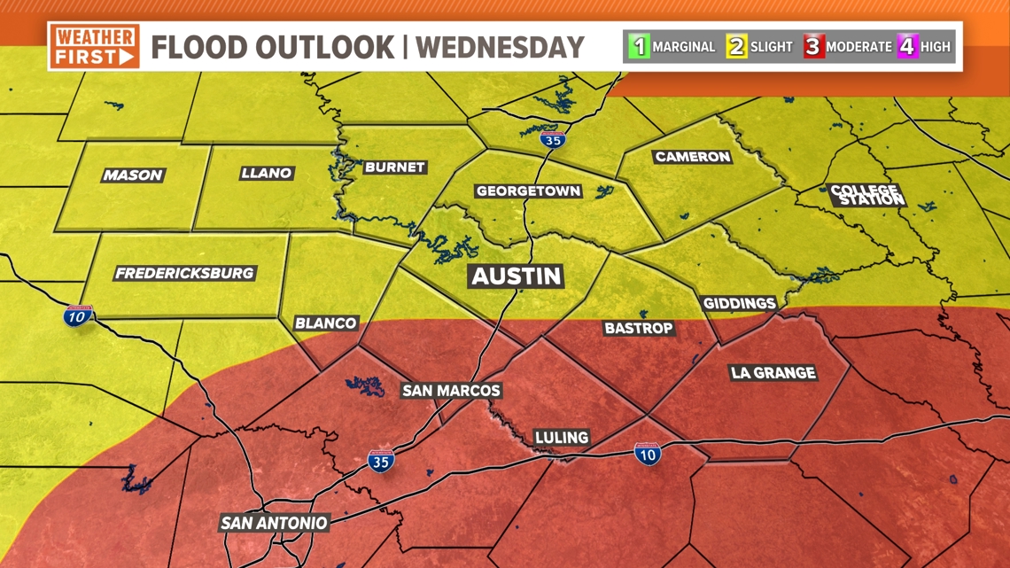
However, with the latest model data now coming into agreement, we can now concretely say that there is a flooding concern through the middle of the week. Most of the KVUE area is now under a 2 out of 4, or “slight,” risk for excessive rainfall on Wednesday, which could lead to flash flooding. Areas south of Austin have been upgraded to a 3 out of 4 risk for flooding.

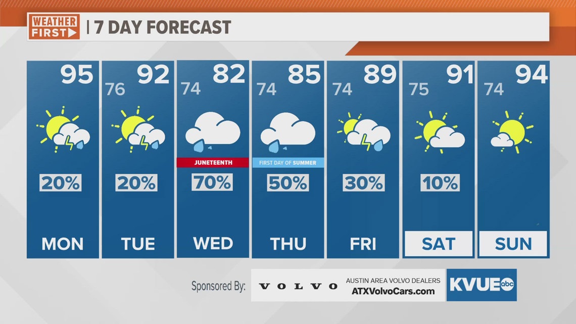
A collateral effect of the expected rainfall and cloud coverage will be lower temperatures as we head into the middle of the week. We’re tracking highs in the lower to mid-80s for Wednesday and Thursday – well below average for both days.

This is a rapidly changing forecast that the KVUE Weather Team will continue to monitor throughout the week. We’ll continue to provide updates on air and online. In the meantime, here is a look at your forecast over the next seven days.