- Seven months after Hurricane Helene, Chimney Rock rebuilds with resilience
- Wildfire in New Jersey Pine Barrens expected to grow before it’s contained, officials say
- Storm damage forces recovery efforts in Lancaster, Chester counties
- Evacuation orders lifted as fast-moving New Jersey wildfire burns
- Heartbreak for NC resident as wildfire reduces lifetime home to ashes
Tropical Storm Alberto likely to form in the Gulf, bringing rain to Central Texas on Wednesday
While the heaviest rain may stay south, we are still tracking flood potential from tropical rains here in Central Texas.
AUSTIN, Texas — Potential Tropical Cyclone 1 has developed over the southwestern Gulf. Although loosely organized at the moment, this system is likely to become our first named storm of the 2024 Atlantic Hurricane season within the next 24 hours. The first name on the list is Alberto.
The initial forecast from the National Hurricane Center calls for Alberto to make landfall in northern Mexico late Wednesday into Thursday as a low-end tropical storm. Although the center of this system will be well to the south of the KVUE area, remember that tropical feeder bands can extend hundreds of miles from the center of the system.
This will likely be the case with Alberto as heavy tropical rains are expected mid-week for south Texas, the Texas Gulf coast and even into parts of South-Central Texas.

When will the rain arrive?
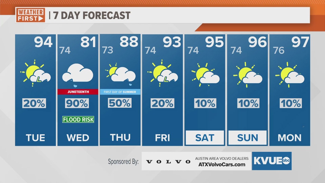
Tuesday will bring scattered showers and storms to Central Texas, but these will not be associated with Alberto. Wednesday is when we expect the bulk of the tropical moisture here in the KVUE area.
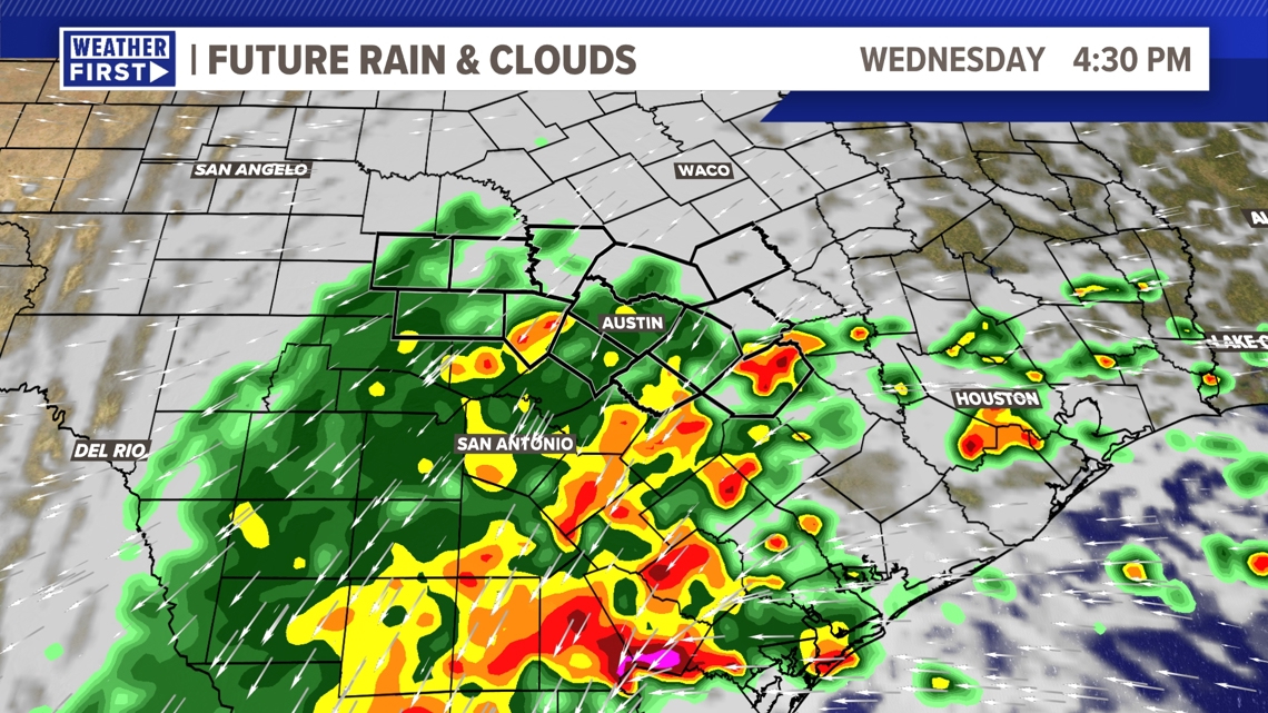
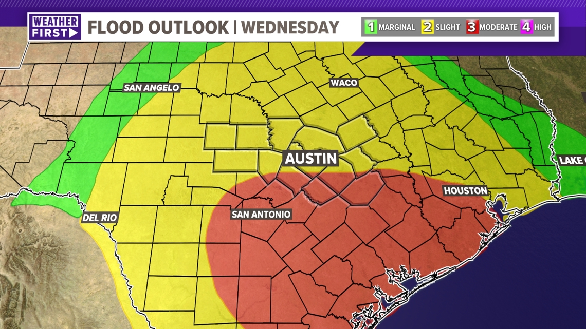
Rain chances will gradually increase through the day but will start in the morning, with the highest rain chances during the afternoon and evening on Wednesday. Caldwell and Fayette counties will be under a Flood Watch from Wednesday morning through Thursday afternoon.
Although the heaviest totals are currently on track to miss our KVUE area to the south, we still have the risk of localized flooding locally. We also can’t rule out an isolated spin-up tornado.

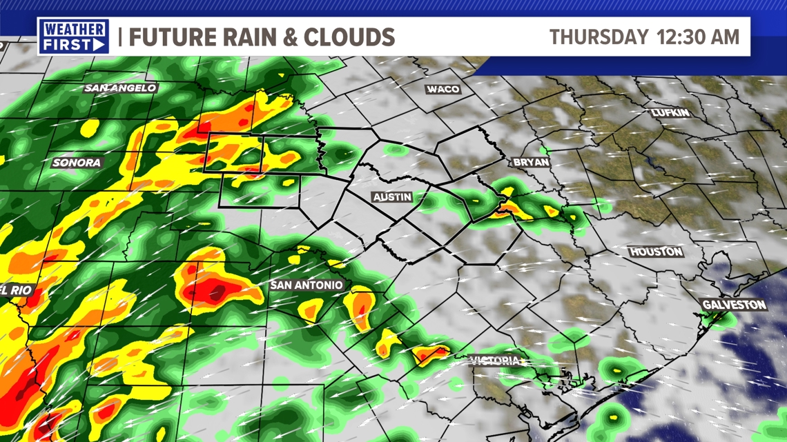
Tropical rain bands will continue through Wednesday evening and into the overnight. Generally, the forecast trends drier through the day on Thursday, although tropical downpours and rain bands will still be a possibility, especially through the morning.
We expect the highest flood potential for Wednesday and Wednesday night.
The forecast will quickly trend drier for late week and this weekend.

What is the impact from Alberto in Central Texas?
The main thing that we will watch in the KVUE area is the potential for flooding. Overall, it continues to look like the highest risk for flooding will be across South Texas and along the Texas coastline. This is where pockets of 6 to 10 inches or more of rainfall appear likely. However, locally, there will still be the potential for pockets of heavy rain that could lead to flooding.

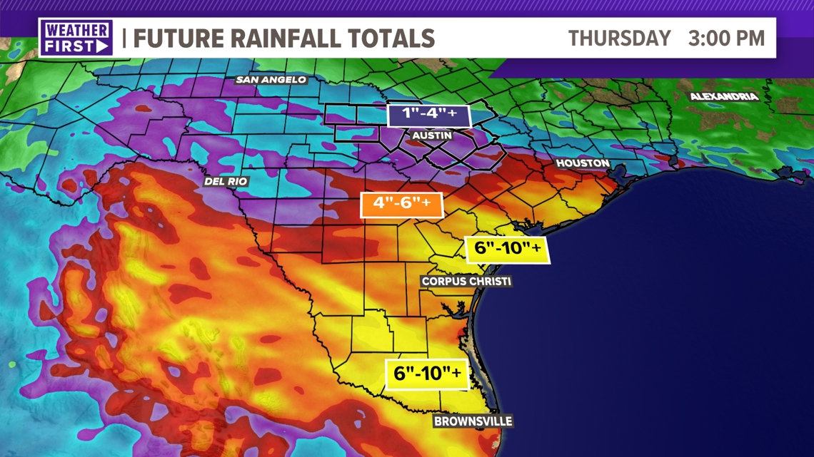
There is still a decent amount of uncertainty in our exact rainfall totals. Due to the fact that the center of circulation is just now forming, the models still don’t have a great grasp on where the axis of heaviest rain will set up over Texas. If the center of the system tracks closer to South Texas, our totals and flood concerns will go up. A track farther south reduces our flood risk and rainfall totals.
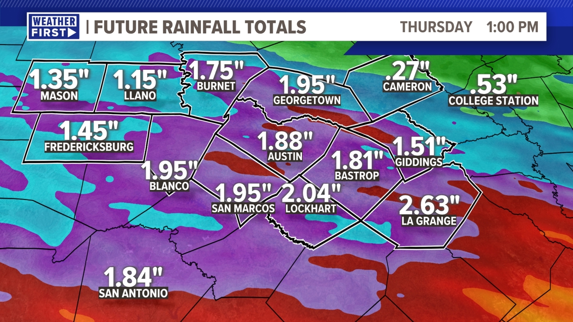
As of now, the most likely range for local rainfall totals is between 1 to 4 inches, with isolated higher amounts possible. The highest totals currently favor the southern and southeastern tiers of our area.

Again, the exact zone with the greatest flood potential is still subject to change, but as of now, there is a “moderate” – level 3 of 4 – flood risk for southern sections of our area Wednesday and Wednesday night. The remainder of our area is under a level 2 of 4 risk.

What do you need to do in Central Texas?
The bottom line for our KVUE area is that tropical rainfall is likely on Wednesday, and this will bring a low to moderate flood risk with 1 to 4 inches of rainfall for most of Central Texas. Remember, we need rain for our ongoing drought across the Hill Country and for our lake levels. However, that can also come along with a flood concern.
If you live in a flood-prone area, go ahead and make your typical flood preps. Otherwise, just stay close to the forecast over the next 24 hours as we fine-tune the details and get a better grasp on exactly how much rain to expect here in Central Texas.
The KVUE Weather Team will continue to closely monitor this developing forecast.
In the meantime, the extended forecast can be found below:

