- 'A little emotional': Hurricanes equipment manager got seconds in goal, memory to last a lifetime
- WMO retires three hurricane names after devastating 2024 season
- Beryl removed from future hurricane naming lists
- Hurricane names Helene, Milton and Beryl are now retired
- Hurricane Helene's name retired after deadly 2024 impact on US
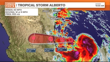
Tropical Storm Alberto forms in Gulf | What Central Texas can expect
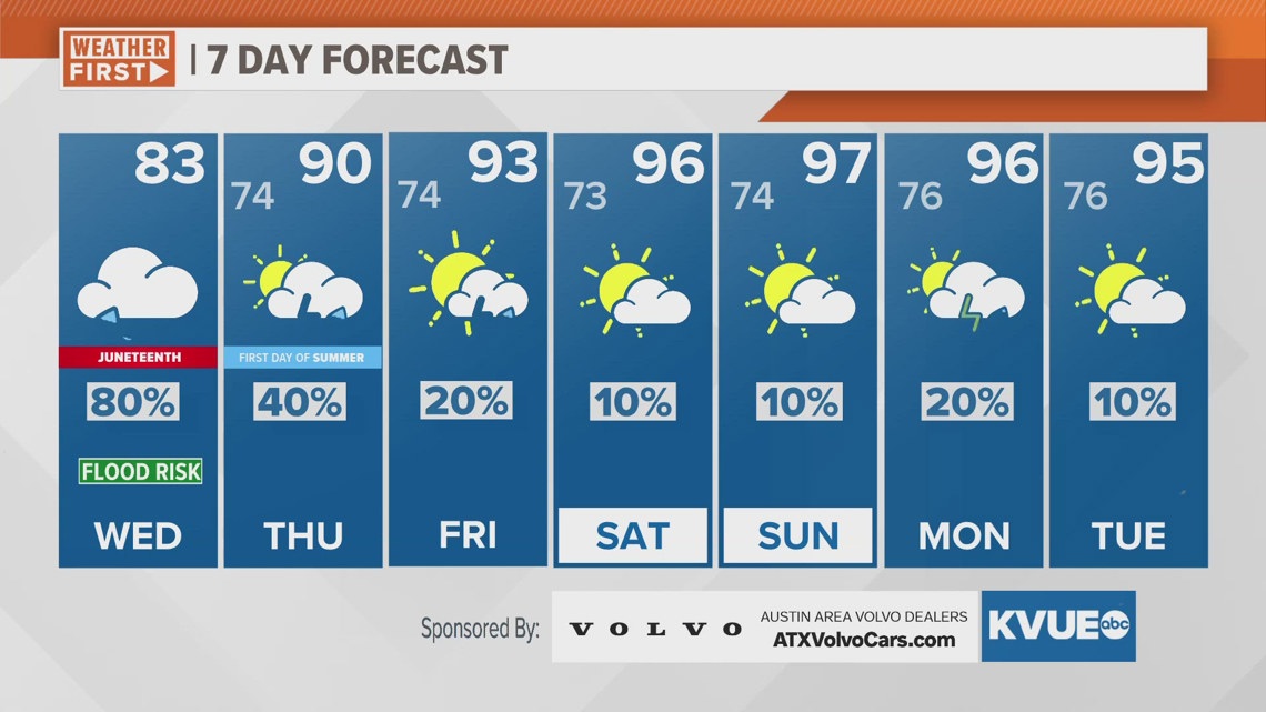
While the rainfall totals have trended down for Central Texas, we’re still expecting up to 3 inches of rain with a minor flood risk.
AUSTIN, Texas — Tropical Storm Alberto has officially developed in the Western Gulf of Mexico.
It will continue to move west and make landfall in Mexico later tonight/early Thursday morning. Impacts in Central Texas will be widespread rain and the potential for isolated tornadoes.
Unfortunately, local rainfall totals have been trending lower, but we are still expecting a widespread 0.25 to 1 inch of rain with isolated pockets of 1 to 3 inches possible. This will bring a minor flood risk, but likely not any widespread issues like what looked possible a couple days ago. Therefore, the Flood Watch for Caldwell and Fayette counties has been canceled.
The latest forecast cone has Alberto making landfall in northern Mexico late Wednesday night or early Thursday morning. The center of the storm remains in northern Mexico, but heavy tropical rains will produce 5 to 10 inches of rain for parts of South Texas, and lesser totals in Central Texas. Some areas near the Texas coastline or in Mexico could receive isolated totals as high as 15 inches.

When to expect rain in Central Texas
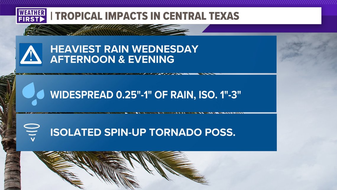
There will be some spotty tropical downpours during the morning, but the highest rain chances and heaviest rain potential will be during the afternoon and evening on Wednesday. It won’t be raining constantly, but we expect periodic tropical downpours and tropical feeder bands that will bring some gusty winds up to 35 mph and pockets of heavy rainfall.
Rain chances ramp up mid-to-late morning, then the heaviest rain is from 3 p.m. to 10 p.m. Wednesday.

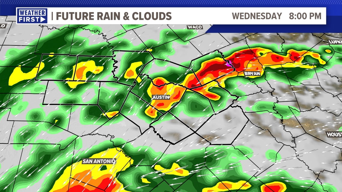
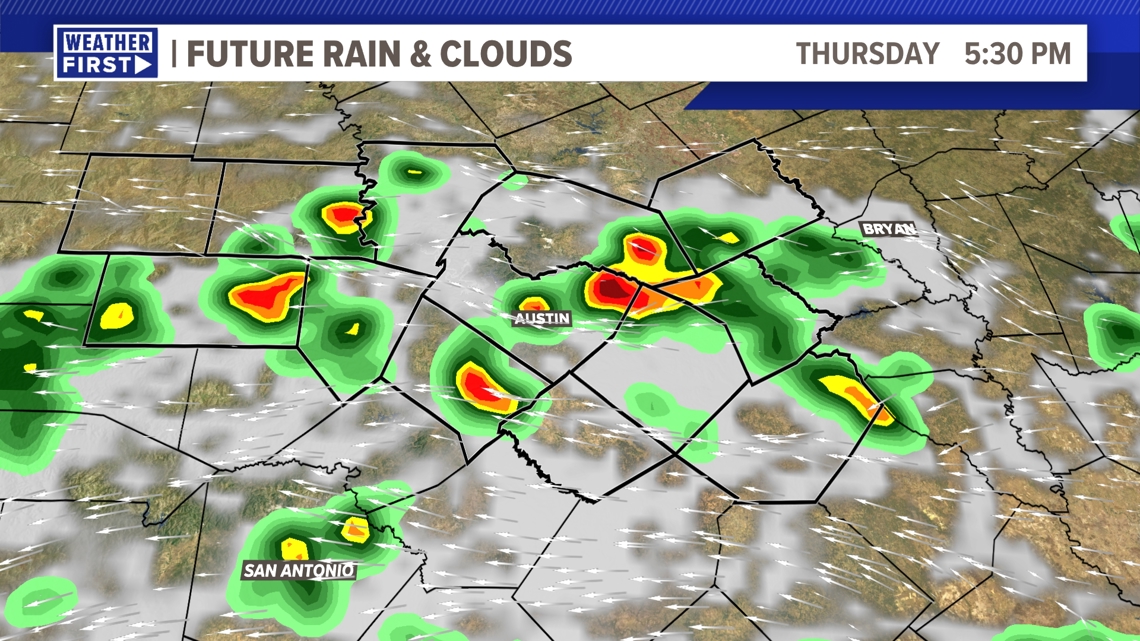
Activity will gradually wind down Wednesday night into Thursday morning, but a few more scattered tropical downpours will be possible on Thursday afternoon and early evening.
Our weather will quickly trend drier for Friday into this weekend.

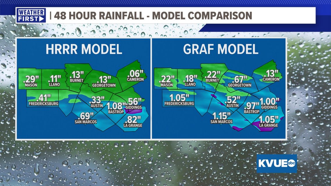
How much rain will fall?
Although the totals have trended down, we’re still expecting some beneficial rain locally. Generally, we are expecting between a quarter inch and 1 inch of rainfall with isolated totals as high as 1 to 3 inches possible. The lower totals will be north of Austin, with a sharp gradient into higher totals along the Interstate 10 corridor.

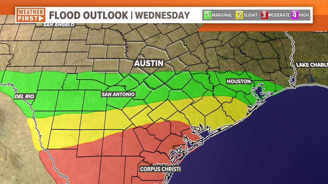
Since the rainfall forecast for Central Texas has lowered, the flood outlook has been reduced to a “marginal” risk for areas south of Travis County. Further south of Central Texas, the flood risk increases.

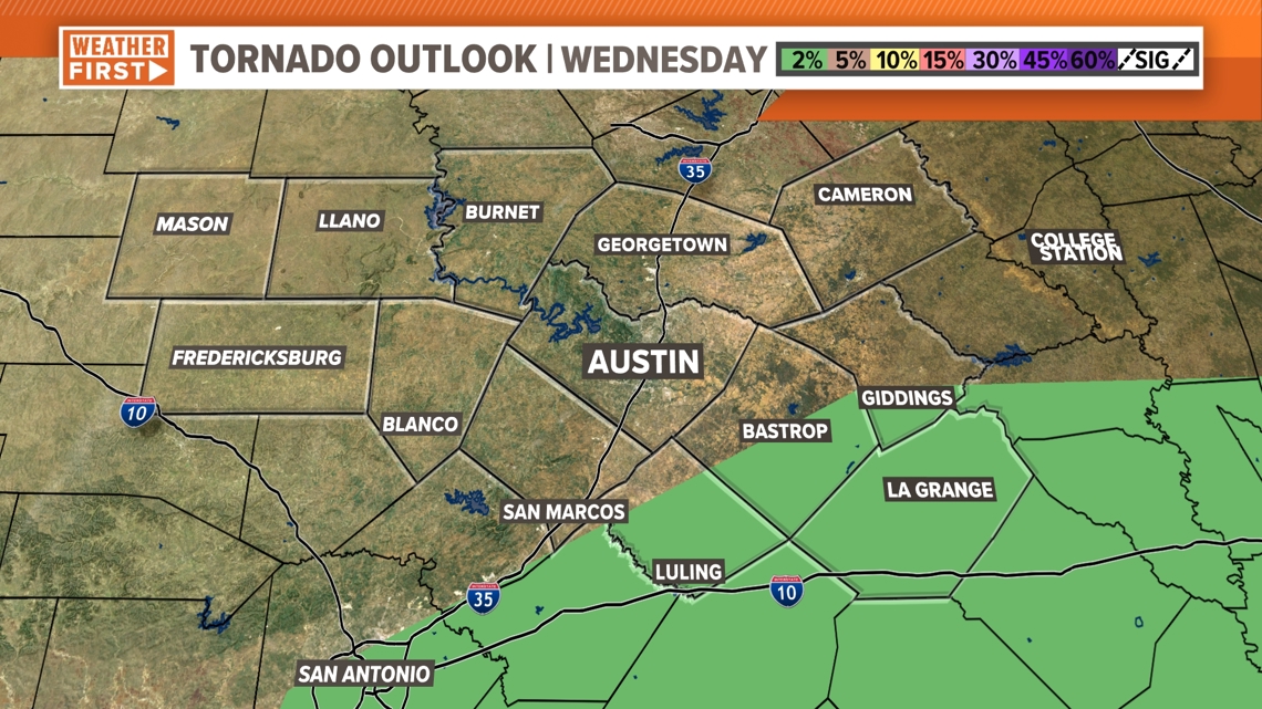
In addition to the minor flood risk, we’ll monitor an isolated tornado threat for portions of the Coastal Plains. A brief spin-up tornado will be possible due to outer bands from the tropical system.

The bottom line for Central Texas
Although this system will not be as impactful as appeared possible a few days ago, we still have tropical rain in the forecast on Wednesday that could create minor flooding. In addition to the flood risk, the Storm Prediction Center has added a low-end tornado risk for areas southeast of Austin.
If you live in a traditionally flood-prone spot, especially areas south of the Austin metro area, make sure you complete your flood preps by Wednesday morning. Also, make sure you are keeping up with the forecast and have a reliable way to get alerts such as the KVUE app.

The KVUE Weather Team will continue to closely monitor this developing forecast.
In the meantime, the extended forecast can be found below: